Travelers Rest, South Carolina
Travelers Rest is a city in Greenville County, South Carolina, United States. The population was 4,576 at the 2010 census,[5] up from 4,099 in 2000. The population was an estimated 5,253 in 2018. It is part of the Greenville–Mauldin–Easley Metropolitan Statistical Area. Travelers Rest is located between the Blue Ridge Mountains and Greenville, the primary city of the Upstate region of South Carolina. The campus of Furman University is located just south of the city limits of Travelers Rest, but the university retains a Greenville address based on its ZIP code.
Travelers Rest, South Carolina | |
|---|---|
 U.S. Route 276 in Travelers Rest | |
| Nickname(s): TR, Gateway to the Foothills | |
| Motto(s): "Get in Your Element" | |
 Location of Travelers Rest, South Carolina | |
| Coordinates: 34°58′12″N 82°26′16″W | |
| Country | United States |
| State | South Carolina |
| County | Greenville |
| Government | |
| • Type | Mayor-Council |
| • Mayor | Brandy Amidon[1] |
| • City Administrator | Eric Vinson[2] |
| Area | |
| • Total | 4.54 sq mi (11.77 km2) |
| • Land | 4.52 sq mi (11.71 km2) |
| • Water | 0.02 sq mi (0.06 km2) |
| Elevation | 1,096 ft (334 m) |
| Population (2010) | |
| • Total | 4,576 |
| • Density | 1,012/sq mi (390.8/km2) |
| Time zone | UTC−5 (Eastern (EST)) |
| • Summer (DST) | UTC−4 (EDT) |
| ZIP code | 29690 |
| Area code(s) | 864 |
| FIPS code | 45-72430[3] |
| GNIS feature ID | 1251197[4] |
| Website | travelersrestsc |
History
The name "Travelers Rest" came from the fact that it is situated close to the border with the North Carolina mountains. Travelers would stop for a moment in the town before they began the difficult journey into the mountains.[6] Travelers would often have to spend the winter there, waiting for the snow to clear in the mountains before continuing northward.
The John H. Goodwin House and George Salmon House are listed on the National Register of Historic Places.[7] A marker has been placed at the site of the home of Dicey Langston, regarded as a "heroine in the American Revolution", on Tigerville Road.[8]
Geography
Travelers Rest is located north of the center of Greenville County at 34°58′12″N 82°26′16″W (34.970100, -82.437814).[9] U.S. Route 276 passes through the center of town as Main Street, leading northwest 25 miles (40 km) to the North Carolina border at the crest of the Blue Ridge Mountains north of Caesars Head and south 9 miles (14 km) to the center of Greenville. U.S. Route 25 passes through the east side of the city, leading north 30 miles (48 km) to Hendersonville, North Carolina, and south 12 miles (19 km) to Interstate 185 to the west of Greenville.
As of the 2010 census, the city had a total area of 4.6 square miles (11.8 km2), of which 0.02 square miles (0.06 km2), or 0.54%, were water.[5]
Climate
| Climate data for Travelers Rest, SC | |||||||||||||
|---|---|---|---|---|---|---|---|---|---|---|---|---|---|
| Month | Jan | Feb | Mar | Apr | May | Jun | Jul | Aug | Sep | Oct | Nov | Dec | Year |
| Average high °F (°C) | 51.1 (10.6) |
55.0 (12.8) |
62.8 (17.1) |
72.3 (22.4) |
79.9 (26.6) |
85.6 (29.8) |
88.3 (31.3) |
87.4 (30.8) |
81.5 (27.5) |
72.3 (22.4) |
62.4 (16.9) |
53.1 (11.7) |
71.0 (21.7) |
| Daily mean °F (°C) | 40.5 (4.7) |
43.5 (6.4) |
50.7 (10.4) |
59.4 (15.2) |
67.6 (19.8) |
74.1 (23.4) |
77.4 (25.2) |
76.6 (24.8) |
70.5 (21.4) |
59.9 (15.5) |
50.5 (10.3) |
42.6 (5.9) |
59.4 (15.3) |
| Average low °F (°C) | 30.0 (−1.1) |
32.0 (0.0) |
38.7 (3.7) |
46.4 (8.0) |
55.4 (13.0) |
62.8 (17.1) |
66.6 (19.2) |
65.8 (18.8) |
59.7 (15.4) |
47.7 (8.7) |
38.8 (3.8) |
32.4 (0.2) |
48.0 (8.9) |
| Source: [10] | |||||||||||||
Demographics
| Historical population | |||
|---|---|---|---|
| Census | Pop. | %± | |
| 1960 | 1,973 | — | |
| 1970 | 2,241 | 13.6% | |
| 1980 | 3,017 | 34.6% | |
| 1990 | 3,069 | 1.7% | |
| 2000 | 4,099 | 33.6% | |
| 2010 | 4,576 | 11.6% | |
| Est. 2018 | 5,253 | [11] | 14.8% |
| U.S. Decennial Census[12] | |||
As of the census[3] of 2000, there were 4,099 people, 1,563 households, and 1,137 families residing in the city. The population density was 930.8 people per square mile (359.7/km²). There were 1,729 housing units at an average density of 392.6 per square mile (151.7/km²). The racial makeup of the city was 77.36% White, 18.30% African American, 0.27% Native American, 1.22% Asian, 1.68% from other races, and 1.17% from two or more races. 4.22% of the population were of Hispanic or Latino ethnicity.
There were 1,563 households out of which 38.0% had children under the age of 18 living with them, 49.6% were married couples living together, 18.6% had a female householder with no husband present, and 27.2% were non-families. 22.5% of all households were made up of individuals and 8.8% had someone living alone who was 65 years of age or older. The average household size was 2.60 and the average family size was 3.04.
In the city, the population was spread out with 29.9% under the age of 18, 9.6% from 18 to 24, 29.4% from 25 to 44, 20.3% from 45 to 64, and 10.7% who were 65 years of age or older. The median age was 32 years. For every 100 females, there were 93.1 males. For every 100 females age 18 and over, there were 86.7 males.
The median income for a household in the city was $34,917, and the median income for a family was $38,229. Males had a median income of $30,377 versus $22,634 for females. The per capita income for the city was $15,704. About 12.2% of families and 15.8% of the population were below the poverty line, including 23.9% of those under age 18 and 11.8% of those age 65 or over.
Education
Furman University was incorporated into the city of Travelers Rest on April 18, 2013. The city is the home of the Travelers Rest High School Devildogs.
Travelers Rest has a public library, a branch of the Greenville County Library System.[13]
References
- "Government". Travelers Rest SC. Retrieved March 12, 2018.
- "Administration". Travelers Rest SC. Retrieved June 3, 2020.
- "U.S. Census website". United States Census Bureau. Retrieved January 31, 2008.
- "US Board on Geographic Names". United States Geological Survey. October 25, 2007. Retrieved January 31, 2008.
- "Geographic Identifiers: 2010 Demographic Profile Data (G001): Travelers Rest city, South Carolina". American Factfinder. U.S. Census Bureau. Retrieved February 10, 2017.
- Bailey, Louise (April 11, 1988). "For settlers, places told their stories". Times-News. p. 5. Retrieved April 23, 2015.
- "National Register Information System". National Register of Historic Places. National Park Service. July 9, 2010.
- Fork Shoals Historical Society (2013). Fork Shoals: Images of America. Arcadia Publishing. p. 119. ISBN 9780738590837. Retrieved December 18, 2015.
- "US Gazetteer files: 2010, 2000, and 1990". United States Census Bureau. February 12, 2011. Retrieved April 23, 2011.
- "CLIMATE TRAVELERS REST". Retrieved November 4, 2018.
- "Population and Housing Unit Estimates". Retrieved October 1, 2019.
- "Census of Population and Housing". Census.gov. Retrieved June 4, 2015.
- "Locations & Hours". Greenville County Library System. Retrieved June 8, 2019.
External links
- City of Travelers Rest official website
- TravelersRestHere.com - Destination Information for Visitors
- Greater Travelers Rest Chamber of Commerce
- Travelers Rest Tribune
- ExploreTR
| Wikimedia Commons has media related to Travelers Rest, South Carolina. |
Municipalities and communities of Greenville County, South Carolina, United States | ||
|---|---|---|
| Cities | 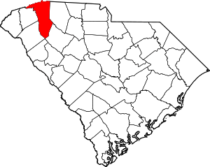 Map of South Carolina highlighting Greenville County | |
| CDPs | ||
| Unincorporated communities | ||
| Footnotes | ‡This populated place also has portions in an adjacent county or counties | |
| Authority control |
|
|---|