Fitzroy Island (Queensland)
Fitzroy Island (originally Koba or Gabar) is a continental island out from Djujbirri (formally known as Cape Grafton), 29 km south-east of Cairns, Queensland, Australia. It is a locality in the Cairns Region.[1][2]
| Native name: Koba or Gabar | |
|---|---|
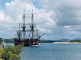
 Welcome Bay, Fitzroy Island | |
| Geography | |
| Location | Coral Sea |
| Coordinates | 16°56′S 146°00′E |
| Area | 3.33 km2 (1.29 sq mi) |
| Highest elevation | 375 m (1,230 ft) |
| Administration | |
Australia | |
| State | Queensland |
| LGA | Cairns Region |
| Fitzroy Island Queensland | |
|---|---|
 Fitzroy Island | |
| Coordinates | 16.9302°S 145.9922°E |
| Postcode(s) | 4871 |
| Area | 3.3 km2 (1.3 sq mi) |
| LGA(s) | Cairns Region |
| State electorate(s) | Mulgrave |
| Federal Division(s) | Kennedy |
Geography
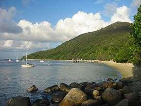
Fitzroy Island is a large tropical island, with a rainforest covering and its own fringe coral reef system. The island has a total area of 339 hectares (838 acres). The highest point of the island is 269 metres above sea level.
Fitzroy Island is a 45-minute ferry ride (about 30 km) from Cairns and is surrounded by a reef system that forms part of the Great Barrier Reef Marine Park. Nearly all of the continental island is protected within the Fitzroy Island National Park. It is covered in tropical rainforest. Four walking tracks have been established.[3]
Climate
Fitzroy enjoys a typical North Queensland tropical climate but with the added advantage of the cooling effects of the prevailing southeasterly ocean breezes for the majority of the year. Temperatures range from 24 - 31 C (75 - 88 F) in summer and 19 - 25 C (66 - 77 F) in winter.

History
The island separated from the mainland about 8000 years ago, at the end of the last ice age. There were Aboriginal visits, mainly for visiting hunting trips and recreation. The Yidiny people named the island "Gabaɽ", meaning "lower arm", because of how it was partially submerged.[4]
Lieutenant James Cook named the island in 1770 after Augustus Henry Fitzroy.[2][3] The island was used for a considerable time as a significant Chinese quarantine station for the Queensland goldfields.[3] Subsequently it was used as a mission school and during World War II, as a coast watch station.[5]
The island has also been important as a significant lighthouse base, with the last permanent lighthouse structures on the main island still being an important community attraction. Since its closure the marine community has been serviced with an automatic lighthouse based on the adjacent Little Fitzroy Island. There has been both a giant clam farm at Welcome Bay and now a tourist resort and day visitor centre.
Resort
The island is home to a 100-room resort. Property developer Doug Gamble bought and renovated the resort in 2010.[6] The resort manages the camping area.[3]
See also
References
- "Fitzroy Island - locality in Cairns Region (entry 48635)". Queensland Place Names. Queensland Government. Retrieved 30 July 2017.
- "Fitzroy Island (Goon-Gan-Jee Island) - Island in Cairns Region (entry 12563)". Queensland Place Names. Queensland Government. Retrieved 7 May 2018.
- "About Fitzroy Island". Department of National Parks, Sport and Racing. 6 February 2013. Archived from the original on 16 June 2015. Retrieved 25 April 2015.
- Dixon, R. M. W. (1977). A Grammar of Yidiny. Cambridge University Press. p. 14-15.
- "Royal Australian Air Force (RAAF) 28 Radar Station, Fitzroy Island". Queensland World War II Historic Places. Queensland Government. Archived from the original on 6 May 2018. Retrieved 7 May 2018.
- "Nudey Beach, Fitzroy Island, Queensland: From nudist favourite to family friendly". The Wimmera Mail-Times. Fairfax Media. 13 April 2015. Archived from the original on 6 May 2018. Retrieved 25 April 2015.
External links
| Wikimedia Commons has media related to Fitzroy Island. |