Pigeon House Mountain
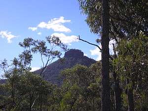
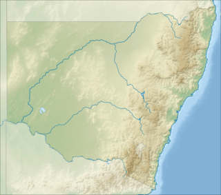
Pigeon House Mountain (Aboriginal: Didthul[1]) is a mountain at an elevation of 720 metres (2,360 ft) AHD [2] on the Budawang Range that is situated within the Morton National Park,[1] located on the South Coast region of New South Wales, Australia.
| Pigeon House Mountain | |
|---|---|
| Aboriginal: Didthul[1] | |
 | |
| Highest point | |
| Elevation | 720 m (2,360 ft) [2] |
| Coordinates | 35°20′57.44″S 150°15′53.94″E |
| Geography | |
 Pigeon House Mountain | |
| Parent range | Budawang Range |
The prominent remnant of a two tier sandstone structure, the nearest town is Milton. Pigeon House Mountain is a popular walking destination, taking an average of three to four hours for a complete ascent and descent from the car park.
Pigeon House Mountain is home to eastern grey kangaroos and superb lyrebirds.
Etymology
The mountain was first seen by Captain James Cook at 7 a.m. on 21 April, 1770, during his voyage of discovery along Australia's eastern coast. Cook described -
a remarkable peaked hill which resembled a square dovehouse with a dome on top and for that reason I called it Pigeon House.[1][3]:24
The Aboriginal name for the mountain is Didthul,[1] Didhol,[2] or Dithol[3]:184 which means "woman's breast" on account of the distinctive shape of the mountain.[2]
Gallery
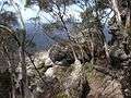 The summit
 View from the summit
 As seen from Mount Budawang, (Pigeon House on right horizon)
 Pigeon House ash on Pigeon House Mountain
References
- "Pigeon House Mountain". Geographical Names Register (GNR) of NSW. Geographical Names Board of New South Wales. Retrieved 9 October 2013.

- "Didhol (Pigeon House Mountain)". South Coast of NSW. Morningside web publishers. Retrieved 9 October 2013.
- The Budawang Committee. Pigeon House and beyond : a guide to the Budawang Range and environs. Budawang Committee. ISBN 0959338101.