Woree, Queensland
Woree is a suburb of Cairns in the Cairns Region, Queensland, Australia.[2] The population in 2006 was 4372 people.
| Woree Queensland | |||||||||||||||
|---|---|---|---|---|---|---|---|---|---|---|---|---|---|---|---|
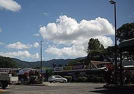 Southside Shopping Village | |||||||||||||||
 Woree | |||||||||||||||
| Coordinates | 16.9627°S 145.7430°E | ||||||||||||||
| Population | 4,821 (2016 census)[1] | ||||||||||||||
| • Density | 790/km2 (2,047/sq mi) | ||||||||||||||
| Postcode(s) | 4868 | ||||||||||||||
| Area | 6.1 km2 (2.4 sq mi) | ||||||||||||||
| LGA(s) | Cairns Region | ||||||||||||||
| State electorate(s) | |||||||||||||||
| Federal Division(s) | Leichhardt | ||||||||||||||
| |||||||||||||||
Geography
The Bruce Highway passes through Woree. From Woree to Brisbane is 1,677 km via the Bruce Highway.
History
The origin of the suburb name Woree is from the Yidinji Aboriginal traditional group of the predominantly inner-north, inner-north west and south Cairns region areas from the Yidiny language, meaning 'piccaninny' referring to the young persons near or at the waterways.[3] It was named by Queensland Rail in 1914. Prior to this, the area was known as Four Mile and Pryns Station.[3]
Woree State School was opened on 5 May 1925 and closed circa 1953.[4] In October 1954, it was decided to relocate its buildings which were relocated to Holloway's Beach to establish a school there (which opened in 1955).[5] The present Woree State School opened in January 1980.[4][6]
Saint Mary's College opened 1 January 1986.[6]
Woree State High School opened on 29 January 1985.[4][6][7]
St Gerard Majella Catholic Primary School opened on 27 January 1988.[4]
Cairns State Special School opened in 2017.[8]
Education
Schools located in Woree are Woree State School, Woree State High School, Saint Mary's College and St Gerard Majella Catholic School.
Woree State School caters for students from Prep to Year 6.[9]
Saint Mary's College provides secondary education for students from Year 7 to Year 12.[10]
St Gerard Majella Catholic School caters for students from Prep to Year 6.[6][11]
Cairns State Special School is a government school from Prep to Year 12 offering individualised education to students with special needs. In 2017, the school had 44 students with 16 teachers (14 full-time equivalent) and 34 non-teaching staff (24 full-time equivalent).[8]
Amenities
There was a popular Drive In movie theatre close by but it is no longer operational.
References
- Australian Bureau of Statistics (27 June 2017). "Woree (State Suburb)". 2016 Census QuickStats. Retrieved 18 April 2018.

- "Woree - suburb in Cairns Region (entry 48945)". Queensland Place Names. Queensland Government. Retrieved 30 July 2017.
- "W Suburbs" (PDF). Cairns Heritage Page. Cairns Regional Council. Archived (PDF) from the original on 13 April 2020. Retrieved 14 April 2020.
- Queensland Family History Society (2010), Queensland schools past and present (Version 1.01 ed.), Queensland Family History Society, ISBN 978-1-921171-26-0
- "NORTHERN LOANS AND WORKS". Cairns Post (16, 410). Queensland, Australia. 15 October 1954. p. 7. Retrieved 6 May 2018 – via National Library of Australia.
- "Opening and closing dates of Queensland Schools". Queensland Government. Retrieved 18 April 2019.
- "Woree State High School". Archived from the original on 21 January 2018. Retrieved 21 January 2018.
- "Annual Report 2017" (PDF). Cairns State Special School. Archived (PDF) from the original on 21 October 2018. Retrieved 21 October 2018.
- "Woree State School". 20 May 2014. Archived from the original on 22 January 2018. Retrieved 21 January 2018.
- "Saint Mary's College Cairns". Archived from the original on 26 February 2018. Retrieved 21 January 2018.
- "St Gerard Majella School". Archived from the original on 28 December 2017. Retrieved 21 January 2018.
Further reading
- "Woree". 2006 Census. Australian Bureau of Statistics. 10 February 2007.