Sandy Cape
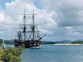
Sandy Cape is the most northern point on Fraser Island off the coast of Queensland, Australia. The place was named by James Cook during his 1770 voyage up the eastern coast of Australia aboard the Endeavour. To the south the next two ocean headlands are Waddy Point and Indian Head which was also named by Cook.[1]
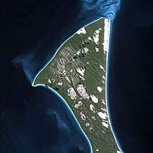
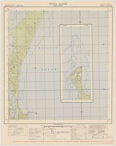
The cape is protected within the Fraser Island section of the Great Sandy National Park. BreakSea Spit extends about 30 km north of Sandy Cape.[2] Nesting loggerhead and green turtles use the remote, sandy location as a rookery.[3] Nighttime driving along the beach at Sandy Cape is banned during the nesting season. The vegetation at the cape is stunted and windswept.[2] The foredunes are lightly covered by spinifex grass.
Vehicle access to Sandy Cape is only available by the eastern beach at low tide.[2] Camping is permitted in the area and it is a popular location with anglers.
History
Matthew Flinders, traveling aboard the Investigator, landed at Sandy Cape in 1802[4] and noted the desolate landscape. In August 1803, the ships Cato and Porpoise were both sunk off the cape in bad weather.
In late December 1842, HMS Fly anchored behind Sandy Cape where some crewmen and naturalists went ashore and commented on the poor sparse surroundings. The Fly returned in April 1845 and took water from an abundant supply behind the beach and about 7 miles within the Cape.
The Seabelle was wrecked in 1857 and the Chang Chow in 1884 in waters closer to the cape which may contain hidden sandbars.[2] Because of the number of shipwrecks in the vicinity the Sandy Cape Light was constructed in 1870. This marked the first permanent European settlement on Fraser Island.[5]
The SS Marloo was wrecked in September 1914.[6]
Clement Lindley Wragge set up an extensive network of weather stations around Queensland, including one at Sandy Cape in 1891.[7] The cape is still used as a reference point for weather observations;[8] however from May 2015, it has been downgraded to a daily observation,[8] compared with the half-hourly observations at some other weather stations.[9]
References
- Hema Maps (1997). Discover Australia's National Parks. Milsons Point, New South Wales: Random House Australia. p. 174. ISBN 1-875992-47-2.
- Hinchliffe, David; Julie Hinchliffe (2006). Explore Fraser Island. Robe, South Australia: Great Sandy Publications. pp. 70–71. ISBN 0-9758190-0-3.
- Jennifer Chapman (8 February 2010). "Tiny turtles start their journey". Noosa News. APN News & Media. Archived from the original on 6 July 2011. Retrieved 3 December 2010.
- "Fraser Coast: History". Fraser Coast Regional Council. Archived from the original on 1 October 2010. Retrieved 11 September 2010.
- "Fraser Island: Culture and History". Sydney Morning Herald. Fairfax Media. 19 November 2008. Archived from the original on 7 November 2012. Retrieved 3 December 2010.
- "Protected Area - SS Marloo (entry 800001)". Queensland Heritage Register. Queensland Heritage Council. Retrieved 1 August 2014.
- "New Meteorological Stations". The Queenslander. Queensland, Australia. 23 May 1891. p. 997. Retrieved 1 February 2017 – via National Library of Australia.
- "Latest Coastal Weather Observations for Sandy Cape". Australian Bureau of Meteorology. 1 February 2017. Archived from the original on 1 February 2017. Retrieved 1 February 2017.
- "Latest Coastal Weather Observations for Queensland". Australian Bureau of Meteorology. 1 February 2017. Archived from the original on 17 January 2017. Retrieved 1 February 2017.