Weipa
Weipa /ˈwiːpə/[3] is a coastal mining town in the local government area of Weipa Town in Queensland, Australia.[4] It is the largest town on the Cape York Peninsula. It exists because of the enormous bauxite deposits along the coast. The Port of Weipa is mainly involved in exports of bauxite. There are also shipments of live cattle from the port.[5]
| Weipa Queensland | |||||||||
|---|---|---|---|---|---|---|---|---|---|
 Weipa | |||||||||
 Weipa | |||||||||
| Coordinates | 12°37′S 141°52′E | ||||||||
| Population | 3,899 (2016 census)[1] | ||||||||
| • Density | 357.7/km2 (926/sq mi) | ||||||||
| Established | 1961[2] | ||||||||
| Postcode(s) | 4874 | ||||||||
| Area | 10.9 km2 (4.2 sq mi) | ||||||||
| Location |
| ||||||||
| LGA(s) | Weipa Town | ||||||||
| State electorate(s) | Cook | ||||||||
| Federal Division(s) | Leichhardt | ||||||||
| |||||||||
In the 2016 census, Weipa had a population of 3,899 people.[6]
Geography
Weipa is the western coast of the Cape York Peninsula facing the Gulf of Carpentaria.
Weipa is just south of Duyfken Point, which is named by Matthew Flinders on 8 November 1802 after the ship Duyfken commanded by the Dutch explorer Willem Janszoon.[7] It is claimed that Janszoon was the first European to sight the Australian coast in the Gulf of Carpentaria in 1606, 164 years before Lieutenant James Cook sailed up the east coast of Australia.[8]
The town consists of three residential suburbs, Rocky Point, Trunding, and Nanum, in addition to the industrial suburb of Evans Landing; these suburbs are contiguous. The town also includes the suburb of Weipa Airport which is not connected to the other suburbs and contains the town's airport.[9]
History
Yupanguthi (Yuputhimri, Jupangati, Yupangathi, Nggerikudi, Yupungati, Jupangati) is an Australian Aboriginal language spoken on Yupanguthi country. The Yupanguthi language region includes the landscape within the local government boundaries of the landscape within the local government boundaries of the Shire of Cook and Weipa Region.[10]
Kugu Yi'anh is a language of Cape York. The traditional language area of Kugu Yi'anh includes landscape within the local government boundaries of the Cook Shire.[11]
Kugu Nganchara (also known as Wik, Wiknantjara, Wik Nganychara, Wik Ngencherr. See also related Wik languages) is a traditional language of the area which includes the landscape within the local government boundaries of the Cook Shire.[12]
Kugu Muminh (also known as Kuku-Muminh. See also related Wik languages) is one of the traditional languages which includes the landscape within the local government boundaries of the Cook Shire.[13]

Thaynakwith (also known as Awngthim, Tainikuit and Winduwinda) is an Australian Aboriginal language spoken on Western Cape York in the Weipa area taking in Albatross Bay and Mission River. The language region includes areas within the local government boundaries of Weipa Town Council and Cook Shire.[14]
In 1895 Presbyterian missionary Reverend Nicholas John Hey established a mission at the junction of Embley River and Spring Creek which he called Weipa, which is believed to derive from the Anhathangayth word meaning fighting ground. In 1932 the mission relocated approximately 28 kilometres (17 mi) to Jessica Point continuing under the same name.[15]
Very restrictive legislation was enacted by the state of Queensland in 1911, making the Protector of Aborigines the legal guardian of every Aboriginal and part-Aboriginal child (until he/she was 21), and the right to confine (or expel) any such person within any Aboriginal reserve or institution, and the right to imprison any Aboriginal or part-Aboriginal person for 14 days if, in the Protector's judgement, they were guilty of neglect of duty, gross insubordination or wilful preaching of disobedience. It also gave powers to the police to confine Aboriginal people to reserves to "protect them from corruption". This latter power was given by Comalco in 1957 to justify the removal of Weipa Aboriginal people.[16]
In 1932 the community had to relocate to its present site, at Jessica Point now called Napranum because of malaria. It is about 12 kilometres (7.5 mi) south of the present town of Weipa. At this time most of the people were Awngthim but soon different tribes and clans were brought from Old Mapoon (when the people were forcibly removed and the settlement burnt down on 15 November 1963),[17] and other communities.
In 1955 a geologist, Henry Evans (1912–1990), discovered that the red cliffs on the Aboriginal reserve, previously remarked on by the early Dutch explorers and Matthew Flinders, were actually enormous deposits of bauxite – the ore from which aluminium is made – and to a lesser extent tungsten.
The "Comalco Act of 1957" revoked the reserve status, giving the company 5,760 square km (2,270 sq mi) of Aboriginal reserve land on the west coast of the Peninsula and 5,135 square km (1,933 sq mi) on the east coast of Aboriginal-owned (though not reserve) land.[18] Mining commenced in 1960. The mission became a government settlement in 1966 with continued attempts by Comalco to relocate the whole community elsewhere. The company then built a new town for its workers on the other side of the bay.
At the 2011 census, Weipa had a population of 3,334;[19] the largest community on Cape York Peninsula.
Climate
Weipa has a tropical savanna climate, with hot temperatures above 30 °C throughout the year. Three distinct seasons exist. The wet season, which runs from January to April, is characterised by heavy downpours on an almost daily basis. Monsoon lows and tropical cyclones cause even more extreme rainfall, up to 200 mm (8 in) in 24 hours. The dry season, running from May to September, features hot and dry days; however, night-time lows are cooler and rainfall is almost non-existent. The build-up season, running from October to December, is oppressively hot and humid, with frequent days over 35 °C. Dewpoints in the wet season average 24 °C; in the dry season they average 18 °C.[20] Rainfall during the build-up is infrequent, but when it does occur, it usually falls in brief, heavy downpours associated with severe thunderstorms.
These seasons are not always set, however; sometimes the wet season can start as early as November or the dry season can extend as late as December, and monsoonal downpours have occurred as late as May.
Extreme temperatures have ranged from 10.2 °C (49.3 °F) to 38.4 °C (101.1 °F). The highest daily rainfall recorded was 327.8 mm (12.9 in) during the passage of Tropical Cyclone Oswald in January 2013.[21]
| Climate data for Weipa, Queensland (Weipa Aero 1992-2016) | |||||||||||||
|---|---|---|---|---|---|---|---|---|---|---|---|---|---|
| Month | Jan | Feb | Mar | Apr | May | Jun | Jul | Aug | Sep | Oct | Nov | Dec | Year |
| Record high °C (°F) | 37.5 (99.5) |
35.7 (96.3) |
34.7 (94.5) |
35.3 (95.5) |
35.5 (95.9) |
34.5 (94.1) |
34.6 (94.3) |
35.9 (96.6) |
38.1 (100.6) |
39.0 (102.2) |
39.2 (102.6) |
38.8 (101.8) |
39.2 (102.6) |
| Average high °C (°F) | 32.0 (89.6) |
31.5 (88.7) |
31.8 (89.2) |
32.3 (90.1) |
31.9 (89.4) |
31.1 (88.0) |
31.0 (87.8) |
32.1 (89.8) |
34.4 (93.9) |
35.7 (96.3) |
35.7 (96.3) |
34.0 (93.2) |
32.8 (91.0) |
| Average low °C (°F) | 24.2 (75.6) |
24.2 (75.6) |
23.9 (75.0) |
22.8 (73.0) |
21.4 (70.5) |
20.0 (68.0) |
19.0 (66.2) |
18.7 (65.7) |
19.8 (67.6) |
21.8 (71.2) |
23.5 (74.3) |
24.2 (75.6) |
22.0 (71.6) |
| Record low °C (°F) | 20.8 (69.4) |
20.4 (68.7) |
19.1 (66.4) |
18.2 (64.8) |
12.7 (54.9) |
10.2 (50.4) |
11.8 (53.2) |
12.9 (55.2) |
14.7 (58.5) |
15.7 (60.3) |
19.0 (66.2) |
20.7 (69.3) |
10.2 (50.4) |
| Average rainfall mm (inches) | 481.1 (18.94) |
508.6 (20.02) |
409.9 (16.14) |
93.2 (3.67) |
19.8 (0.78) |
3.5 (0.14) |
1.5 (0.06) |
5.0 (0.20) |
1.6 (0.06) |
20.2 (0.80) |
101.3 (3.99) |
272.8 (10.74) |
1,918.1 (75.52) |
| Average rainy days | 22.9 | 24.3 | 22.4 | 12.2 | 4.6 | 2.3 | 1.5 | 1.4 | 1.0 | 2.9 | 8.5 | 17.8 | 121.8 |
| Source: The Bureau of Meteorology [22] | |||||||||||||
Bauxite mining
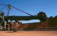
The present town was constructed mainly by Comalco (now called Rio Tinto), a large aluminium company, which began making trial shipments of bauxite to Japan in 1962. A railway was constructed to transport the ore from the mine at Andoom to the dump of the export facility at Lorim Point.[23] The bauxite mine is the world's largest with planned expansions increasing the margin over other mines in 2010.[2]
Education
There are two schools in Weipa.
The Western Cape College is a government co-educational school; it provides early childhood (kindergarten), primary and secondary schooling. It is on the corner of Central and Eastern Avenues in Rocky Point (12.6269°S 141.8805°E).[24] In 2015, the school had an enrolment of 1,073 students with 93 teachers (90 full-time equivalent).[25]
St Joseph's Parish School is a Roman Catholic co-educational primary school at 2 Boundary Road, Rocky Point (12.6293°S 141.8802°E). Opened in 2016, the school only offered enrolment in years P-3 but expects in 2018 to be able to offer enrolment across all primary levels (P-6).[26][27]
Facilities
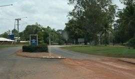
.jpg)
Weipa has a visitor's centre, swimming pool, bowling green, golf club, tennis and squash courts. There are netball and basketball courts as well as football fields. Weipa Town Authority operates a public library at Hibberd Drive in Weipa.[28]
At Nanum the shopping precinct has a Woolworths supermarket, bakery, coffee shop, travel agent, clothing shop, post office, newsagency / sports shop and butchers. There is also a chemist, camping and fishing store and within walking distance is a gift shop, furniture and whitegoods store, credit union and government social security office. At Evans Landing there are a hardware store and a number of mechanical workshops.[29]
Gallery
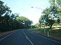 Main road through Weipa township
 Weipa Mission River bridge
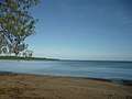 Coastal beach and bay near Wallaby Island
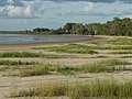 Coastal beach at Nanum suburb
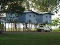 Raised cabins at caravan park near the beach
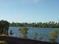 Former mining pit, now a freshwater pond
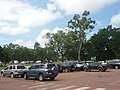 Car park at Woolworths shopping centre, mostly 4WDs
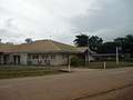 Weipa police station
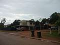 Standard style of housing in Trunding suburb
 Sunset over the Gulf of Carpentaria
See also
- Weipa Airport
- RAAF Base Scherger, also former site of Weipa Immigrant Detention Centre
References
- Australian Bureau of Statistics (27 June 2017). "Weipa (Urban Centre)". 2016 Census QuickStats. Retrieved 23 January 2018.

- Penguin Books Australia (2002). Explore Queensland. Camberwell, Victoria: Penguin Books Australia. p. 60. ISBN 0-14-300015-2.
- Macquarie Dictionary, Fourth Edition (2005). Melbourne, The Macquarie Library Pty Ltd. ISBN 1-876429-14-3
- "Weipa - town in Weipa Town (entry 36899)". Queensland Place Names. Queensland Government. Retrieved 30 May 2019.
- McKillop, Charlie (13 October 2016). "Weipa cattle shipment to Indonesia revives live export hopes in Cape York". ABC News. Australian Broadcasting Corporation. Archived from the original on 10 June 2019. Retrieved 10 June 2019.
- Australian Bureau of Statistics (27 June 2017). "Weipa (UCL)accessdate=20 October 2018". 2016 Census QuickStats.
- "Duyfken Point - point in Cook Shire (entry 10966)". Queensland Place Names. Queensland Government. Retrieved 10 June 2019.
- "Janszoon 1606". Duyfken 1606 Replica. Archived from the original on 2 June 2019. Retrieved 10 June 2019.
- "Queensland Globe". State of Queensland. Retrieved 10 June 2019.
-

-
-
-
-
- "Western Cape History". Weipa Town Authority. Archived from the original on 27 July 2018. Retrieved 8 August 2018.
- Massacres to Mining: The Colonisation of Aboriginal Australia, p. 34. Jan Roberts. 1981. Dove Communications. ISBN 0-85924-171-8.
- Massacres to Mining: The Colonisation of Aboriginal Australia, pp. 115–116. Jan Roberts. 1981. Dove Communications. ISBN 0-85924-171-8.
- Massacres to Mining: The Colonisation of Aboriginal Australia, p. 97. Jan Roberts. 1981. Dove Communications. ISBN 0-85924-171-8.
- Australian Bureau of Statistics (31 October 2012). "Weipa (Urban Centre/Locality)". 2011 Census QuickStats. Retrieved 17 August 2016.
- "Severe Tropical Cyclone Kathy". Bureau of Meteorology. 2011. Archived from the original on 19 March 2011. Retrieved 24 February 2011.
- "Weipa Aero". Climate statistics for Australian locations. Bureau of Meteorology. April 2013. Retrieved 11 April 2013.
- "Climate Statistics for Weipa, Queensland". Archived from the original on 21 October 2018. Retrieved 7 November 2018.
- The Heavy-duty Industrial Railway at Weipa Buckland, John L. Australian Railway Historical Society Bulletin, June, 1975 pp143-148
- "Western Cape College". Western Cape College. Archived from the original on 2 February 2017. Retrieved 22 January 2017.
- "2015 School Annual Report" (PDF). Western Cape College. Archived (PDF) from the original on 2 February 2017. Retrieved 22 January 2017.
- "Join Us". St Joseph's Parish School. Archived from the original on 2 February 2017. Retrieved 22 January 2017.
- "School newsletter" (PDF). Catholic Education. Roman Catholic Diocese of Cairns. April 2015. Archived (PDF) from the original on 7 March 2016. Retrieved 22 January 2017.
- "Hibberd Library". Public Libraries Connect. Archived from the original on 3 February 2018. Retrieved 2 February 2018.
- "Weipa". Centre for the Government of Queensland. Archived from the original on 7 March 2011. Retrieved 17 January 2011.
Further reading
- Moon, Ron & Viv. 2003. Cape York: An Adventurer's Guide. 9th edition. Moon Adventure Publications, Pearcedale, Victoria. ISBN 0-9578766-4-5
- Moore, David R. 1979. Islanders and Aborigines at Cape York: An ethnographic reconstruction based on the 1848–1850 'Rattlesnake' Journals of O. W. Brierly and information he obtained from Barbara Thompson. Australian Institute of Aboriginal Studies. Canberra. ISBN 0-85575-076-6 (hbk); ISBN 0-85575-082-0 (pbk). USA edition ISBN 0-391-00946-X (hbk); ISBN 0-391-00948-6 (pbk).
- Roberts, Jan. 1981. Massacres to Mining: The Colonization of Aboriginal Australia. Dove Communications, Blackburn, Victoria. Rev. Australian ed. Previous ed: CIMRA and War on Want, 1978, London. ISBN 0-85924-171-8.
- Premier's Department (prepared by Connell Wagner). 1989. Cape York Peninsula Resource Analysis. Cairns. OCLC 220913048
- Roth, W.E. 1897. The Queensland Aborigines. 3 Vols. Reprint: Facsimile Edition, Hesperian Press, Victoria Park, W.A., 1984. ISBN 0-85905-054-8
- Ryan, Michelle and Burwell, Colin, eds. 2000. Wildlife of Tropical North Queensland: Cooktown to Mackay. Queensland Museum, Brisbane. ISBN 0-85905-045-9 (set of 3 vols).
- Scarth-Johnson, Vera. 2000. National Treasures: Flowering plants of Cooktown and Northern Australia. Vera Scarth-Johnson Gallery Association, Cooktown. ISBN 0-646-39726-5 (pbk); ISBN 0-646-39725-7 Limited Edition – Leather Bound.
- Sutton, Peter (ed). Languages of Cape York: Papers presented to a Symposium organised by the Australian Institute of Aboriginal Studies. Australian Institute of Aboriginal Studies, Canberra. (1976). ISBN 0-85575-046-4
- Wallace, Lennie. 2003. Cape York Peninsula: A History of Unlauded Heroes 1845–2003. Central Queensland University Press, Rockhampton. ISBN 1-876780-43-6
- Wynter, Jo and Hill, John. 1991. Cape York Peninsula: Pathways to Community Economic Development. The Final Report of The Community Economic Development Projects Cook Shire. Cook Shire Council.
External links
| Wikimedia Commons has media related to Weipa, Queensland. |
- "A Cape to Adventure" A description of a 4WD journey to Cape York by Roderick Eime
- Cooktown Shire Official web page
- Collection of photographs taken by Wolfgang Sievers in 1957 "Presbyterian Mission Station Weipa" held at National Library of Australia, Canberra
- University of Queensland: Queensland Places: Weipa
| Authority control |
|
|---|