Katahari
| Katahari | |
|---|---|
| Rural Municipalities | |
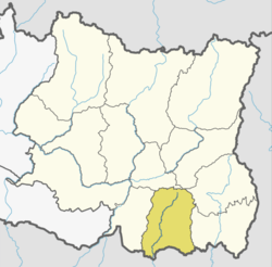
 Katahari Location in Nepal | |
| Coordinates: 26°28′N 87°19′E / 26.47°N 87.32°ECoordinates: 26°28′N 87°19′E / 26.47°N 87.32°E | |
| Country |
|
| Province | Province No. 1 |
| District | Morang District |
| Population (2011-06-22) | |
| • Total | 39,775 |
| Time zone | UTC+5:45 (Nepal Time) |
Katahari is a Village Council or Gaunpalika in Morang District in Nepali Province No.1. Previously, a village development committee (VDC) of the same name existed. The current Katahari Village Council was formed by combining previous VDCs of Katahari, Thalaha and Vaudaha.[1]
Demographics
According to the 2011 census, it had a population of 39,775 inhabitants.[2] The population density is 770.9/km² [2011]. The total population of Katahari Village is 20155 and number of houses is 354. Female Population is 2.4% of total population. Village literacy rate is 57.0% and the Female Literacy rate is 26.0%. Its local language is Hindi.
Geography
Katahari is located in south-east Nepal in Province No. 1 near Biratnagar (बिराटनगर). It has an area of 51.6 km².
References
This article is issued from
Wikipedia.
The text is licensed under Creative Commons - Attribution - Sharealike.
Additional terms may apply for the media files.