South Rockfish Valley Rural Historic District
|
South Rockfish Valley Rural Historic District | |
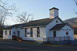 Elk Hill Baptist Church on Glenthorne Loop | |
  | |
| Location | State Route 151 and feeder roads, Nellysford, Virginia |
|---|---|
| Coordinates | 37°53′42″N 78°51′58″W / 37.89500°N 78.86611°WCoordinates: 37°53′42″N 78°51′58″W / 37.89500°N 78.86611°W |
| Area | 1,620 acres (660 ha) |
| NRHP reference # | 16000534[1] |
| Added to NRHP | August 15, 2016 |
The South Rockfish Valley Rural Historic District encompasses a large rural landscape in northern Nelson County, Virginia. It includes more than 1,600 acres (650 ha) of rolling bottomlands of the South Fork Rockfish River, with Virginia State Route 151 as its principal transportation route. This area has been farmed since the 18th century, and many of its early land use patterns persist to this day.[2]
The district was listed on the National Register of Historic Places in 2016.[1] Properties within the district that were previously listed on the National Register include River Bluff, Elk Hill, Three Chimneys, and the Wintergreen Country Store.[2]
See also
References
- 1 2 National Park Service (2008-04-15). "National Register Information System". National Register of Historic Places. National Park Service.
- 1 2 "NRHP nomination for South Rockfish Valley Rural Historic District" (PDF). National Park Service. Retrieved 2017-10-21.


This article is issued from
Wikipedia.
The text is licensed under Creative Commons - Attribution - Sharealike.
Additional terms may apply for the media files.