Sog County
| Sog County 索县 • སོག་རྫོང་། | |
|---|---|
| County | |
.png) Location of Sog County within Tibet | |
 Sog County Location in Tibet | |
| Coordinates: 32°02′44″N 94°16′54″E / 32.04556°N 94.28167°E | |
| Country | China |
| Province | Tibet |
| Prefecture-level city | Nagqu |
| Capital | Sog |
| Time zone | UTC+8 (China Standard) |
Sog County, Sogxian, or Suoxian (Tibetan སོག་རྫོང་ Wylie sog rdzong; Chinese: 索县; Pinyin: Suǒ Xiàn) is a county within Nagqu of the Tibet Autonomous Region.
Sog Dzong lies in the extreme western part of the former province of Kham. To its west is Chamdo and to its right Nagchu. Sogdzong is located between the Drachen and Driru, on the Sogchu River. It is the source of Gyalmo Ngulchu.
Crops include barley, wheat, radish, potatoes, etc. and yaks, sheep, goat, cows, and horses are reared. Nomads move four times annually according to seasons. The county contains Tsangdain Monastery, built in 1667, resembling the Potala Palace.[1]
References
- ↑ "Tibet's three "Potala Palaces"". China-Tibet Online. Retrieved 9 April 2012.
Transport
External links
| District | 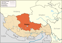 | |
|---|---|---|
| Counties | ||
| Towns and villages |
| |
| Geography |
| |
Coordinates: 32°02′44″N 94°16′54″E / 32.04556°N 94.28167°E
This article is issued from
Wikipedia.
The text is licensed under Creative Commons - Attribution - Sharealike.
Additional terms may apply for the media files.