Gêrzê County
| Gêrzê County 改则县 • སྒེར་རྩེ་རྫོང་། | |
|---|---|
| County | |
.png) Location of Gêrzê County (red) within Ngari Prefecture (yellow) and the Tibet A.R. | |
 Gêrzê Location of the seat in the Tibet A.R. | |
| Coordinates: 33°45′53″N 84°07′22″E / 33.76472°N 84.12278°E | |
| Country | People's Republic of China |
| Region | Tibet |
| Prefecture | Ngari |
| Time zone | UTC+8 (China Standard) |
Gêrzê County (Tibetan: སྒེར་རྩེ་རྫོང་།, Wylie: sger rtse rdzong, ZYPY: Gêrzê Zong ; simplified Chinese: 改则县; traditional Chinese: 改則縣; pinyin: Gǎizé Xiàn) is a county located in the northwest of the Tibet Autonomous Region, bordering Xinjiang to the north. Under the administration of Ngari Prefecture, it has a total area of 135,600 km2 (52,400 sq mi).
Climate
| Climate data for Gêrzê | |||||||||||||
|---|---|---|---|---|---|---|---|---|---|---|---|---|---|
| Month | Jan | Feb | Mar | Apr | May | Jun | Jul | Aug | Sep | Oct | Nov | Dec | Year |
| Average high °C (°F) | −3 (27) |
−1 (30) |
3 (37) |
7 (45) |
13 (55) |
18 (64) |
20 (68) |
18 (64) |
15 (59) |
8 (46) |
2 (36) |
−2 (28) |
8 (47) |
| Average low °C (°F) | −22 (−8) |
−19 (−2) |
−14 (7) |
−10 (14) |
−4 (25) |
2 (36) |
5 (41) |
5 (41) |
2 (36) |
−9 (16) |
−16 (3) |
−21 (−6) |
−8 (17) |
| Average precipitation mm (inches) | 1.0 (0.039) |
1.1 (0.043) |
0.5 (0.02) |
2.0 (0.079) |
6.9 (0.272) |
16.4 (0.646) |
49.1 (1.933) |
63.3 (2.492) |
24.8 (0.976) |
5.3 (0.209) |
0.3 (0.012) |
0.4 (0.016) |
171.1 (6.737) |
| Source: http://www.worldweatheronline.com/Gerze-weather-averages/Xizang/CN.aspx | |||||||||||||
| County-level divisions | 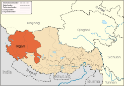 | |
|---|---|---|
| Towns and villages | ||
| Geography | ||
| Landmarks | ||
Coordinates: 33°45′53″N 84°07′22″E / 33.76472°N 84.12278°E
This article is issued from
Wikipedia.
The text is licensed under Creative Commons - Attribution - Sharealike.
Additional terms may apply for the media files.