Saint-Aubin-de-Terregatte
| Saint-Aubin-de-Terregatte | |
|---|---|
| Commune | |
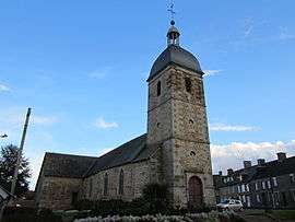 Saint-Aubin church | |
 Saint-Aubin-de-Terregatte Location within Normandy region  Saint-Aubin-de-Terregatte | |
| Coordinates: 48°34′36″N 1°17′54″W / 48.5767°N 1.2983°WCoordinates: 48°34′36″N 1°17′54″W / 48.5767°N 1.2983°W | |
| Country | France |
| Region | Normandy |
| Department | Manche |
| Arrondissement | Avranches |
| Canton | Saint-Hilaire-du-Harcouët |
| Intercommunality | Saint-James |
| Government | |
| • Mayor (2008–2014) | Jean-Pierre Carnet |
| Area1 | 20.96 km2 (8.09 sq mi) |
| Population (1999)2 | 563 |
| • Density | 27/km2 (70/sq mi) |
| Time zone | UTC+1 (CET) |
| • Summer (DST) | UTC+2 (CEST) |
| INSEE/Postal code | 50448 /50240 |
| Elevation |
12–181 m (39–594 ft) (avg. 75 m or 246 ft) |
|
1 French Land Register data, which excludes lakes, ponds, glaciers > 1 km2 (0.386 sq mi or 247 acres) and river estuaries. 2 Population without double counting: residents of multiple communes (e.g., students and military personnel) only counted once. | |
Saint-Aubin-de-Terregatte is a commune in the Manche department in Normandy in north-western France.
See also
References
| Wikimedia Commons has media related to Saint-Aubin-de-Terregatte. |
This article is issued from
Wikipedia.
The text is licensed under Creative Commons - Attribution - Sharealike.
Additional terms may apply for the media files.