Le Tanu
| Le Tanu | |
|---|---|
| Commune | |
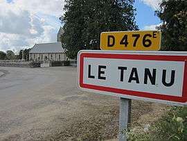 Village entrance | |
 Le Tanu Location within Normandy region  Le Tanu | |
| Coordinates: 48°49′02″N 1°20′38″W / 48.8172°N 1.3439°WCoordinates: 48°49′02″N 1°20′38″W / 48.8172°N 1.3439°W | |
| Country | France |
| Region | Normandy |
| Department | Manche |
| Arrondissement | Avranches |
| Canton | Villedieu-les-Poêles |
| Intercommunality | Communauté de communes du Pays hayland |
| Government | |
| • Mayor (2008–2014) | Léon Grente |
| Area1 | 10.12 km2 (3.91 sq mi) |
| Population (2006)2 | 322 |
| • Density | 32/km2 (82/sq mi) |
| Demonym(s) | Tanuais |
| Time zone | UTC+1 (CET) |
| • Summer (DST) | UTC+2 (CEST) |
| INSEE/Postal code | 50590 /50320 |
| Elevation | 68–166 m (223–545 ft) |
|
1 French Land Register data, which excludes lakes, ponds, glaciers > 1 km2 (0.386 sq mi or 247 acres) and river estuaries. 2 Population without double counting: residents of multiple communes (e.g., students and military personnel) only counted once. | |
Le Tanu is a commune in the Manche department in Normandy in north-western France.
See also
| Wikimedia Commons has media related to Le Tanu. |
This article is issued from
Wikipedia.
The text is licensed under Creative Commons - Attribution - Sharealike.
Additional terms may apply for the media files.