Le Perron
| Le Perron | |
|---|---|
| Commune | |
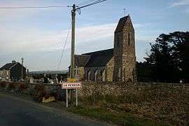 The church | |
 Le Perron Location within Normandy region  Le Perron | |
| Coordinates: 49°03′11″N 0°54′01″W / 49.0531°N 0.9003°WCoordinates: 49°03′11″N 0°54′01″W / 49.0531°N 0.9003°W | |
| Country | France |
| Region | Normandy |
| Department | Manche |
| Arrondissement | Saint-Lô |
| Canton | Condé-sur-Vire |
| Intercommunality | Communauté de communes du canton de Torigni-sur-Vire |
| Government | |
| • Mayor (2008–2014) | Yves Anquetil |
| Area1 | 4.66 km2 (1.80 sq mi) |
| Population (2006)2 | 168 |
| • Density | 36/km2 (93/sq mi) |
| Demonym(s) | Perronnais |
| Time zone | UTC+1 (CET) |
| • Summer (DST) | UTC+2 (CEST) |
| INSEE/Postal code | 50398 /50160 |
| Elevation |
92–180 m (302–591 ft) (avg. 80 m or 260 ft) |
|
1 French Land Register data, which excludes lakes, ponds, glaciers > 1 km2 (0.386 sq mi or 247 acres) and river estuaries. 2 Population without double counting: residents of multiple communes (e.g., students and military personnel) only counted once. | |
Le Perron is a commune in the Manche department in Normandy in north-western France.
See also
| Wikimedia Commons has media related to Le Perron. |
This article is issued from
Wikipedia.
The text is licensed under Creative Commons - Attribution - Sharealike.
Additional terms may apply for the media files.