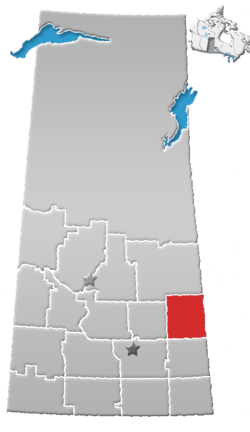
Buchanan, Saskatchewan
| Buchanan | |
|---|---|
| Village | |
| Village of Buchanan | |
 Buchanan Location of Buchanan in Saskatchewan  Buchanan Buchanan (Canada) | |
| Coordinates: 51°42′05″N 102°45′14″W / 51.7013511°N 102.7539806°W | |
| Country |
|
| Province |
|
| Region | East-Central |
| Census division | 9 |
| Rural Municipality | Buchanan No. 304 |
| Post office Founded | 1906 |
| Incorporated (Village) | May 6, 1907 |
| Government[1] | |
| • Type | Municipal |
| • Governing body | Buchanan Village Council |
| • Mayor | Sean Wilson |
| • Administrator | Candace Loshka |
| Area | |
| • Urban | 1.29 km2 (0.50 sq mi) |
| Elevation[2] | 502 m (1,647 ft) |
| Population (2016) | |
| • Village | 218 |
| • Density | 168.8/km2 (437/sq mi) |
| Time zone | UTC-6 (CST) |
| • Summer (DST) | UTC-6 (CST[3]) |
| Postal code | S0A 0J0 |
| Area code(s) | 306 / 639 |
| Highways |
|
Buchanan /bjuːˈkænən/ (2016 Population: 218) is a village within the Rural Municipality of Buchanan No. 304, Saskatchewan, Canada.
Demographics
| Canada census – Buchanan community profile | |||
|---|---|---|---|
| 2016 | 2011 | 2006 | |
| Population: | 218 (-3.1% from 2011) | 225 (0.0% from 2006) | 225 (-3.4% from 2001) |
| Land area: | 1.29 km2 (0.50 sq mi) | 1.29 km2 (0.50 sq mi) | 1.29 km2 (0.50 sq mi) |
| Population density: | 168.8/km2 (437/sq mi) | 174.41/km2 (451.7/sq mi) | 174.41/km2 (451.7/sq mi) |
| Median age: | 53.0 (M: 54.0, F: 51.5) | 54.8 (M: 53.7, F: 58.1) | 53.9 (M: 53.4, F: 55.3) |
| Total private dwellings: | 118 | 134 | 152 |
| Median household income: | |||
| References: 2016[4] 2011[5] 2006[6] earlier[7] | |||
Notable people
- Lois Hole (1929–2005), Canadian writer, businesswoman, and politician; 15th Lieutenant Governor of Alberta
- Michel Hrynchyshyn, Ukrainian Catholic bishop[8]
See also
References
- ↑ "Sask municipal directory". Archived from the original on March 4, 2016. Retrieved August 20, 2014.
- ↑ "Buchanan - NRC". Natural Resources Canada. Retrieved 2014-08-20.
- ↑ "Time zones & daylight saving time". National Research Council Canada. 2012-05-09. Retrieved 2014-07-16.
- ↑ "2016 Community Profiles". Canada 2016 Census. Statistics Canada. February 21, 2017. Retrieved 2017-03-15.
- ↑ "2011 Community Profiles". Canada 2011 Census. Statistics Canada. July 5, 2013. Retrieved February 27, 2015.
- ↑ "2006 Community Profiles". Canada 2006 Census. Statistics Canada. March 30, 2011. Retrieved February 27, 2015.
- ↑ "2001 Community Profiles". Canada 2001 Census. Statistics Canada. February 17, 2012.
- ↑ Michael (Michel) Hrynchyshyn-Catholic-Hierarchy.org
External links
Coordinates: 51°42′14″N 102°45′22″W / 51.70389°N 102.75611°W
This article is issued from
Wikipedia.
The text is licensed under Creative Commons - Attribution - Sharealike.
Additional terms may apply for the media files.
