Hyas, Saskatchewan
| Hyas | |
|---|---|
| Village | |
| Village of Hyas | |
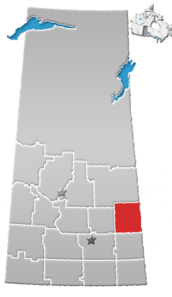
 Location of Hyas in Saskatchewan  Hyas, Saskatchewan (Canada) | |
| Coordinates: 51°52′30″N 102°14′17″W / 51.875°N 102.238°W | |
| Country |
|
| Province |
|
| Region | East-central |
| Census division | 9 |
| Rural Municipality | Clayton No. 333 |
| Post office Founded | 1912-06-01 |
| Government | |
| • Type | Municipal |
| • Governing body | Hyas Village Council |
| • Mayor | Barry Bogucky |
| • Administrator | Shannon Amon |
| • MLA - Yorkton-Melville | Garry Breitkreuz (2008) |
| Area | |
| • Total | 1.17 km2 (0.45 sq mi) |
| Population (2016) | |
| • Total | 70 |
| • Density | 59.6/km2 (154/sq mi) |
| Time zone | UTC-6 (CST) |
| Postal code | S0A 1K0 |
| Area code(s) | 306 |
| Highways |
|
| Railways | Canadian National Railway |
| Website | Village of Hyas |
| [1][2][3][4] | |
Hyas is a village within the Rural Municipality of Clayton No. 333 in the province of Saskatchewan, Canada. The village had a population of 70 in the 2016 Canada Census, (a -38.6% decrease from 114 in the 2011 Canada Census).
Demographics
| Canada census – Hyas, Saskatchewan community profile | |||
|---|---|---|---|
| 2016 | 2011 | 2006 | |
| Population: | 70 (-38.6% from 2011) | 114 (2.7% from 2006) | 111 (-15.3% from 2001) |
| Land area: | 1.17 km2 (0.45 sq mi) | 1.17 km2 (0.45 sq mi) | 1.17 km2 (0.45 sq mi) |
| Population density: | 59.6/km2 (154/sq mi) | 97.1/km2 (251/sq mi) | 94.5/km2 (245/sq mi) |
| Median age: | 59.0 (M: 59.3, F: 56.0) | 54.8 (M: 48.8, F: 56.5) | |
| Total private dwellings: | 49 | 73 | 74 |
| Median household income: | |||
| References: 2016[5] 2011[6] 2006[7] earlier[8] | |||
See also
References
- ↑ National Archives, Archivia Net, Post Offices and Postmasters, archived from the original on October 6, 2006
- ↑ Government of Saskatchewan, MRD Home, Municipal Directory System, archived from the original (– Scholar search) on November 21, 2008
- ↑ Canadian Textiles Institute. (2005), CTI Determine your provincial constituency, archived from the original on 2007-09-11
- ↑ Commissioner of Canada Elections, Chief Electoral Officer of Canada (2005), Elections Canada On-line, archived from the original on April 21, 2007
- ↑ "2016 Community Profiles". Canada 2016 Census. Statistics Canada. February 21, 2017. Retrieved 2017-03-15.
- ↑ "2011 Community Profiles". Canada 2011 Census. Statistics Canada. July 5, 2013. Retrieved 2012-02-22.
- ↑ "2006 Community Profiles". Canada 2006 Census. Statistics Canada. March 30, 2011. Retrieved 2009-02-24.
- ↑ "2001 Community Profiles". Canada 2001 Census. Statistics Canada. February 17, 2012.
External links
| Subdivisions | |
|---|---|
| Communities | |
| Cities | |
| Topics |
|
| |
Coordinates: 51°52′30″N 102°14′17″W / 51.875°N 102.238°W
This article is issued from
Wikipedia.
The text is licensed under Creative Commons - Attribution - Sharealike.
Additional terms may apply for the media files.