Invermay, Saskatchewan
| Invermay | |
|---|---|
| Village | |
| Village of Invermay | |
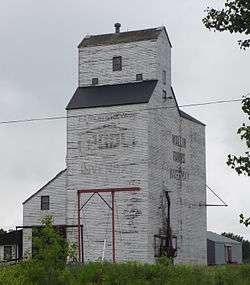 Grain elevator in Invermay | |
| Motto(s): "The Crossroads Centre" | |
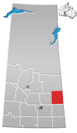
 Invermay Invermay in Saskatchewan  Invermay Invermay (Canada) | |
| Coordinates: 51°48′21″N 103°09′23″W / 51.80583°N 103.15639°WCoordinates: 51°48′21″N 103°09′23″W / 51.80583°N 103.15639°W[1] | |
| Country |
|
| Province |
|
| Region | East-central |
| Census division | 9 |
| Rural Municipality | Invermay No. 305 |
| Government | |
| • Type | Mayor-Council |
| • Governing body | Invermay Village Council |
| • Mayor | Michael J. Kaminski |
| • Administrator | Tammy Loerzel |
| Area | |
| • Urban | 1.22 km2 (0.47 sq mi) |
| Elevation[2] | 556 m (1,825 ft) |
| Population (2016) | |
| • Urban | 247 |
| • Urban density | 201.8/km2 (523/sq mi) |
| Time zone | UTC-6 (CST) |
| • Summer (DST) | UTC-6 (CST (No DST)[3]) |
| Postal code | S0A 1M0 |
| Area code(s) | 306/639 |
| Highways |
|
| Railways | Canadian National Railway |
| [4][5][6][7] | |
Invermay is a village within the Rural Municipality of Invermay No. 305 in the province of Saskatchewan, Canada. The village had a population of 273 in the 2016 Canada Census, (a 10.5% increase from 247 in the 2011 Canada Census). Invermay is about 75 km west of Canora or about 50 km east of Wadena on Highway 5.
Demographics
| Canada census – Invermay, Saskatchewan community profile | |||
|---|---|---|---|
| 2016 | 2011 | 2006 | |
| Population: | 273 (10.5% from 2011) | 247 (-5.7% from 2006) | 262 (-7.7% from 2001) |
| Land area: | 1.22 km2 (0.47 sq mi) | 1.22 km2 (0.47 sq mi) | 1.22 km2 (0.47 sq mi) |
| Population density: | 223.0/km2 (578/sq mi) | 201.8/km2 (523/sq mi) | 214.0/km2 (554/sq mi) |
| Median age: | 46.2 (M: 41.5, F: 52.5) | 50.2 (M: 43.8, F: 56.0) | 55.0 (M: 50.2, F: 57.2) |
| Total private dwellings: | 105 | 130 | 145 |
| Median household income: | |||
| References: 2016[8] 2011[9] 2006[10] earlier[11] | |||

See also
References
- ↑ "The Atlas of Canada Toporama". Retrieved August 20, 2014.
- ↑ "NRC - Invermay". Retrieved August 20, 2014.
- ↑ "Time zones & daylight saving time". National Research Council Canada. 2012-05-09. Retrieved 2014-07-16.
- ↑ National Archives, Archivia Net, Post Offices and Postmasters, archived from the original on 2006-10-06
- ↑ Government of Saskatchewan, MRD Home, Municipal Directory System, archived from the original (– Scholar search) on November 21, 2008
- ↑ Canadian Textiles Institute. (2005), CTI Determine your provincial constituency, archived from the original on 2007-09-11
- ↑ Commissioner of Canada Elections, Chief Electoral Officer of Canada (2005), Elections Canada On-line, archived from the original on 2007-04-21
- ↑ "2016 Community Profiles". Canada 2016 Census. Statistics Canada. February 21, 2017. Retrieved August 23, 2017.
- ↑ "2011 Community Profiles". Canada 2011 Census. Statistics Canada. July 5, 2013. Retrieved February 27, 2015.
- ↑ "2006 Community Profiles". Canada 2006 Census. Statistics Canada. March 30, 2011. Retrieved February 27, 2015.
- ↑ "2001 Community Profiles". Canada 2001 Census. Statistics Canada. February 17, 2012.
External links
- Saskatchewan City & Town Maps
- Saskatchewan Gen Web - One Room School Project
- Post Offices and Postmasters - ArchiviaNet - Library and Archives Canada
- Saskatchewan Gen Web Region
- Online Historical Map Digitization Project
- GeoNames Query
Places adjacent to Invermay, Saskatchewan | ||||||||||
|---|---|---|---|---|---|---|---|---|---|---|
| ||||||||||
| Subdivisions | |
|---|---|
| Communities | |
| Cities | |
| Topics |
|
| |
This article is issued from
Wikipedia.
The text is licensed under Creative Commons - Attribution - Sharealike.
Additional terms may apply for the media files.