Amsterdam, Saskatchewan
| Amsterdam | |
|---|---|
| Organized hamlet | |
| Hamlet of Amsterdam | |
 Amsterdam | |
| Coordinates: 51°37′37″N 102°26′53″W / 51.627°N 102.448°WCoordinates: 51°37′37″N 102°26′53″W / 51.627°N 102.448°W | |
| Country |
|
| Province |
|
| Region | East-central |
| Census division | 9 |
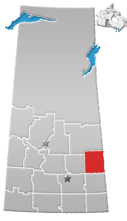
| Rural Municipality | Buchanan No. 304 |
| Government | |
| • Type | Municipal |
| • Governing body | Rural Municipality of Buchanan |
| • Reeve | Don Skoretz |
| • Administrator | Twila Hadubiak |
| Area | |
| • Total | 0.31 km2 (0.12 sq mi) |
| Population (2016) | |
| • Total | 25 |
| • Density | 80.7/km2 (209/sq mi) |
| Time zone | UTC-6 (CST) |
| Postal code | S0A 0L0 |
| Area code(s) | 306 |
| Highways |
|
| Railways | (abandoned) |
| [1][2][3][4] | |
Amsterdam is a hamlet within the Rural Municipality of Buchanan No. 304, Saskatchewan, Canada. Listed as a designated place by Statistics Canada, the hamlet had a population of 25 in the Canada 2016 Census.[5] The hamlet is located 63.9 km north of the city of Yorkton and 1.5 km west of Highway 9. The community was founded at the turn of the 20th century by Dutch immigrants, hence the name. In its prime, the community had a post office, grain elevator, garage, and a school. It, like many small towns, has been hit hard by the gradual trend toward urbanization. The hamlet now has fewer than 25 people, most are of Ukrainian descent.
Demographics
| Canada census – Amsterdam, Saskatchewan community profile | |||
|---|---|---|---|
| 2016 | 2011 | ||
| Population: | 25 (-3.5% from 2011) | 26 (+36.8% from 2006) | |
| Land area: | 0.31 km2 (0.12 sq mi) | 0.31 km2 (0.12 sq mi) | |
| Population density: | 80.7/km2 (209/sq mi) | 83.9/km2 (217/sq mi) | |
| Median age: | |||
| Total private dwellings: | 10 | 13 | |
| Median household income: | |||
| References: 2016[6] 2011[7] earlier[8] | |||
See also
References
- ↑ National Archives, Archivia Net, Post Offices and Postmasters, archived from the original on 2006-10-06
- ↑ Government of Saskatchewan, MRD Home, Municipal Directory System, archived from the original (– Scholar search) on 2008-11-21
- ↑ Canadian Textiles Institute. (2005), CTI Determine your provincial constituency, archived from the original on 2007-09-11
- ↑ Commissioner of Canada Elections, Chief Electoral Officer of Canada (2005), Elections Canada On-line, archived from the original on 2007-04-21
- ↑ Canada 2016 Census: Designated places in Saskatchewan
- ↑ "2016 Community Profiles". Canada 2016 Census. Statistics Canada. February 21, 2017. Retrieved 2017-03-15.
- ↑ "2011 Community Profiles". Canada 2011 Census. Statistics Canada. July 5, 2013. Retrieved February 27, 2015.
- ↑ "2001 Community Profiles". Canada 2001 Census. Statistics Canada. February 17, 2012.
External links
- Saskatchewan City & Town Maps
- Saskatchewan Gen Web - One Room School Project
- Post Offices and Postmasters - ArchiviaNet - Library and Archives Canada
- Saskatchewan Gen Web Region
- Online Historical Map Digitization Project
- GeoNames Query
| Subdivisions | |
|---|---|
| Communities | |
| Cities | |
| Topics |
|
| |
This article is issued from
Wikipedia.
The text is licensed under Creative Commons - Attribution - Sharealike.
Additional terms may apply for the media files.