Coderre, Saskatchewan
| Coderre | |
|---|---|
| Village | |
| Village of Coderre | |
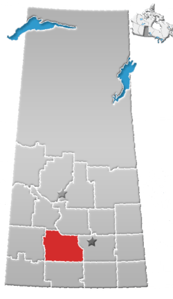
 Location of Coderre in Saskatchewan  Coderre, Saskatchewan (Canada) | |
| Coordinates: 50°08′06″N 106°23′02″W / 50.135°N 106.384°W | |
| Country |
|
| Province |
|
| Region | Southeast |
| Census division | 7 |
| Rural Municipality | Rodgers No. 133 |
| Government | |
| • Type | Municipal |
| • Governing body | Coderre Village Council |
| • Mayor | Keven Bender |
| • Administrator | Patti Verville |
| Area | |
| • Total | 0.85 km2 (0.33 sq mi) |
| Population (2016) | |
| • Total | 30 |
| • Density | 35.1/km2 (91/sq mi) |
| Time zone | UTC-6 (CST) |
| Postal code | S0H 0X0 |
| Area code(s) | 306 |
| Highways |
|
| Railways | (Defunct pulled) |
Coderre is a village within the Rural Municipality of Rodgers No. 133 Saskatchewan, Canada. The village had a population of 30 in the 2016 Census, (a 0.0 change from 30 in the 2011 Census. The village is located appoximately 85 km southwest of the city of Moose Jaw on Highway 627.
Demographics
| Canada census – Coderre community profile | |||
|---|---|---|---|
| 2016 | 2011 | 2006 | |
| Population: | 30 (0.0% from 2011) | 30 (-25.0% from 2006) | 40 (-20.0% from 2001) |
| Land area: | 0.85 km2 (0.33 sq mi) | 0.85 km2 (0.33 sq mi) | 0.85 km2 (0.33 sq mi) |
| Population density: | 35.1/km2 (91/sq mi) | 35.1/km2 (91/sq mi) | 46.8/km2 (121/sq mi) |
| Median age: | 42.5 (M: 42.5, F: 42.5) | ||
| Total private dwellings: | 19 | 23 | 26 |
| Median household income: | |||
| References: 2016[1] 2011[2] 2006[3] earlier[4] | |||
Climate
| Climate data for Coderre | |||||||||||||
|---|---|---|---|---|---|---|---|---|---|---|---|---|---|
| Month | Jan | Feb | Mar | Apr | May | Jun | Jul | Aug | Sep | Oct | Nov | Dec | Year |
| Record high °C (°F) | 13 (55) |
19 (66) |
22 (72) |
32.2 (90) |
37 (99) |
41.5 (106.7) |
39 (102) |
38.9 (102) |
38 (100) |
33 (91) |
23.5 (74.3) |
12.5 (54.5) |
41.5 (106.7) |
| Average high °C (°F) | −8.6 (16.5) |
−4.6 (23.7) |
2.1 (35.8) |
11.7 (53.1) |
18.7 (65.7) |
23.3 (73.9) |
26.1 (79) |
25.7 (78.3) |
19.2 (66.6) |
12.1 (53.8) |
0.8 (33.4) |
−5.9 (21.4) |
10 (50) |
| Daily mean °C (°F) | −14.5 (5.9) |
−10.4 (13.3) |
−4 (25) |
4.7 (40.5) |
11.3 (52.3) |
16.1 (61) |
18.5 (65.3) |
17.7 (63.9) |
11.5 (52.7) |
4.8 (40.6) |
−4.8 (23.4) |
−11.8 (10.8) |
3.3 (37.9) |
| Average low °C (°F) | −20.3 (−4.5) |
−16.3 (2.7) |
−10 (14) |
−2.3 (27.9) |
3.9 (39) |
8.8 (47.8) |
10.9 (51.6) |
9.8 (49.6) |
3.7 (38.7) |
−2.5 (27.5) |
−10.4 (13.3) |
−17.7 (0.1) |
−3.5 (25.7) |
| Record low °C (°F) | −41.7 (−43.1) |
−42 (−44) |
−40.6 (−41.1) |
−30 (−22) |
−15 (5) |
−5 (23) |
1.1 (34) |
−1.5 (29.3) |
−13.3 (8.1) |
−23 (−9) |
−35.6 (−32.1) |
−42 (−44) |
−42 (−44) |
| Average precipitation mm (inches) | 16 (0.63) |
14 (0.55) |
19.3 (0.76) |
20.9 (0.823) |
51.7 (2.035) |
65.1 (2.563) |
64.4 (2.535) |
39.3 (1.547) |
36.2 (1.425) |
18.7 (0.736) |
13.3 (0.524) |
18.4 (0.724) |
377.3 (14.854) |
| Source: Environment Canada[5] | |||||||||||||
See also
References
- ↑ "2016 Community Profiles". Canada 2016 Census. Statistics Canada. February 21, 2017. Retrieved 2017-03-15.
- ↑ "2011 Community Profiles". Canada 2011 Census. Statistics Canada. July 5, 2013. Retrieved 2012-10-30.
- ↑ "2006 Community Profiles". Canada 2006 Census. Statistics Canada. March 30, 2011.
- ↑ "2001 Community Profiles". Canada 2001 Census. Statistics Canada. February 17, 2012.
- ↑ Environment Canada Canadian Climate Normals 1971–2000, accessed 24 July 2010
External links
| Subdivisions | |
|---|---|
| Communities | |
| Cities | |
| Topics |
|
| |
Coordinates: 50°08′06″N 106°23′02″W / 50.135°N 106.384°W
This article is issued from
Wikipedia.
The text is licensed under Creative Commons - Attribution - Sharealike.
Additional terms may apply for the media files.