Mistusinne
| Mistusinne, Saskatchewan | |
|---|---|
| Resort Village | |
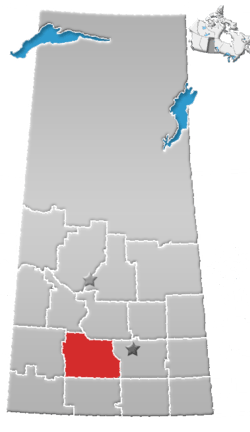
 Location of Mistusinne in Saskatchewan | |
| Coordinates: 51°02′26″N 106°18′49″W / 51.040687°N 106.313480°W | |
| Country | Canada |
| Province | Saskatchewan |
| Region | Central |
| Census division | 7 |
| Rural Municipality | Maple Bush |
| Post office Founded | N/A |
| Village Incorporated | N/A |
| Government | |
| • Mayor | Lloyd Montgomery |
| • Administrator | Yvonne Jess |
| • Governing body | Mistusinne Village Council |
| Area | |
| • Total | 1.49 km2 (0.58 sq mi) |
| Population (2006) | |
| • Total | 56 |
| • Density | 37.6/km2 (97/sq mi) |
| Time zone | CST |
| Area code(s) | 306 |
| Highways | Highway 19 |
| Railways |
|
| Website | Resort Village of Mistusinne |
Mistusinne is a resort village in Maple Bush Rural Municipality No. 224, Saskatchewan, Canada. The population was 56 at the 2006 Census. The village's name is derived from the Plains Cree word mistasiniy (meaning "big stone") which refers to a massive stone that resembled a sleeping bison that once rested in the Qu'Appelle Valley before Lake Diefenbaker was built. Douglas Provincial Park extends from the community to the Qu'Appelle River Dam and is 8 km south of the village of Elbow on highway 19. The community serves as a summer retreat that contains many cabins and a golf course, with a view of Lake Diefenbaker. Part of the golf course along the shore had to be rebuilt when waters of Lake Diefenbaker rose in 1998 and collapsed the shoreline.
The town's namesake, the boulder Mistusinne (also spelled Mistaseni), was a 400-ton glacial erratic and a sacred gathering place for the Cree and Assiniboine peoples. During the South Saskatchewan River Dam Project, it was in the flood path to the new reservoir of Lake Diefenbaker. In 1966, the Prairie Farm Rehabilitation Administration had the rock blasted apart with explosives, despite efforts by groups to save it. Pieces of the rock were used in monuments to Chief Poundmaker and a memorial to the boulder itself in Elbow. Large fragments were located under the waters of the lake in 2014.[1]
Demographics
| Canada census – Mistusinne community profile | |||
|---|---|---|---|
| 2011 | 2006 | ||
| Population: | 66 (17.9% from 2006) | 56 (80.6% from 2001) | |
| Land area: | 1.49 km2 (0.58 sq mi) | 1.49 km2 (0.58 sq mi) | |
| Population density: | 44.3/km2 (115/sq mi) | 37.6/km2 (97/sq mi) | |
| Median age: | 64.3 (M: 65.3, F: 63.7) | NA (M: NA, F: NA) | |
| Total private dwellings: | 245 | 243 | |
| Median household income: | $NA | $NA | |
| References: 2011[2] 2006[3] earlier[4] | |||
See also
References
- ↑ Spray, Hannah (2014-08-27). "Remnants of sacred rock located in Lake Diefenbaker". The StarPhoenix. Postmedia Network. Retrieved 2014-08-27.
- ↑ "2011 Community Profiles". Canada 2011 Census. Statistics Canada. July 5, 2013. Retrieved 2011-08-01.
- ↑ "2006 Community Profiles". Canada 2006 Census. Statistics Canada. March 30, 2011. Retrieved 2011-08-01.
- ↑ "2001 Community Profiles". Canada 2001 Census. Statistics Canada. February 17, 2012.
External links
Coordinates: 51°04′06″N 106°31′34″W / 51.06833°N 106.52611°W
