Hodgeville
| Hodgeville | |
|---|---|
| Village | |
| Village of Hodgeville | |
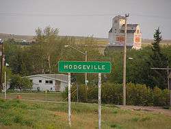 Hodgeville from the highway. | |
 Hodgeville  Hodgeville | |
| Coordinates: 50°07′16″N 106°58′01″W / 50.121°N 106.967°W | |
| Country |
|
| Province |
|
| Region | South-central |
| Census division | 7 |
| Rural Municipality | Lawtonia No. 135 |
| Incorporated (Village) | June, 1921 |
| Government | |
| • Type | Municipal |
| • Governing body | Hodgeville Village Council |
| • Mayor | Kevin Fehler |
| • Administrator | Raegan Funk |
| • MP | David L. Anderson |
| • MLA | Wayne Elhard |
| Area | |
| • Total | 1.35 km2 (0.52 sq mi) |
| Population (2016) | |
| • Total | 172 |
| • Density | 127.6/km2 (330/sq mi) |
| Time zone | UTC-6 (CST) |
| Postal code | S0H 2B0 |
| Area code(s) | 306 |
| Highways |
|
| Railways | Canadian Pacific Railway |
| [1][2][3][4] | |
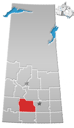
Hodgeville is a village within the Rural Municipality of Lawtonia No. 135, in the province of Saskatchewan, Canada. The village is located approximately 34 km south of the Trans Canada Highway, 97 km southeast of the City of Swift Current. It has a population of approximately 172 (as of 2016).[5] The village was incorporated in June, 1921.
Demographics
| Canada census – Hodgeville community profile | |||
|---|---|---|---|
| 2016 | 2011 | 2006 | |
| Population: | 172 (0.0% from 2011) | 172 (+21.1% from 2006) | 142 (-18.9% from 2001) |
| Land area: | 1.35 km2 (0.52 sq mi) | 1.35 km2 (0.52 sq mi) | 1.35 km2 (0.52 sq mi) |
| Population density: | 127.6/km2 (330/sq mi) | 127.6/km2 (330/sq mi) | 105.3/km2 (273/sq mi) |
| Median age: | 45.0 (M: 43.0, F: 48.5) | 44.5 (M: 43.5, F: 47.5) | 45.0 (M: 43.0, F: 48.3) |
| Total private dwellings: | 97 | 89 | 85 |
| Median household income: | |||
| References: 2016[6] 2011[7] 2006[8] earlier[9] | |||
Economy
Hodgeville's economic base is mainly agricultural and related services.
Education
Hodgeville School is located in the community. Prior to 2002, there was an elementary school and a high school. The elementary school underwent renovations and the high school moved into the elementary school building.
Notable people
It is not known to many, but the Flag of Saskatchewan was originally created here, by a man named Anthony Drake a school teacher from Hodgeville. The Heritage Museum displays the flag, a Western Red Lily on a green and gold field, alongside Anthony's story.
The author of the song "There's a Bluebird on my Windowsill" was Elizabeth (née Huber) Clarke. She lived near Hodgeville, became a nurse, married Dr. Clarke in Hodgeville. After they moved to Vancouver, she nursed in the Children's Hospital. While there, she made up this song to sing to her little patients. "There's a Bluebird on my Windowsill" was picked up by the March of Dimes and used as their theme song. Elizabeth received Royalties from the song and donated them to the Children's Hospital. Her story is one of those proudly displayed in the Heritage Museum at Hodgeville.
See also
References
- ↑ National Archives, Archivia Net, Post Offices and Postmasters, archived from the original on 2006-10-06
- ↑ Government of Saskatchewan, MRD Home, Municipal Directory System, archived from the original on November 21, 2008
- ↑ Canadian Textiles Institute. (2005), CTI Determine your provincial constituency, archived from the original on 2007-09-11
- ↑ Commissioner of Canada Elections, Chief Electoral Officer of Canada (2005), Elections Canada On-line, archived from the original on 2007-04-21
- ↑ "Census Profile, 2016 Census". Statistics Canada. 2017-04-14.
- ↑ "2016 Community Profiles". Canada 2016 Census. Statistics Canada. February 21, 2017.
- ↑ "2011 Community Profiles". Canada 2011 Census. Statistics Canada. July 5, 2013. Retrieved 2017-06-23.
- ↑ "2006 Community Profiles". Canada 2006 Census. Statistics Canada. March 30, 2011. Retrieved 2009-02-24.
- ↑ "2001 Community Profiles". Canada 2001 Census. Statistics Canada. February 17, 2012.
External links
- Hodgeville Village Council
- Saskatchewan City & Town Maps
- Saskatchewan Gen Web - One Room School Project
- Post Offices and Postmasters - ArchiviaNet - Library and Archives Canada
- Saskatchewan Gen Web Region
- Online Historical Map Digitization Project
- GeoNames Query
- 2006 Community Profiles
Places adjacent to Hodgeville | ||||||||||
|---|---|---|---|---|---|---|---|---|---|---|
| ||||||||||
| Subdivisions | |
|---|---|
| Communities | |
| Cities | |
| Topics |
|
| |