Riverhurst
| Riverhurst | |
|---|---|
| Village | |
 Riverhurst  Riverhurst | |
| Coordinates: 50°33′00″N 106°30′36″W / 50.5500°N 106.5100°W | |
| Country | Canada |
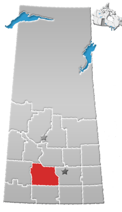
| Province | Saskatchewan |
| Region | Southwest |
| Census division | 7 |
| Rural Municipality | Maple Bush |
| Government | |
| • Governing body | Riverhurst Village Council |
| Area | |
| • Total | 124.8 km2 (48.2 sq mi) |
| Population (2011) | |
| • Total | 114 |
| • Density | 0.91/km2 (2.4/sq mi) |
| Time zone | CST |
| Area code(s) | 306 |
| Highways | Highway 42 |
| Website | Village of Riverhurst |
| [1][2][3][4] | |
Riverhurst is a village in Maple Bush Rural Municipality No. 224, Saskatchewan, Canada. It is located in the south-west Coteau Hills area of Saskatchewan, north of the Vermillion Hills. The community is located on Highway 42 east of Riverhurst Ferry. The village is primarily a farming community, with a 2011 population of 114 residents.
The name is a portmanteau of Riverside and Boldenhurst, two nearby post offices.[5]
Demographics
| Canada census – Riverhurst community profile | |||
|---|---|---|---|
| 2011 | 2006 | ||
| Population: | 114 (-5.8% from 2006) | 121 (-15.4% from 2001) | |
| Land area: | 0.91 km2 (0.35 sq mi) | 0.91 km2 (0.35 sq mi) | |
| Population density: | 124.8/km2 (323/sq mi) | 132.4/km2 (343/sq mi) | |
| Median age: | 61.7 (M: 62.2, F: 61.2) | 57.2 (M: 56.4, F: 58.8) | |
| Total private dwellings: | 105 | 99 | |
| Median household income: | |||
| References: 2011[6] 2006[7] earlier[8] | |||
Infrastructure
Riverhurst is situated close to the east bank of Lake Diefenbaker, and is the location of the Riverhurst Ferry, a cable ferry that crosses the lake to Lucky Lake on the west bank. Highway 42 (which provides access to the community) crosses Lake Diefenbaker by the Riverhurst Ferry. The village is located 8 km south of the Elbow crater.
Notable residents
Royal Canadian Mounted Police Constable Thomas Brian King (who was shot to death in Saskatoon) lived in Riverhurst.
See also
References
- ↑ National Archives, Archivia Net. "Post Offices and Postmasters".
- ↑ Government of Saskatchewan, MRD Home. "Municipal Directory System". Archived from the original on November 21, 2008.
- ↑ Canadian Textiles Institute. (2005). "CTI Determine your provincial constituency". Archived from the original on 2007-09-11.
- ↑ Commissioner of Canada Elections, Chief Electoral Officer of Canada (2005). "Elections Canada On-line".
- ↑ Barry, Bill (September 2005). Geographic Names of Saskatchewan. Regina, Saskatchewan: People Places Publishing, Ltd. p. 358. ISBN 1-897010-19-2.
- ↑ "2011 Community Profiles". Canada 2011 Census. Statistics Canada. July 5, 2013. Retrieved 2012-10-30.
- ↑ "2006 Community Profiles". Canada 2006 Census. Statistics Canada. March 30, 2011. Retrieved 2009-02-24.
- ↑ "2001 Community Profiles". Canada 2001 Census. Statistics Canada. February 17, 2012.
External links
Places adjacent to Riverhurst | ||||||||||
|---|---|---|---|---|---|---|---|---|---|---|
| ||||||||||