Southwest Historic District (Roanoke, Virginia)
|
Southwest Historic District | |
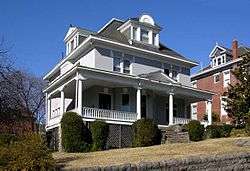 House in the Southwest Historic District, June 2010 | |
  | |
| Location | Roughly bounded by Salem Ave., Jefferson St., Roanoke River and 20th St., Roanoke, Virginia |
|---|---|
| Coordinates | 37°16′03″N 79°57′21″W / 37.26750°N 79.95583°WCoordinates: 37°16′03″N 79°57′21″W / 37.26750°N 79.95583°W |
| Area | 375 acres (152 ha) |
| Architect | Multiple |
| Architectural style | Late 19th And 20th Century Revivals, Late 19th And Early 20th Century American Movements, Late Victorian |
| NRHP reference # | 85001349[1] |
| VLR # | 128-0049 |
| Significant dates | |
| Added to NRHP | June 19, 1985 |
| Designated VLR | April 16, 1985[2] |
Southwest Historic District is a national historic district located at Roanoke, Virginia. It encompasses 1,547 contributing buildings constructed between 1882 and 1930 in the Roanoke neighborhoods of Old Southwest, Mountain View, and Hurt Park. It is a primarily residential district with houses in a variety of popular late-19th and early-20th century architectural styles. The district also includes a small number of commercial structures, churches, and two schools.[3]
It was listed on the National Register of Historic Places in 1985.[1]
References
- 1 2 National Park Service (2010-07-09). "National Register Information System". National Register of Historic Places. National Park Service.
- ↑ "Virginia Landmarks Register". Virginia Department of Historic Resources. Retrieved 19 March 2013.
- ↑ Division of Historic Landmarks Staff (1985). "National Register of Historic Places Inventory/Nomination: Southwest Historic District" (PDF). Virginia Department of Historic Resources. and Accompanying photo and Accompanying map Archived 2012-09-27 at the Wayback Machine.


This article is issued from
Wikipedia.
The text is licensed under Creative Commons - Attribution - Sharealike.
Additional terms may apply for the media files.