Montpelier, Hanover County, Virginia
| Montpelier, Hanover County, Virginia | |
|---|---|
| Unincorporated community | |
 Montpelier  Montpelier | |
| Coordinates: 37°49′17″N 77°41′04″W / 37.82139°N 77.68444°WCoordinates: 37°49′17″N 77°41′04″W / 37.82139°N 77.68444°W | |
| Country | United States |
| State | Virginia |
| County | Hanover |
| Area | |
| • Total | 77 sq mi (200 km2) |
| • Land | 76 sq mi (200 km2) |
| • Water | 1 sq mi (3 km2) |
| Elevation | 335 ft (102 m) |
| Population (2010) | |
| • Total | 7,067 |
| • Density | 88/sq mi (34/km2) |
| Time zone | UTC-5 (Eastern (EST)) |
| • Summer (DST) | UTC-4 (EDT) |
| Area code(s) | 804 |
| GNIS feature ID | 1495961[1] |
Montpelier is an unincorporated community in Hanover County in the central region of the U.S. state of Virginia. Montpelier is on U.S. Route 33, which was long named as "the Mountain Road" between Richmond and the Blue Ridge Mountains. The community is located midway between Richmond and President James Madison's home "Montpelier", and may have been named for the famous estate, which is a tourist attraction. Montpelier now has a shopping center with a Food Lion, 24-hour fitness, Domino's Pizza, a Subway, and a CVS Pharmacy.
Formerly consisting primarily of farmland and a small business district, today Montpelier serves as a bedroom community for many residents who commute to jobs in large metropolitan areas such as Richmond. Professional wrestler Mickie James was born in Montpeiler.
The Montpelier Historic District, Oakland, and Sycamore Tavern are listed on the National Register of Historic Places.[2]
References
- ↑ "Montpelier". Geographic Names Information System. United States Geological Survey.
- ↑ National Park Service (2010-07-09). "National Register Information System". National Register of Historic Places. National Park Service.
External links
Municipalities and communities of Hanover County, Virginia, United States | ||
|---|---|---|
| Town | 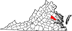 | |
| CDPs | ||
| Unincorporated communities | ||