Atlee, Virginia
| Atlee, Virginia | |
|---|---|
| Unincorporated community | |
 Atlee  Atlee | |
| Coordinates: 37°39′28″N 77°24′25″W / 37.65778°N 77.40694°WCoordinates: 37°39′28″N 77°24′25″W / 37.65778°N 77.40694°W | |
| Country | United States |
| State | Virginia |
| County | Hanover |
| Elevation | 194 ft (59 m) |
| Time zone | UTC-5 (Eastern (EST)) |
| • Summer (DST) | UTC-4 (EDT) |
| GNIS feature ID | 1499069[1] |
Atlee or Atlee Station is an unincorporated community in northeastern Hanover County in the Mid-Atlantic state of Virginia, United States.[1] Atlee is located 11 miles (18 km) north of Richmond on Route 637 approximately .6 miles (0.97 km) north-northwest of the intersection of Route 637 and Virginia State Route 2.[2] and approximately 50 miles (80 km) south of Fredericksburg, Virginia
History
Known for its two train stops, Atlee's name more than likely came from a delegate to the state legislature who lived in the area, Jacob S. Atlee. There were two stations, West and East Atlee. In 1921 they were combined. Until 1931, there was a telegraph office also. In 1947 Atlee was a flag stop until 1960. In the late 1950s, the C&O railroad petitioned the State Corporation Commission for authority to stop freight handling at Atlee.
Urban sprawl
Mostly rural until the mid 1980s, with interstate 295 being constructed through the area and the widening of U.S. Route 301 from a 2 lane highway to a 4 lane divided highway in the late 1960's through the area, developments such as King's Charter started popping up with over 500 houses. The Atlee area went through small growths until the early 2000's with many new residential developments and most notable mixed-use development, Rutland, which sits on an 18th-century historic farm by the same name. The community is over 200 acres and features national, regional and local shopping with a Kroger Marketplace as the anchor. Caldwell Park (an English themed development) that's in the planning stage 2.8 miles (4.5 km) to the north is a mixed-use development that will be anchored by an unnamed grocer, fine dining and shopping along with apartments, townhomes, single family, nature trails, parks and tot lots. The Atlee area is one of the fastest growing in Hanover with one of the top school districts in the commonwealth and U.S. Route 301 which becomes an alternate for north/south Interstate 95 travelers. Atlee is also home to one of the highest median household income zip code 23116, in the commonwealth. Many residents in the area work in Richmond or commute to northern Virginia or Washington D.C. due to Hanover County's central location and three major thoroughfares: U.S. Route 301, Interstate 95, U.S. Route 1 and the to be built high speed rail in nearby Ashland.
References
- 1 2 "Atlee". Geographic Names Information System. United States Geological Survey.
- ↑ Google (August 18, 2013). "Atlee, Virginia" (Map). Google Maps. Google. Retrieved August 18, 2013.
External links
- "Atlee" at Chesapeake & Ohio Piedmont Subdivision website
Municipalities and communities of Hanover County, Virginia, United States | ||
|---|---|---|
| Town | 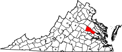 | |
| CDPs | ||
| Unincorporated communities | ||