Cluster Springs, Virginia
| Cluster Springs, Virginia | |
|---|---|
| Census-designated place | |
 Cluster Springs  Cluster Springs | |
| Coordinates: 36°37′16″N 78°55′18″W / 36.62111°N 78.92167°WCoordinates: 36°37′16″N 78°55′18″W / 36.62111°N 78.92167°W | |
| Country | United States |
| State | Virginia |
| County | Halifax |
| Area | |
| • Total | 8.6 sq mi (22.3 km2) |
| • Land | 8.6 sq mi (22.2 km2) |
| • Water | 0.04 sq mi (0.1 km2) |
| Elevation | 495 ft (151 m) |
| Population (2010) | |
| • Total | 811 |
| • Density | 95/sq mi (36.5/km2) |
| Time zone | UTC-5 (Eastern (EST)) |
| • Summer (DST) | UTC-4 (EDT) |
| ZIP code | 24535 |
| FIPS code | 51-17776 |
| GNIS feature ID | 1492788 |
Cluster Springs is an unincorporated community and census-designated place (CDP) in Halifax County, Virginia, United States. The population as of the 2010 census was 811.[1]
Geography
The community is in southern Halifax County, along U.S. Route 501, which leads north 5 miles (8 km) to South Boston and south 18 miles (29 km) to Roxboro, North Carolina.
According to the U.S. Census Bureau, the CDP has a total area of 8.6 square miles (22.3 km2), of which 0.03 square miles (0.08 km2), or 0.35%, are water.[1] It is drained by tributaries of the Dan River and is part of the Roanoke River watershed.
References
- 1 2 "Geographic Identifiers: 2010 Census Summary File 1 (G001): Cluster Springs CDP, Virginia". American Factfinder. U.S. Census Bureau. Retrieved March 21, 2018.
Municipalities and communities of Halifax County, Virginia, United States | ||
|---|---|---|
| Towns | 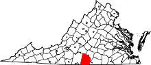 | |
| CDPs | ||
| Unincorporated communities | ||
| Footnotes | ‡This populated place also has portions in an adjacent county or counties | |
This article is issued from
Wikipedia.
The text is licensed under Creative Commons - Attribution - Sharealike.
Additional terms may apply for the media files.