Ernfold
| Ernfold | |
|---|---|
| Village | |
| Village of Ernfold | |
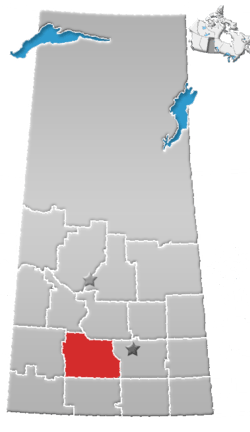
 Location of Ernfold in Saskatchewan  Ernfold (Canada) | |
| Coordinates: 50°26′53″N 106°53′31″W / 50.448°N 106.892°W | |
| Country |
|
| Province |
|
| Region | South-central |
| Census division | 7 |
| Rural Municipality | Morse No. 165 |
| Government | |
| • Type | Municipal |
| • Governing body | Ernfold Village Council[1] |
| • Mayor | Christine Bauck |
| • Administrator | Mark Wilson |
| • MLA | David Anderson |
| • MP | Brad Wall |
| Area | |
| • Total | 1.19 km2 (0.46 sq mi) |
| Population (2016) | |
| • Total | 15 |
| • Density | 12.6/km2 (33/sq mi) |
| Time zone | UTC-6 (CST) |
| Postal code | S0H 3C0 |
| Area code(s) | 306 |
| Highways |
|
| Railways | Canadian Pacific Railway |
| [2][3][4][5] | |
Ernfold is a village located between the Trans-Canada Highway within the Rural Municipality of Morse No. 165, in the province of Saskatchewan, Canada. At first alongside the original one-lane highway, the village was enclosed by the opposing lanes of the newly-divided Trans-Canada in 1973. In order to avoid complete destruction of the village the eastbound lane of the Trans-Canada Highway was rerouted approximately 3 km south of the village, leaving the village sandwiched between the Trans-Canada.
The village's population peaked at around 300 citizens.[6] As of the 2016 Canada Census, the village of Ernfold has a population of 15 (a 50% decrease from 30 in the 2011 Canada Census), making it one of Saskatchewan's smallest villages.
Demographics
| Canada census – Ernfold community profile | |||
|---|---|---|---|
| 2016 | 2011 | 2006 | |
| Population: | 15 (-50.0% from 2011) | 30 (-14.3% from 2006) | 35 (-30.0% from 2001) |
| Land area: | 1.19 km2 (0.46 sq mi) | 1.19 km2 (0.46 sq mi) | 1.19 km2 (0.46 sq mi) |
| Population density: | 12.6/km2 (33/sq mi) | 25.2/km2 (65/sq mi) | 29.4/km2 (76/sq mi) |
| Median age: | |||
| Total private dwellings: | 13 | 15 | 24 |
| Median household income: | |||
| References: 2016[7] 2011[8] 2006[9] earlier[10] | |||
Heritage sites
The Ernfold School is a stately red brick, 1 1/2 story Georgian Revival structure built in 1919. The building served as an integral part of the community as a school until it closed in 1972. It was then used as a Baptist Church for a shot time until the church closed in 1989.
The schoolhouse remains a notable landmark with its bell tower and symmetrical form, to passersby through the village, driving westbound on the Trans-Canada Highway.
On May 6, 1990 the Village of Ernfold passed (Bylaw No. 90-1), placing the building on the Canadian Register of Historic Places as a Municipal Heritage Property.[11]
See also
References
- ↑ Ernfold Village Council
- ↑ National Archives, Archivia Net, Post Offices and Postmasters, archived from the original on 2006-10-06
- ↑ Government of Saskatchewan, MRD Home, Municipal Directory System, archived from the original (– Scholar search) on November 21, 2008
- ↑ Canadian Textiles Institute. (2005), CTI Determine your provincial constituency, archived from the original on 2007-09-11
- ↑ Commissioner of Canada Elections, Chief Electoral Officer of Canada (2005), Elections Canada On-line, archived from the original on 2007-04-21
- ↑ Richardson, Mark (2012-07-24). "Decline and development of the prairie". Maclean's. Retrieved 2017-01-19.
- ↑ "2016 Community Profiles". Canada 2016 Census. Statistics Canada. February 21, 2017. Retrieved 2017-03-15.
- ↑ "2011 Community Profiles". Canada 2011 Census. Statistics Canada. July 5, 2013. Retrieved 2012-10-14.
- ↑ "2006 Community Profiles". Canada 2006 Census. Statistics Canada. March 30, 2011. Retrieved 2009-02-24.
- ↑ "2001 Community Profiles". Canada 2001 Census. Statistics Canada. February 17, 2012.
- ↑ Ernfold School - Canadian Register of Historic Places
External links
- Ernfold: Life and death in a not-quite ghost town - Regina Leader-Post
- Saskatchewan City & Town Maps
- Saskatchewan Gen Web - One Room School Project
- Post Offices and Postmasters - ArchiviaNet - Library and Archives Canada
- Saskatchewan Gen Web Region
- Online Historical Map Digitization Project
- GeoNames Query
- 2006 Community Profiles
Places adjacent to Ernfold | ||||||||||
|---|---|---|---|---|---|---|---|---|---|---|
| ||||||||||
| Subdivisions | |
|---|---|
| Communities | |
| Cities | |
| Topics |
|
| |
Coordinates: 50°26′53″N 106°53′31″W / 50.448°N 106.892°W