Monte Vista, Colorado
| Monte Vista, Colorado | |
|---|---|
| Home Rule Municipality | |
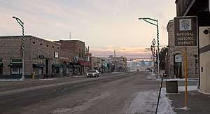 Downtown Monte Vista in late 2012. | |
| Motto(s): Experience the Full Monte | |
 Location of Monte Vista in Rio Grande County, Colorado. | |
| Coordinates: 37°34′38″N 106°8′45″W / 37.57722°N 106.14583°WCoordinates: 37°34′38″N 106°8′45″W / 37.57722°N 106.14583°W | |
| Country |
|
| State |
|
| County[1] | Rio Grande |
| Incorporated | September 27, 1886[2] |
| Government | |
| • Type | Home Rule Municipality[1] |
| Area[3] | |
| • Total | 2.61 sq mi (6.76 km2) |
| • Land | 2.59 sq mi (6.71 km2) |
| • Water | 0.02 sq mi (0.05 km2) |
| Elevation[4] | 7,664 ft (2,336 m) |
| Population (2010) | |
| • Total | 4,444 |
| • Estimate (2016)[5] | 4,266 |
| • Density | 1,645.20/sq mi (635.30/km2) |
| Time zone | UTC-7 (Mountain (MST)) |
| • Summer (DST) | UTC-6 (MDT) |
| ZIP codes[6] | 81135 (PO Box), 81144 |
| Area code(s) | 719 Exchange: 852 |
| FIPS code | 08-51635 |
| GNIS feature ID | 0204764 |
| Website | City of Monte Vista |
Monte Vista is the Home Rule Municipality that is the most populous municipality in Rio Grande County, Colorado, United States. The city population was 4,444 at the 2010 United States Census.
History
Monte Vista was laid out in 1884. The site had previously served as a watering stop for the Denver and Rio Grande Western Railroad.[7] Monte Vista is a name derived from Spanish meaning "mountain view".[8]
Geography
Monte Vista is located in the San Luis Valley at 37°34′38″N 106°8′45″W / 37.57722°N 106.14583°W (37.577287, -106.145828).[9]
According to the United States Census Bureau, the city has a total area of 2.0 square miles (5.2 km2), of which, 1.9 square miles (4.9 km2) of it is land and 0.1 square miles (0.26 km2) of it (2.56%) is water.
Demographics
| Historical population | |||
|---|---|---|---|
| Census | Pop. | %± | |
| 1890 | 780 | — | |
| 1900 | 556 | −28.7% | |
| 1910 | 2,544 | 357.6% | |
| 1920 | 2,484 | −2.4% | |
| 1930 | 2,610 | 5.1% | |
| 1940 | 3,208 | 22.9% | |
| 1950 | 3,272 | 2.0% | |
| 1960 | 3,385 | 3.5% | |
| 1970 | 3,909 | 15.5% | |
| 1980 | 3,902 | −0.2% | |
| 1990 | 4,324 | 10.8% | |
| 2000 | 4,529 | 4.7% | |
| 2010 | 4,444 | −1.9% | |
| Est. 2016 | 4,266 | [5] | −4.0% |
| U.S. Decennial Census[10] | |||
As of the 2000 census,[11] there were 4,529 people, 1,715 households, and 1,212 families residing in the city. The population density was 2,390.1 people per square mile (925.2/km²). There were 1,854 housing units at an average density of 978.4 per square mile (378.7/km²). The racial makeup of the city was 63.08% White, 0.38% African American, 1.61% Native American, 0.29% Asian, 0.04% Pacific Islander, 31.82% from other races, and 2.78% from two or more races. Hispanic or Latino of any race were 58.20% of the population.
There were 1,715 households out of which 36.8% had children under the age of 18 living with them, 50.1% were married couples living together, 15.9% had a female householder with no husband present, and 29.3% were non-families. 25.9% of all households were made up of individuals, and 11.8% had someone living alone who was 65 years of age or older. The average household size was 2.59, and the average family size was 3.13.
In the city, the population was spread out with 29.6% under the age of 18, 9.2% from 18 to 24, 26.1% from 25 to 44, 20.5% from 45 to 64, and 14.6% who were 65 years of age or older. The median age was 34 years. For every 100 females, there were 90.7 males. For every 100 females age 18 and over, there were 85.3 males.
The median income for a household in the city was $28,392, and the median income for a family was $33,780. Males had a median income of $29,057 versus $23,482 for females. The per capita income for the city was $13,612.
Culture
Monte Vista is served by the Carnegie Public Library.
See also
References
- 1 2 "Active Colorado Municipalities". State of Colorado, Department of Local Affairs. Archived from the original on 2010-11-23. Retrieved 2007-09-01.
- ↑ "Colorado Municipal Incorporations". State of Colorado, Department of Personnel & Administration, Colorado State Archives. 2004-12-01. Retrieved 2007-09-02.
- ↑ "2016 U.S. Gazetteer Files". United States Census Bureau. Retrieved Jul 25, 2017.
- ↑ "US Board on Geographic Names". United States Geological Survey. 2007-10-25. Retrieved 2008-01-31.
- 1 2 "Population and Housing Unit Estimates". Retrieved June 9, 2017.
- ↑ "ZIP Code Lookup". United States Postal Service. Archived from the original (JavaScript/HTML) on November 23, 2010. Retrieved November 23, 2007.
- ↑ Fielder, John (2002). John Fielder's Best of Colorado. Big Earth Publishing. p. 319. Retrieved 4 November 2013.
- ↑ Dawson, John Frank. Place names in Colorado: why 700 communities were so named, 150 of Spanish or Indian origin. Denver, CO: The J. Frank Dawson Publishing Co. p. 35.
- ↑ "US Gazetteer files: 2010, 2000, and 1990". United States Census Bureau. 2011-02-12. Retrieved 2011-04-23.
- ↑ "Census of Population and Housing". Census.gov. Retrieved June 4, 2015.
- ↑ "American FactFinder". United States Census Bureau. Retrieved 2008-01-31.
External links
- City of Monte Vista website
- CDOT map of the City of Monte Vista
- SLV Dweller - Since 2002, SLV Dweller has served as an agglomeration of San Luis Valley news and information from varied sources.
Municipalities and communities of Rio Grande County, Colorado, United States | ||
|---|---|---|
| City | 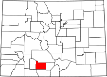 | |
| Towns | ||
| CDPs | ||
| Unincorporated community | ||
| Footnotes | ‡This populated place also has portions in an adjacent county or counties | |
