Cal-Nev-Ari, Nevada
| Cal-Nev-Ari, Nevada | |
|---|---|
| Census-designated place | |
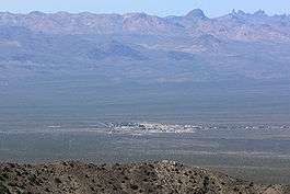 Seen from Spirit Mountain to the east; New York Mountains in the distance | |
 Location of Cal-Nev-Ari in Clark County, Nevada | |
 Cal-Nev-Ari, Nevada Location in the United States | |
| Coordinates: 35°18′12″N 114°52′51″W / 35.30333°N 114.88083°W | |
| Country | United States |
| State | Nevada |
| County | Clark |
| Area | |
| • Total | 2.3 sq mi (6.0 km2) |
| • Land | 2.3 sq mi (6.0 km2) |
| • Water | 0.0 sq mi (0.0 km2) |
| Elevation | 2,579 ft (786 m) |
| Population (2010) | |
| • Total | 244 |
| • Density | 110/sq mi (41/km2) |
| Time zone | UTC-8 (PST) |
| • Summer (DST) | UTC-7 (PDT) |
| ZIP code | 89039 |
| Area code(s) | 702 |
| FIPS code | 32-08600 |
| GNIS feature ID | 0858257 |
Cal-Nev-Ari is a census-designated place on U.S. Route 95 in Clark County, Nevada, United States, near the state's southernmost point. As of the 2010 census, the town had a population of 244.[1] The town's name is a syllabic abbreviation of California, Nevada, and Arizona.
Cal-Nev-Ari was created in the mid-1960s by Nancy and Slim Kidwell, who acquired a 640-acre (2.6 km2) section of land from the U.S. government and commenced development of an airport-based community. In addition to the FAA-designated Kidwell Airport, the community has grown over the years to include a casino, motel, RV and mobile home parks, convenience market, and over 100 residential lots.
The town was listed for sale in 2016 for $8 million[2] although it had been originally listed in 2010 for $17 million.[3]
Geography
Cal-Nev-Ari is located at 35°18′12″N 114°52′51″W / 35.30333°N 114.88083°WCoordinates: 35°18′12″N 114°52′51″W / 35.30333°N 114.88083°W (35.303196, -114.880795).[4]
According to the United States Census Bureau, the CDP has a total area of 2.3 square miles (6.0 km2), all of it land.
Demographics
As of the census[5] of 2000, there were 278 people, 154 households, and 93 families residing in the CDP. The population density was 120.9 people per square mile (46.7/km²). There were 199 housing units at an average density of 86.5 per square mile (33.4/km²). The racial makeup of the CDP was 95.32% White, 1.80% from other races, and 2.88% from two or more races. Hispanic or Latino of any race were 2.16% of the population.
There were 154 households out of which 7.1% had children under the age of 18 living with them, 55.8% were married couples living together, 1.9% had a female householder with no husband present, and 39.6% were non-families. Of all households 33.8% were made up of individuals and 14.9% had someone living alone who was 65 years of age or older. The average household size was 1.81 and the average family size was 2.20.
In the CDP, the population was spread out with 7.6% under the age of 18, 1.1% from 18 to 24, 14.7% from 25 to 44, 42.1% from 45 to 64, and 34.5% who were 65 years of age or older. The median age was 59 years. For every 100 females, there were 104.4 males. For every 100 females age 18 and over, there were 110.7 males.
The median income for a household in the CDP was $42,563, and the median income for a family was $44,333. Males had a median income of $24,632 versus $19,531 for females. The per capita income for the CDP was $20,870. None of the population or families were below the poverty line.
References
- ↑ "Profile of General Population and Housing Characteristics: 2010 Demographic Profile Data (DP-1): Cal-Nev-Ari CDP, Nevada". U.S. Census Bureau, American Factfinder. Archived from the original on September 11, 2013. Retrieved March 9, 2012.
- ↑ "A town near Vegas including casino and diner is for sale". BBC Newsbeat.
- ↑ "Quirky Cal-Nev-Ari for sale from the ground up for $17 million". Las Vegas Review-Journal.
- ↑ "US Gazetteer files: 2010, 2000, and 1990". United States Census Bureau. 2011-02-12. Retrieved 2011-04-23.
- ↑ "American FactFinder". United States Census Bureau. Archived from the original on 2013-09-11. Retrieved 2008-01-31.
External links

Municipalities and communities of Clark County, Nevada, United States | ||
|---|---|---|
| Cities | 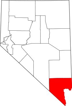 | |
| CDPs | ||
| Unincorporated communities | ||
| Township | ||
| Ghost towns | ||
| Indian reservations | ||
| Footnotes | ‡This populated place also has portions in an adjacent county or counties | |