Beaver Dam, Arizona
| Beaver Dam, Arizona | |
|---|---|
 | |
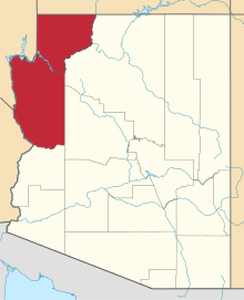
 Location of Beaver Dam in Mohave County, Arizona. | |
 Beaver Dam, Arizona Location in the United States | |
| Coordinates: 36°54′N 113°56′W / 36.900°N 113.933°WCoordinates: 36°54′N 113°56′W / 36.900°N 113.933°W | |
| Country | United States |
| State | Arizona |
| Counties | Mohave |
| Founded | 1863 |
| Founded by | Henry W. Miller |
| Area[1] | |
| • Total | 8.42 sq mi (21.80 km2) |
| • Land | 8.42 sq mi (21.80 km2) |
| • Water | 0.00 sq mi (0.00 km2) |
| Population (2010) | |
| • Total | 3,933[2] |
| • Estimate (2016)[3] | N/A |
| Time zone | MST |
| ZIP codes | 86432 |
| FIPS code | 04-05490 |
Beaver Dam is an unincorporated community in Mohave County located in the extreme northwestern corner of the U.S. state of Arizona, settled in 1863. It is located along Interstate 15 approximately 10 miles northeast of Mesquite, Nevada. Beaver Dam is located in the 86432 zip code, which had a population of 3,933 as of the 2010 census[4].
History
The site of Beaver Dam was located along the pack horse route of the Old Spanish Trail from 1828 and the later wagon route of the Mormon Road between Salt Lake City and Los Angeles from 1847. Beaver Dam Creek and subsequently the town was named for a beaver dam that occupied and held back the waters on the wash when the first Mormon party under Jefferson Hunt established the wagon road through the area in 1847.
The Mormon Road was used by Forty-niners in 1849 and Mormon colonists and other travelers from then on. Both routes passed southward from the Beaver Dam Mountains, to the Virgin River along Beaver Dam Wash to where it met the river. From 1855, the road was a major wagon freighting road until the railroad arrived in Nevada in 1905. Beaver Dam was first settled by Mormon colonists in 1863.

Contemporary Beaver Dam

Beaver Dam is home to the three schools that make up the Littlefield Unified School District, the geographically largest school district in Arizona; Beaver Dam Elementary and Beaver Dam Jr./Sr. High School. Beaver Dam and neighboring Littlefield have the distinction of being the only towns in Arizona along I-15. Owing to its location northwest of Grand Canyon National Park and west of the Virgin River, Beaver Dam is essentially isolated from the rest of the state. Travel to other towns within Arizona requires crossing through either Nevada or Utah, or by traversing unpaved roads to Arizona State Route 389 (which is paved) — and even at that, is connected only to the rest of the "Arizona Strip" (that part of Arizona separated from the rest of the state by the Grand Canyon), not to Arizona at large.

The Virgin River Gorge is located just to the east of Beaver Dam.
The Post Office is located in Beaver Dam on McKnight Boulevard. Fire Station No. 2 is located in Beaver Dam (No. 1 is located in Desert Springs). Beaver Dam has a large population of "snowbirds" (retirees from colder latitudes seeking temperate winter temperatures) during the winter months.
See also
References
- ↑ "2016 U.S. Gazetteer Files". United States Census Bureau. Retrieved Jul 18, 2017.
- ↑ http://censusviewer.com/city/AZ/Beaver%20Dam
- ↑ "Population and Housing Unit Estimates". Retrieved June 9, 2017.
- ↑ http://factfinder.census.gov/bkmk/table/1.0/en/DEC/10_DP/DPDP1/8600000US86432