Matthews, New Jersey
| Matthews, New Jersey | |
|---|---|
| Unincorporated community | |
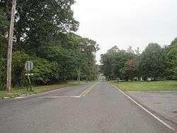 Looking west along Hulses Corner Road in Matthews | |
 Matthews, New Jersey Location of Matthews in Monmouth County Inset: Location of county within the state of New Jersey  Matthews, New Jersey Matthews, New Jersey (New Jersey)  Matthews, New Jersey Matthews, New Jersey (the US) | |
| Coordinates: 40°09′25″N 74°15′27″W / 40.15694°N 74.25750°WCoordinates: 40°09′25″N 74°15′27″W / 40.15694°N 74.25750°W | |
| Country |
|
| State |
|
| County | Monmouth |
| Township | Howell |
| Elevation[1] | 108 ft (33 m) |
| GNIS feature ID | 878189[1] |
Matthews is an unincorporated community located within Howell Township in Monmouth County, New Jersey, United States.[2] The settlement is located on the western border of the township near Jackson Township, Ocean County and Interstate 195. It is located about the intersection of Hulses Corner Road and Fort Plains Road. The Howell side of the North Branch Metedeconk River (through which the county line runs) is mainly rural with only a few houses located along the main surface roads while the Jackson side of the river is more suburbanized.[3]
References
- 1 2 "Matthews". Geographic Names Information System. United States Geological Survey.
- ↑ Locality Search, State of New Jersey. Accessed June 9, 2016.
- ↑ Google (February 26, 2015). "Matthews, Howell Township, Monmouth County, New Jersey 07731" (Map). Google Maps. Google. Retrieved February 26, 2015.

This article is issued from
Wikipedia.
The text is licensed under Creative Commons - Attribution - Sharealike.
Additional terms may apply for the media files.