Pleasant Valley Crossroads, New Jersey
| Pleasant Valley Crossroads, New Jersey | |
|---|---|
| Unincorporated community | |
 | |
 Pleasant Valley Crossroads, New Jersey Location of Pleasant Valley Crossroads in Monmouth County Inset: Location of county within the state of New Jersey  Pleasant Valley Crossroads, New Jersey Pleasant Valley Crossroads, New Jersey (New Jersey)  Pleasant Valley Crossroads, New Jersey Pleasant Valley Crossroads, New Jersey (the US) | |
| Coordinates: 40°20′43″N 74°11′42″W / 40.34528°N 74.19500°WCoordinates: 40°20′43″N 74°11′42″W / 40.34528°N 74.19500°W | |
| Country |
|
| State |
|
| County | Monmouth |
| Township | Holmdel |
| Elevation[1] | 69 ft (21 m) |
| ZIP code | 07733 |
| GNIS feature ID | 879367[1] |
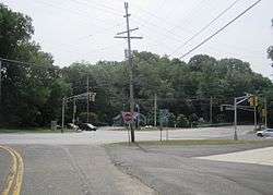
Pleasant Valley Crossroads is an unincorporated community located within Holmdel Township in Monmouth County, New Jersey, United States.[2] Route 34 and County Route 520 are major roads in this area.
References
- 1 2 "Pleasant Valley Crossroads". Geographic Names Information System. United States Geological Survey.
- ↑ Google (February 28, 2015). "Pleasant Valley Crossroads, Holmdel, New Jersey" (Map). Google Maps. Google. Retrieved February 28, 2015.

This article is issued from
Wikipedia.
The text is licensed under Creative Commons - Attribution - Sharealike.
Additional terms may apply for the media files.