Vanderburg, New Jersey
| Vanderburg, New Jersey | |
|---|---|
| Unincorporated community | |
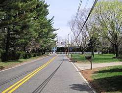 Approaching the center of Vanderburg from the west | |
 Vanderburg, New Jersey Location of Vanderburg in Monmouth County Inset: Location of county within the state of New Jersey  Vanderburg, New Jersey Vanderburg, New Jersey (New Jersey)  Vanderburg, New Jersey Vanderburg, New Jersey (the US) | |
| Coordinates: 40°18′51″N 74°11′21″W / 40.31417°N 74.18917°WCoordinates: 40°18′51″N 74°11′21″W / 40.31417°N 74.18917°W | |
| Country |
|
| State |
|
| County | Monmouth |
| Township | Colts Neck |
| Elevation[1] | 98 ft (30 m) |
| Time zone | UTC-5 (Eastern (EST)) |
| • Summer (DST) | UTC-4 (EDT) |
| ZIP code | 07722 |
| GNIS feature ID | 881431[1] |
Vanderburg is an unincorporated community located within Colts Neck Township in Monmouth County, New Jersey, United States.[2] Conover Road and Crine Road (two separate segments of County Route 4) intersect at the center of Vanderburg. Route 34 is a major road that travels through the east side of Vanderburg.
References
- 1 2 "Vanderburg". Geographic Names Information System. United States Geological Survey.
- ↑ Locality Search, State of New Jersey. Accessed March 9, 2015.

This article is issued from
Wikipedia.
The text is licensed under Creative Commons - Attribution - Sharealike.
Additional terms may apply for the media files.