Mount Pleasant, Monmouth County, New Jersey
| Mount Pleasant, New Jersey | |
|---|---|
| Unincorporated community | |
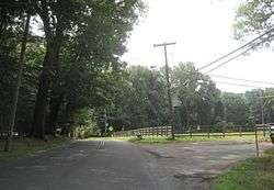 Intersection of Beacon Hill Road and Reids Hill Road | |
 Mount Pleasant, New Jersey Location of Mount Pleasant in Monmouth County Inset: Location of county within the state of New Jersey  Mount Pleasant, New Jersey Mount Pleasant, New Jersey (New Jersey)  Mount Pleasant, New Jersey Mount Pleasant, New Jersey (the US) | |
| Coordinates: 40°22′27″N 74°13′02″W / 40.37417°N 74.21722°WCoordinates: 40°22′27″N 74°13′02″W / 40.37417°N 74.21722°W | |
| Country |
|
| State |
|
| County | Monmouth |
| Township | Marlboro |
| Elevation[1] | 295 ft (90 m) |
| GNIS feature ID | 878575[1] |
Mount Pleasant is an unincorporated community located within Marlboro Township in Monmouth County, New Jersey, United States.[2] It is named for a hill of the same name, one of the highest points in Marlboro Township. The settlement is located at the intersection of Reids Hill Road and Beacon Hill Road.[3]
References
- 1 2 "Mount Pleasant". Geographic Names Information System. United States Geological Survey.
- ↑ Google (February 27, 2015). "Mount Pleasant, Marlboro Township, Monmouth County, New Jersey 07751" (Map). Google Maps. Google. Retrieved February 27, 2015.
- ↑ Google (August 15, 2015). "Terrain map of Mount Pleasant" (Map). Google Maps. Google. Retrieved August 15, 2015.

This article is issued from
Wikipedia.
The text is licensed under Creative Commons - Attribution - Sharealike.
Additional terms may apply for the media files.