Claytons Corner, New Jersey
| Claytons Corner, New Jersey | |
|---|---|
| Unincorporated community | |
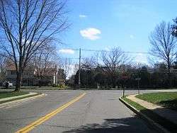 Intersection of Church Road and Gordons Corner Road | |
 Claytons Corner, New Jersey Location of Claytons Corner in Monmouth County Inset: Location of county within the state of New Jersey  Claytons Corner, New Jersey Claytons Corner, New Jersey (New Jersey)  Claytons Corner, New Jersey Claytons Corner, New Jersey (the US) | |
| Coordinates: 40°19′43″N 74°17′12″W / 40.32861°N 74.28667°WCoordinates: 40°19′43″N 74°17′12″W / 40.32861°N 74.28667°W | |
| Country |
|
| State |
|
| County | Monmouth |
| Township | Marlboro |
| Elevation[1] | 151 ft (46 m) |
| GNIS feature ID | 875473[1] |
Claytons Corner located at latitude 40.329 and longitude -74.287 is an unincorporated community located within Marlboro Township in Monmouth County, New Jersey, United States.[2] The community is located along Gordons Corner Road near its intersections with Church Road and Robertsville Road and is completely suburban in nature as the area is part of houses in planned communities.[3] The last remaining farm in Clayton's Corner belonged to the Yoncak family.[4]
In 1897, Clayton's Corner was known for being the source of the Manasquan River.[5]
References
- 1 2 "Claytons Corner". Geographic Names Information System. United States Geological Survey.
- ↑ Locality Search, State of New Jersey. Accessed February 21, 2015.
- ↑ Google (March 31, 2016). "Aerial view of Claytons Corner" (Map). Google Maps. Google. Retrieved March 31, 2016.
- ↑ Claytons Corner, Asbury Park Press, September 3 1989, page 115
- ↑ NJ Board of Fish and Game - Commissioners Report, 1894-1897, Page 24

This article is issued from
Wikipedia.
The text is licensed under Creative Commons - Attribution - Sharealike.
Additional terms may apply for the media files.