Stonehurst East, New Jersey
| Stonehurst East, New Jersey | |
|---|---|
| Unincorporated community | |
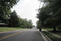 Along Schanck Road | |
 Stonehurst East Location of Stonehurst East in Monmouth County Inset: Location of county within the state of New Jersey  Stonehurst East Stonehurst East (New Jersey)  Stonehurst East Stonehurst East (the US) | |
| Coordinates: 40°13′48″N 74°17′14″W / 40.23000°N 74.28722°WCoordinates: 40°13′48″N 74°17′14″W / 40.23000°N 74.28722°W | |
| Country |
|
| State |
|
| County | Monmouth |
| Township | Freehold |
| Elevation[1] | 125 ft (38 m) |
| Time zone | UTC-5 (Eastern (EST)) |
| • Summer (DST) | UTC-4 (EDT) |
| GNIS feature ID | 883198[1] |
Stonehurst East is an unincorporated community located within Freehold Township in Monmouth County, New Jersey, United States. The area is mostly made up of a housing development bordered by U.S. Route 9, Schanck Road, Stillwells Corner Road, and County Route 524.[2] The area was farmland until it was developed into homes in the late 1960s.[3][4]
References
- 1 2 "Stonehurst East". Geographic Names Information System. United States Geological Survey.
- ↑ Google (October 4, 2015). "Stonehurst East, New Jersey" (Map). Google Maps. Google. Retrieved October 4, 2015.
- ↑ "Aerial view of Stonehurst East, 1963" Check
|url=value (help). Historic Aerials. 1963. Retrieved October 4, 2015. - ↑ "Aerial view of Stonehurst East, 1970" Check
|url=value (help). Historic Aerials. 1970. Retrieved October 4, 2015.

This article is issued from
Wikipedia.
The text is licensed under Creative Commons - Attribution - Sharealike.
Additional terms may apply for the media files.