Holland, Monmouth County, New Jersey
- For the township in Hunterdon County, see Holland Township, New Jersey.
| Holland, New Jersey | |
|---|---|
| Unincorporated community | |
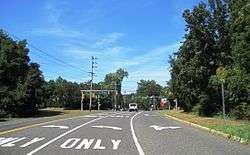 Along westbound Holland Road at CR 52 | |
 Holland, New Jersey Location of Holland in Monmouth County Inset: Location of county within the state of New Jersey  Holland, New Jersey Holland, New Jersey (New Jersey)  Holland, New Jersey Holland, New Jersey (the US) | |
| Coordinates: 40°23′27″N 74°08′43″W / 40.39083°N 74.14528°WCoordinates: 40°23′27″N 74°08′43″W / 40.39083°N 74.14528°W | |
| Country |
|
| State |
|
| County | Monmouth |
| Township | Holmdel, Middletown |
| Elevation[1] | 121 ft (37 m) |
| GNIS feature ID | 877168[1] |
Holland is an unincorporated community located on the border of Holmdel and Middletown townships in Monmouth County, New Jersey, United States. The community is centered on the intersection of County Route 52 (through which the township line runs) and Holland Road. The area making up Holland is hilly and consists of large single-family residences. An AT&T Labs campus is located off Laurel Avenue (CR 52 north of Holland Road) while Tatum County Park is also located in the area, both of which are on the Middletown side of the border.[2]
References
- 1 2 "Holland". Geographic Names Information System. United States Geological Survey.
- ↑ Google (February 24, 2015). "Holland, Middletown Township, Monmouth County, New Jersey" (Map). Google Maps. Google. Retrieved February 24, 2015.

This article is issued from
Wikipedia.
The text is licensed under Creative Commons - Attribution - Sharealike.
Additional terms may apply for the media files.