Charleston Springs, New Jersey
| Charleston Springs, New Jersey | |
|---|---|
| Unincorporated community | |
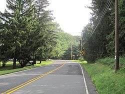 Charleston Springs as seen from Stage Coach Road (CR 524) approaching Ely Harmony Road | |
 Charleston Springs, New Jersey Location of Charleston Springs in Monmouth County Inset: Location of county within the state of New Jersey  Charleston Springs, New Jersey Charleston Springs, New Jersey (New Jersey)  Charleston Springs, New Jersey Charleston Springs, New Jersey (the US) | |
| Coordinates: 40°12′02″N 74°22′24″W / 40.20056°N 74.37333°WCoordinates: 40°12′02″N 74°22′24″W / 40.20056°N 74.37333°W | |
| Country |
|
| State |
|
| County | Monmouth |
| Township | Millstone |
| Elevation[1] | 203 ft (62 m) |
| GNIS feature ID | 875372[1] |
Charleston Springs is an unincorporated community located within Millstone Township in Monmouth County, New Jersey, United States.[2] Stage Coach Road, also designated County Route 524, is the main road that runs through the settlement, with Ely Harmony Road as the intersecting road defining the locality. The Manalapan Brook runs to the west of the center of Charleston Springs and CR 537 runs to the south of the area. The Monmouth County-owned Charleston Springs Golf Course is located one mile (1.6 km) northeast of the center of Charleston Springs on CR 527.[3]
References
- 1 2 "Charleston Springs". Geographic Names Information System. United States Geological Survey.
- ↑ Locality Search, State of New Jersey. Accessed February 21, 2015.
- ↑ Google (August 25, 2015). "Aerial view of Charleston Springs" (Map). Google Maps. Google. Retrieved August 25, 2015.

This article is issued from
Wikipedia.
The text is licensed under Creative Commons - Attribution - Sharealike.
Additional terms may apply for the media files.