Elton, New Jersey
| Elton, New Jersey | |
|---|---|
| Unincorporated community | |
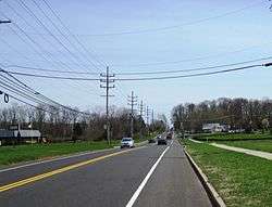 County Route 537 eastbound in Elton, approaching the County Route 524 split | |
 Elton, New Jersey Elton's location in Monmouth County (Inset: Monmouth County in New Jersey)  Elton, New Jersey Elton, New Jersey (New Jersey)  Elton, New Jersey Elton, New Jersey (the US) | |
| Coordinates: 40°13′01″N 74°20′29″W / 40.21694°N 74.34139°WCoordinates: 40°13′01″N 74°20′29″W / 40.21694°N 74.34139°W | |
| Country |
|
| State |
|
| County | Monmouth |
| Township | Manalapan |
| Elevation | 154 ft (47 m) |
| ZIP code | 07726 |
| GNIS feature ID | 0876179[1] |
Elton is an unincorporated community located within Manalapan Township, in Monmouth County, New Jersey, United States.[2]
The community of Elton is located near the intersection of County Route 537 (Monmouth Road) and County Route 524 (Elton-Adelphia Road), at the Freehold Township border. JB's Diner is a 1950s style diner located at this intersection. A fire destroyed the diner on the evening of May 24, 2016. The owners plan to rebuild the diner.[3]
References
- ↑ "Elton". Geographic Names Information System. United States Geological Survey. Retrieved September 25, 2012.
- ↑ Locality Search, State of New Jersey. Accessed February 23, 2015.
- ↑ Alex N. Gecan; Andrew Ford (May 25, 2016). "WATCH: JB's Diner fire started in ceiling". Asbury Park Press. Retrieved July 13, 2016.

This article is issued from
Wikipedia.
The text is licensed under Creative Commons - Attribution - Sharealike.
Additional terms may apply for the media files.