Fort Plains, New Jersey
| Fort Plains, New Jersey | |
|---|---|
| Unincorporated community | |
 | |
 Fort Plains, New Jersey Location of Fort Plains in Monmouth County Inset: Location of county within the state of New Jersey  Fort Plains, New Jersey Fort Plains, New Jersey (New Jersey)  Fort Plains, New Jersey Fort Plains, New Jersey (the US) | |
| Coordinates: 40°11′00″N 74°15′16″W / 40.18333°N 74.25444°WCoordinates: 40°11′00″N 74°15′16″W / 40.18333°N 74.25444°W | |
| Country |
|
| State |
|
| County | Monmouth |
| Township | Howell |
| Elevation[1] | 135 ft (41 m) |
| GNIS feature ID | 876421[1] |
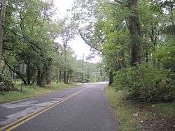
Fort Plains is an unincorporated community located within Howell Township in Monmouth County, New Jersey, United States.[2] The settlement is centered about the intersection of Fort Plains Road and West Farms Road on the western side of the township. Nearby the intersection are numerous housing developments consisting of larger single-family houses. U.S. Route 9 also runs north and south where numerous commercial businesses are found. The remainder of the area consists of forestland.[3]
References
- 1 2 "Fort Plains". Geographic Names Information System. United States Geological Survey.
- ↑ Locality Search, State of New Jersey. Accessed February 24, 2015.
- ↑ Google (October 4, 2016). "Aerial view of Fort Plains" (Map). Google Maps. Google. Retrieved October 4, 2016.

This article is issued from
Wikipedia.
The text is licensed under Creative Commons - Attribution - Sharealike.
Additional terms may apply for the media files.