Kirbys Mills, New Jersey
| Kirbys Mills, New Jersey | |
|---|---|
| Unincorporated community | |
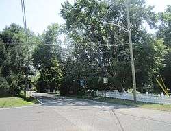 Looking south along Holmes Mill Road (CR 27) | |
 Kirbys Mills, New Jersey Location of Kirbys Mills in Monmouth County Inset: Location of county within the state of New Jersey  Kirbys Mills, New Jersey Kirbys Mills, New Jersey (New Jersey)  Kirbys Mills, New Jersey Kirbys Mills, New Jersey (the US) | |
| Coordinates: 40°07′43″N 74°32′21″W / 40.12861°N 74.53917°WCoordinates: 40°07′43″N 74°32′21″W / 40.12861°N 74.53917°W | |
| Country |
|
| State |
|
| County | Monmouth |
| Township | Upper Freehold |
| Elevation[1] | 105 ft (32 m) |
| GNIS feature ID | 877592[1] |
Kirbys Mills is an unincorporated community located within Upper Freehold Township in Monmouth County, New Jersey, United States.[2] Centered about the intersection of Burlington Path Road and Holmes Mill Road (with Monmouth County Route 27 and the Upper Freehold Historic Farmland Byway taking the south and east legs of the intersection[3]), the area consists of housing developments and small farms.[4]
References
- 1 2 "Kirbys Mills". Geographic Names Information System. United States Geological Survey.
- ↑ Locality Search, State of New Jersey. Accessed February 26, 2015.
- ↑ "UPPER FREEHOLD HISTORIC FARMLAND SCENIC BYWAY" (PDF). New Jersey Department of Transportation. Retrieved August 17, 2015.
- ↑ Google (August 17, 2015). "Aerial view of Kirbys Mills" (Map). Google Maps. Google. Retrieved August 17, 2015.

This article is issued from
Wikipedia.
The text is licensed under Creative Commons - Attribution - Sharealike.
Additional terms may apply for the media files.