Burlington Heights, New Jersey
| Burlington Heights, New Jersey | |
|---|---|
| Unincorporated community | |
 | |
 Burlington Heights, New Jersey  Burlington Heights, New Jersey  Burlington Heights, New Jersey | |
| Coordinates: 40°16′18″N 74°14′09″W / 40.27167°N 74.23583°WCoordinates: 40°16′18″N 74°14′09″W / 40.27167°N 74.23583°W | |
| Country |
|
| State |
|
| County | Monmouth |
| Township | Freehold |
| Elevation[1] | 128 ft (39 m) |
| GNIS feature ID | 883511[1] |
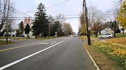
Burlington Heights is an unincorporated community located within Freehold Township in Monmouth County, New Jersey, United States.[2] The community was created in the early 1960s and originally consisted of 112 homes of mixed styles designed by Peter Petillo and Associates of Freehold.[3] It is located along Colts Neck Road (County Route 537) on the east side of the township, near New Jersey Route 18 and the Colts Neck municipal line.[2]
References
- 1 2 "Burlington Heights". Geographic Names Information System. United States Geological Survey.
- 1 2 Google (December 7, 2016). "Aerial view of Burlington Heights" (Map). Google Maps. Google. Retrieved December 7, 2016.
- ↑ "Real Estate Review". Asbury Park Press. November 17, 1961. Retrieved December 7, 2016 – via Newspapers.com. (Subscription required (help)).

This article is issued from
Wikipedia.
The text is licensed under Creative Commons - Attribution - Sharealike.
Additional terms may apply for the media files.