Ashley County, Arkansas
| Ashley County, Arkansas | ||
|---|---|---|
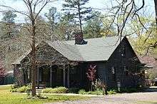
 Ashley County Courthouse in Hamburg | ||
| ||
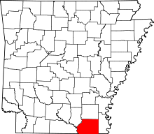 Location in the U.S. state of Arkansas | ||
 Arkansas's location in the U.S. | ||
| Founded | 1848 | |
| Named for | Chester Ashley | |
| Seat | Hamburg | |
| Largest city | Crossett | |
| Area | ||
| • Total | 941 sq mi (2,437 km2) | |
| • Land | 925 sq mi (2,396 km2) | |
| • Water | 15 sq mi (39 km2), 1.6% | |
| Population (est.) | ||
| • (2016) | 20,492 | |
| • Density | 23.6/sq mi (9.1/km2) | |
| Congressional district | 4th | |
| Time zone | Central: UTC−6/−5 | |
| Website |
ashleycounty | |

Ashley County is a county located in the U.S. state of Arkansas. As of the 2010 census, the population was 21,853.[1] The county seat is Hamburg.[2] The county was formed in 1848 from parts of Chicot, Drew and Union counties and named after Chester Ashley. It is an alcohol prohibition or dry county.
History
Ashley County, the fifth-largest county in Arkansas in terms of land area, was formed on November 30, 1848 from portions of Drew, Chicot and Union Counties. It was named after Chester Ashley, a US Senator and land speculator. The final borders were laid in 1861. The courtroom in the courthouse has a one-of-a-kind architecture: it is round, and the seats are arranged so that members of the audience can always see each other.
Geography
Ashley County is split between two geographic regions, divided by the Bayou Bartholomew. The rich, fertile, alluvial soils of the Mississippi Alluvial Plain extend into the eastern part of the county. In Arkansas, this region is called the Arkansas Delta (in Arkansas, usually referred to as "the Delta"), having a distinct history and culture from adjacent regions. West of the Ouachita, Ashley County is characterized by forests of shortleaf pine and hardwoods typical of the Gulf Coastal Plain. In Arkansas, this region is referred to as the Arkansas Timberlands, a subdivision of the Piney Woods.
According to the U.S. Census Bureau, the county has a total area of 941 square miles (2,440 km2), of which 925 square miles (2,400 km2) is land and 15 square miles (39 km2) (1.6%) is water.[3] The lowest point in the state of Arkansas is located on the Ouachita River in Ashley County and Union County, where it flows out of Arkansas and into Louisiana.
The county is located approximately 58 miles (93 km) north of Monroe, Louisiana, 118 miles (190 km) south of Little Rock, and 158 miles (254 km) northwest of Jackson, Mississippi.[Note 1] Ashley County is surrounded by Drew County to the north, Chicot County to the east, Morehouse Parish, Louisiana to the south, Union Parish, Louisiana to the southwest, and two Timberlands counties; Union County to the west and Bradley County to the northwest.
Protected areas
Ashley County contains Overflow National Wildlife Refuge, part of the Felsenthal National Wildlife Refuge, and four Wildlife Management Areas (WMAs) under Arkansas Game and Fish Commission jurisdiction.
Beryl Anthony Lower Ouachita WMA preserves seasonally flooded bottomland hardwood forest habitat along the Ouachita River between the Felsenthal NWR and the Louisiana state line for preservation, recreation, and hunting opportunities. Duck hunting, especially when the Ouachita River floods, is the primary hunting opportunity due to the site's position along the Mississippi Flyway, with deer and squirrel hunting also available during the year.[5] Most of the 7,020 acres (2,840 ha) is on the Union County side of the Ouachita River, leaving the only public access to the Ashley County area via boat.[6] A small segment in Ashley County contains the Coffee Prairie Natural Area, owned by the Arkansas Natural Heritage Commission.[7]
The Casey Jones Leased Lands WMA is a common name for five fragmented parcels in Ashley and Drew counties established in 1988. The two largest segments in Ashley County are south of Crossett and in the northwest corner of the county, with a small area northwest of the Overflow WMA also included in Casey Jones WMA.[8] This lease includes segments of working forest actively managed for forest products, primarily by single tree selection. Habitats range from upland pine to bottomland hardwood depending upon location. Deer and turkey hunting are most common in the WMA.[9]
Little Bayou WMA is located in northeastern Ashley County along the western banks of Bayou Bartholomew at the mouth of Little Bayou. The area contains a boat ramp on Bayou Bartholomew, as well as birding, camping, fishing, and hunting. The former agricultural area was replanted with bottomland and upland hardwoods, short-leaf pines, and native warm season grasses in the 1990s.[10]
The Crossett Experimental Forest is a 1,765 acres (714 ha) property donated by Georgia-Pacific Corporation in 1934 to research forest management in second-growth loblolly pine and shortleaf pine forests. Within the Forest is the Reynolds Natural Area, a stand that has been largely untouched since the area's creation in 1934. The property is managed by the Southern Research Station of the United States Forest Service.
Demographics
| Historical population | |||
|---|---|---|---|
| Census | Pop. | %± | |
| 1850 | 2,058 | — | |
| 1860 | 8,590 | 317.4% | |
| 1870 | 8,042 | −6.4% | |
| 1880 | 10,156 | 26.3% | |
| 1890 | 13,295 | 30.9% | |
| 1900 | 19,734 | 48.4% | |
| 1910 | 25,268 | 28.0% | |
| 1920 | 23,410 | −7.4% | |
| 1930 | 25,151 | 7.4% | |
| 1940 | 26,785 | 6.5% | |
| 1950 | 25,660 | −4.2% | |
| 1960 | 24,220 | −5.6% | |
| 1970 | 24,976 | 3.1% | |
| 1980 | 26,538 | 6.3% | |
| 1990 | 24,319 | −8.4% | |
| 2000 | 24,209 | −0.5% | |
| 2010 | 21,853 | −9.7% | |
| Est. 2016 | 20,492 | [11] | −6.2% |
| U.S. Decennial Census[12] 1790–1960[13] 1900–1990[14] 1990–2000[15] 2010–2016[1] | |||
As of the 2000 census,[16] there were 24,209 people, 9,384 households, and 6,906 families residing in the county. The population density was 26 people per square mile (10/km²). There were 10,615 housing units at an average density of 12 per square mile (4/km²). The racial makeup of the county was 69.78% White, 27.10% Black or African American, 0.21% Native American, 0.18% Asian, 0.05% Pacific Islander, 1.73% from other races, and 0.96% from two or more races. 3.21% of the population were Hispanic or Latino of any race.
There were 9,384 households out of which 33.60% had children under the age of 18 living with them, 56.80% were married couples living together, 13.00% had a female householder with no husband present, and 26.40% were non-families. 23.90% of all households were made up of individuals and 11.20% had someone living alone who was 65 years of age or older. The average household size was 2.55 and the average family size was 3.02.
In the county, the population was spread out with 26.80% under the age of 18, 8.30% from 18 to 24, 27.20% from 25 to 44, 23.90% from 45 to 64, and 13.80% who were 65 years of age or older. The median age was 36 years. For every 100 females there were 93.30 males. For every 100 females age 18 and over, there were 90.60 males.
The median income for a household in the county was $31,758, and the median income for a family was $37,370. Males had a median income of $35,089 versus $19,501 for females. The per capita income for the county was $15,702. About 13.90% of families and 17.50% of the population were below the poverty line, including 25.70% of those under age 18 and 17.20% of those age 65 or over.
As of 2010 Ashley County had a population of 21,853 people. 68.19% of the population were non-Hispanic whites, 25.81% were blacks, 0.32% Native Americans, 0.18% Asians and 4.89% Hispanics or Latinos.
In 2000, the largest denominational group was the Evangelical Protestants (with 16,752 adherents) and Mainline Protestants (with 1,817 adherents).[17] The largest religious bodies were The Southern Baptist Convention (with 11,398 members) and The American Baptist Association (with 2,890 members).[18]
Human resources
Education
Educational attainment in Ashley County is typical for a rural Arkansas county, with a 2012 study finding 84.9% of Ashley County residents over age 25 held a high school degree or higher and 13.2% holding a bachelor's degree or higher, compared to Arkansas statewide averages of 84.8% and 21.1%. Ashley County is significantly below national averages of 86.7% and 29.8%, respectively.[19]
Primary and secondary education
Two public school districts are based in Ashley County; Hamburg School District is the largest school district in Ashley County, with the Crossett School District serving the west side of the county. Successful completion of the curriculum of these schools leads to graduation from Hamburg High School or Crossett High School, respectively. Both high schools are accredited by the Arkansas Department of Education (ADE). A small area in eastern Ashley County is served by the Lakeside School District, which is based in Lake Village.
Higher education
There are no institutions of higher education in Ashley County. The nearest public community college is Louisiana Delta Community College in Bastrop, Louisiana, followed by South Arkansas Community College in El Dorado. Nearby public four-year universities include University of Arkansas at Monticello, University of Louisiana at Monroe, and Louisiana Tech University in Ruston, Louisiana. The University of Arkansas at Monticello's College of Technology—Crossett, formerly the Forest Echoes Technology Institute, is located between North Crossett and Hamburg and offers associates' degrees in general and industrial technology and technical certifications in a number of medical and technical programs.
Libraries
Ashley County has two libraries: the Ashley County Library in Hamburg and Crossett Public Library in Crossett. Both institutions offers books, e-books, media, reference, youth, business and genealogy services.
Public health
Ashley County's above-average poverty rate also indicates a high Medicaid eligibility rate. As of 2012, 35.3% of Ashley County was eligible for Medicaid, with 72.5% of children under 19 eligible for ARKids First, a program by the Arkansas Department of Human Services that combines children's Medicaid (ARKids A) and other programs for families with higher incomes (ARKids B).[20] The county's population is significantly above healthy weight, with 71.9% of adults and 39.8% of children/adolescents ranking as overweight or obese, above the state averages of 67.1% and 39.3%, themselves significantly above national averages of 62.9% and 30.3%, respectively.[21]
The Ashley County Medical Center in Crossett is the nearest medical center offering acute inpatient care, emergency care, diagnostics, general surgery, orthopedic surgery, OB/GYN, rehabilitation, therapy, and senior care services. The facility is rated as a Level 4 Trauma Center by the Arkansas Department of Health.
The nearest Level 1 Trauma Centers are Arkansas Children's Hospital and University of Arkansas for Medical Sciences, both in Little Rock.[22]
Public safety
The Ashley County Sheriff's Office is the primary law enforcement agency in the county. The agency is led by the Ashley County Sheriff, an official elected by countywide vote every four years.
The county is under the jurisdiction of the Ashley County District Court, a local district court.[23] Local district courts in Arkansas are courts of original jurisdiction for criminal, civil, small claims, and traffic matters.[24] Local district courts are presided over by an elected part-time judge who may privately practice law. The district court has two departments, Crossett and Hamburg.[25]
Superseding district court jurisdiction is the 10th Judicial Circuit Court, which covers Ashley, Bradley, Chicot, Desha, Drew counties. The 10th Circuit contains three circuit judges, elected to six-year terms circuitwide.[26]
Government and politics
The county government is a constitutional body granted specific powers by the Constitution of Arkansas and the Arkansas Code. The quorum court is the legislative branch of the county government and controls all spending and revenue collection. Representatives are called justices of the peace and are elected from county districts every even-numbered year. The number of districts in a county vary from nine to fifteen based on population, and district boundaries are drawn by the Ashley County Election Commission. The Ashley County Quorum Court has eleven members.[27] Presiding over quorum court meetings is the county judge, who serves as the chief operating officer of the county. The county judge is elected at-large and does not vote in quorum court business, although capable of vetoing quorum court decisions.[28][29]
| Year | GOP | Dem | Others |
|---|---|---|---|
| 2016 | 66.04% 5,338 | 29.79% 2,408 | 4.17% 337 |
| 2012 | 61.44% 4,867 | 36.09% 2,859 | 2.46% 195 |
| 2008 | 62.55% 5,406 | 34.44% 2,976 | 3.01% 260 |
| 2004 | 53.65% 4,567 | 45.59% 3,881 | 0.75% 64 |
| 2000 | 46.86% 3,876 | 51.42% 4,253 | 1.72% 142 |
| 1996 | 29.32% 2,428 | 60.51% 5,011 | 10.17% 842 |
| 1992 | 28.08% 2,686 | 61.42% 5,876 | 10.50% 1,005 |
| 1988 | 47.48% 4,111 | 51.58% 4,466 | 0.95% 82 |
| 1984 | 62.44% 5,675 | 37.11% 3,373 | 0.45% 41 |
| 1980 | 45.27% 3,960 | 52.03% 4,552 | 2.70% 236 |
| 1976 | 37.01% 3,092 | 62.88% 5,253 | 0.11% 9 |
| 1972 | 76.44% 5,506 | 23.32% 1,680 | 0.24% 17 |
| 1968 | 18.59% 1,470 | 25.74% 2,035 | 55.67% 4,401 |
| 1964 | 55.77% 3,742 | 43.23% 2,901 | 1.00% 67 |
| 1960 | 25.63% 1,288 | 62.04% 3,118 | 12.34% 620 |
| 1956 | 27.70% 1,183 | 66.04% 2,820 | 6.25% 267 |
| 1952 | 26.41% 1,249 | 73.40% 3,471 | 0.19% 9 |
| 1948 | 8.18% 197 | 76.58% 1,844 | 15.24% 367 |
| 1944 | 11.59% 285 | 88.17% 2,169 | 0.24% 6 |
| 1940 | 9.10% 184 | 90.71% 1,835 | 0.20% 4 |
| 1936 | 6.43% 95 | 93.57% 1,382 | 0.00% 0 |
| 1932 | 6.88% 188 | 92.83% 2,537 | 0.29% 8 |
| 1928 | 36.02% 786 | 63.84% 1,393 | 0.14% 3 |
| 1924 | 30.69% 506 | 63.55% 1,048 | 5.76% 95 |
| 1920 | 35.04% 725 | 63.41% 1,312 | 1.55% 32 |
| 1916 | 23.36% 463 | 76.64% 1,519 | 0.00% 0 |
| 1912 | 23.15% 439 | 54.27% 1,029 | 22.57% 428 |
| 1908 | 41.24% 821 | 55.25% 1,100 | 3.52% 70 |
| 1904 | 29.84% 347 | 69.13% 804 | 1.03% 12 |
| 1900 | 27.18% 524 | 71.63% 1,381 | 1.19% 23 |
| 1896 | 17.96% 405 | 78.05% 1,760 | 3.99% 90 |
Taxation
Property tax is assessed by the Ashley County Assessor annually based upon the fair market value of the property and determining which tax rate, commonly called a millage in Arkansas, will apply. The rate depends upon the property's location with respect to city limits, school district, and special tax increment financing (TIF) districts. This tax is collected by the Ashley County Collector between the first business day of March of each year through October 15th without penalty. The Ashley County Treasurer disburses tax revenues to various government agencies, such as cities, county road departments, fire departments, libraries, and police departments in accordance with the budget set by the quorum court.
Sales and use taxes in Arkansas are voter approved and collected by the Arkansas Department of Finance and Administration. Arkansas's statewide sales and use tax has been 6.5% since July 1, 2013.[31] Ashley County has an additional sales and use tax of 1.50% since July 1, 2010. Within Ashley County, the City of Crossett has an additional 2.25% sales and use tax since January 1, 2014, and Fountain Hill, Hamburg, Portland, and Wilmot have a 1.00% sales and use tax rate.[32] The Arkansas State Treasurer disburses tax revenue to counties/cities in accordance with tax rules.
Communities
Cities
Towns
Census-designated places
Unincorporated community
- Beech Creek Crossing
- Berea
- Berlin
- Bovine
- Boydell
- Cremer
- Crossroad
- Donbey
- Forest Park Addition
- Gulledge
- Kimball
- Lloyd
- Longview Crossing
- Martinville
- Meridian
- Miller's Chapel
- Milo
- Mist
- Moore's Mill
- Mount Olive
- Mount Pleasant
- Oakhurst Addition
- Old Milo
- Post Oak
- Promised Land
- Pugh
- Rawls
- Riley
- Roark
- Rolfe Junction
- Snyder
- South Crossett
- Stillions
- Sulphur Springs
- Sunshine
- Thebes
- Trafalgar
- Unity
- Venice
- Wallace
- White
- Whitlow
- Whitlow Junction
- Petersburg
Historical communities
- Brushy
- Elon
- Jackson
- Matoka
- Phelan
Townships
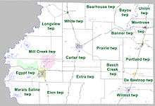
Townships in Arkansas are the divisions of a county. Each township includes unincorporated areas; some may have incorporated cities or towns within part of their boundaries. Arkansas townships have limited purposes in modern times. However, the United States Census does list Arkansas population based on townships (sometimes referred to as "county subdivisions" or "minor civil divisions"). Townships are also of value for historical purposes in terms of genealogical research. Each town or city is within one or more townships in an Arkansas county based on census maps and publications. The townships of Ashley County are listed below; listed in parentheses are the cities, towns, and/or census-designated places that are fully or partially inside the township. [34][35]
- Banner
- Bayou
- Bearhouse
- Beech Creek
- Carter (contains Hamburg)
- De Bastrop (contains Parkdale)
- Egypt (contains Crossett, West Crossett, and most of North Crossett)
- Elon
- Extra
- Longview
- Marais Saline
- Mill Creek (contains part of North Crossett)
- Montrose (contains Montrose)
- Portland (contains Portland)
- Prairie
- Union
- White (contains Fountain Hill)
- Wilmot (contains Wilmot)
Source:[36]
Infrastructure
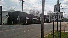
Major highways


See also
Notes
References
- 1 2 "State & County QuickFacts". United States Census Bureau. Retrieved May 19, 2014.
- ↑ "Find a County". National Association of Counties. Archived from the original on 2011-05-31. Retrieved 2011-06-07.
- ↑ "2010 Census Gazetteer Files". United States Census Bureau. August 22, 2012. Retrieved August 25, 2015.
- ↑ "Google Maps (Search for Hamburg, AR)". Google. Retrieved April 29, 2017.
- ↑ "Wildlife Management Area Details". Beryl Anthony Lower Ouachita WMA. Little Rock: Arkansas Game and Fish Commission. 2011. Retrieved April 29, 2017.
- ↑ GIS Division (September 2006). Beryl Anthony Lower Ouachita WMA (PDF) (Map). Little Rock: Arkansas Game and Fish Commission. Retrieved April 29, 2017.
- ↑ Transportation Planning and Policy Division (November 16, 2007). General Highway Map, Ashley County, Arkansas (PDF) (Map). 1:62500. Little Rock: Arkansas State Highway and Transportation Department. Retrieved April 29, 2017.
- ↑ GIS Division (September 2014). Casey Jones WMA (PDF) (Map). Little Rock: Arkansas Game and Fish Commission. Retrieved April 29, 2017.
- ↑ "Wildlife Management Area Details". Casey Jones WMA. Little Rock: Arkansas Game and Fish Commission. 2011. Retrieved April 29, 2017.
- ↑ "Wildlife Management Area Details". Little Bayou WMA. Little Rock: Arkansas Game and Fish Commission. 2011. Retrieved April 29, 2017.
- ↑ "Population and Housing Unit Estimates". Retrieved June 9, 2017.
- ↑ "U.S. Decennial Census". United States Census Bureau. Archived from the original on May 12, 2015. Retrieved August 25, 2015.
- ↑ "Historical Census Browser". University of Virginia Library. Retrieved August 25, 2015.
- ↑ Forstall, Richard L., ed. (March 27, 1995). "Population of Counties by Decennial Census: 1900 to 1990". United States Census Bureau. Retrieved August 25, 2015.
- ↑ "Census 2000 PHC-T-4. Ranking Tables for Counties: 1990 and 2000" (PDF). United States Census Bureau. April 2, 2001. Retrieved August 25, 2015.
- ↑ "American FactFinder". United States Census Bureau. Archived from the original on 2013-09-11. Retrieved 2011-05-14.
- ↑ "County Membership Reports". thearda.com. Archived from the original on 12 July 2011. Retrieved 2011-08-22.
- ↑ "County Membership Reports". thearda.com. Retrieved 2010-08-22.
- ↑ "American Community Survey". United States Census Bureau. 2011–2015. Retrieved May 11, 2017.
- ↑ "Profile" (2015), p. 56.
- ↑ "Nutrition, Physical Activity and Obesity: Data, Trends and Maps". Centers for Disease Control and Prevention. Retrieved December 20, 2016.
- ↑ "Designated Trauma Centers". Arkansas Department of Health. June 7, 2016. Retrieved May 12, 2017.
- ↑ "Directory" (2017), p. 30.
- ↑ Staff of the Arkansas Judiciary (September 2, 2014). "Arkansas Court Structure" (PDF). Arkansas Judiciary. Retrieved December 26, 2016.
- ↑
- ↑ "Directory" (2017), p. 14.
- ↑ "Ashley County". Association of Arkansas Counties. Retrieved April 30, 2017.
- ↑ Teske, Steven (March 24, 2014). "Quorum Courts". Encyclopedia of Arkansas History and Culture. Butler Center for Arkansas Studies at the Central Arkansas Library System. Retrieved January 23, 2016.
- ↑ Goss, Kay C. (August 28, 2015). "Office of County Judge". Encyclopedia of Arkansas History and Culture. Butler Center for Arkansas Studies at the Central Arkansas Library System. Retrieved January 23, 2016.
- ↑ "Dave Leip's Atlas of U.S. Presidential Elections". Retrieved November 18, 2016.
- ↑ "State Tax Rates". Arkansas Department of Finance and Administration. Retrieved December 19, 2016.
- ↑ "List of Cities and Counties with Local Sales and Use Tax" (PDF). Arkansas Department of Finance and Administration. October–December 2016. Retrieved April 30, 2017.
- ↑ https://ualr.edu/aedi/census-state-data-center/arkansas-census-data/
- ↑ 2011 Boundary and Annexation Survey (BAS): Ashley County, AR (PDF) (Map). United States Census Bureau. Archived from the original (PDF) on 2012-10-19. Retrieved 2011-08-11.
- ↑ "Arkansas: 2010 Census Block Maps - County Subdivision". United States Census Bureau. Retrieved May 27, 2014.
- ↑ "Summary Population and Housing Characteristics, CPH-1-5, Arkansas" (PDF). 2010 Census of Population and Housing. United States Census Bureau. September 2012. Retrieved May 31, 2014.
- Staff of the University of Arkansas Division of Agriculture Research and Extension (2015). "Rural Profile of Arkansas" (PDF). Little Rock: University of Arkansas Cooperative Extension Services. Retrieved December 5, 2016.
- Staff of the Arkansas Judiciary (April 18, 2017). "Arkansas Judicial Directory" (PDF). Little Rock: Arkansas Judiciary. Retrieved May 12, 2017.
External links
Places adjacent to Ashley County, Arkansas | ||||||||||
|---|---|---|---|---|---|---|---|---|---|---|
| ||||||||||
Municipalities and communities of Ashley County, Arkansas, United States | ||
|---|---|---|
| Cities | | |
| Town | ||
| CDPs | ||
| Unincorporated communities |
| |
Coordinates: 33°12′32″N 91°47′43″W / 33.20889°N 91.79528°W