Baxter County, Arkansas
| Baxter County, Arkansas | ||
|---|---|---|
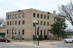 Baxter County courthouse in Mountain Home | ||
| ||
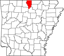 Location in the U.S. state of Arkansas | ||
 Arkansas's location in the U.S. | ||
| Founded | March 24, 1873 | |
| Named for | Elisha Baxter | |
| Seat | Mountain Home | |
| Largest city | Mountain Home | |
| Area | ||
| • Total | 587 sq mi (1,520 km2) | |
| • Land | 554 sq mi (1,435 km2) | |
| • Water | 32 sq mi (83 km2), 5.5% | |
| Population (est.) | ||
| • (2016) | 41,062 | |
| • Density | 75/sq mi (29/km2) | |
| Congressional district | 1st | |
| Time zone | Central: UTC−6/−5 | |
| Website | Baxter County government's website | |

Baxter County is a county in the U.S. state of Arkansas. As of the 2010 census, the county's population was 41,513.[1] The county seat is Mountain Home.[2] It is Arkansas's 66th county, formed on March 24, 1873, and named for Elisha Baxter, the tenth governor of Arkansas.
The Mountain Home, AR, Micropolitan Statistical Area includes all of Baxter County. It is in the northern part of the state, bordering Missouri. It is commonly referred to as the Twin Lakes Area because it is bordered by two of Arkansas' largest lakes, Bull Shoals Lake and Norfork Lake. On its southern border is the Norfork Tailwater and the Buffalo National River.
Mountain Home, a small town whose origins date back to the early nineteenth century, is located in north-central Arkansas on a plateau in the Ozark Mountains. The natural environment of nearby Norfork and Bull Shoals lakes and the surrounding countryside has attracted tourists from around the country for many years. Educational institutions have also played a role in the life of the community.[3]
The Baxter Bulletin weekly newspaper was named in 1973 by the Newspaper Enterprise Association as the "Best Overall Weekly Newspaper in the United States" in the over 10,000-circulation category. At the time it was published by Harold E. Martin and was the largest weekly paper in Arkansas.
Geography
According to the U.S. Census Bureau, the county has a total area of 587 square miles (1,520 km2), of which 554 square miles (1,430 km2) is land and 32 square miles (83 km2) (5.5%) is water.[4]
Major highways
.svg.png)


Adjacent counties
- Ozark County, Missouri (north)
- Fulton County (east)
- Izard County (southeast)
- Stone County (south)
- Searcy County (southwest)
- Marion County (west)
National protected areas
- Buffalo National River (part)
- Ozark National Forest (part)
Demographics
| Historical population | |||
|---|---|---|---|
| Census | Pop. | %± | |
| 1880 | 6,004 | — | |
| 1890 | 8,527 | 42.0% | |
| 1900 | 9,298 | 9.0% | |
| 1910 | 10,389 | 11.7% | |
| 1920 | 10,216 | −1.7% | |
| 1930 | 9,519 | −6.8% | |
| 1940 | 10,281 | 8.0% | |
| 1950 | 11,683 | 13.6% | |
| 1960 | 9,943 | −14.9% | |
| 1970 | 15,319 | 54.1% | |
| 1980 | 27,409 | 78.9% | |
| 1990 | 31,186 | 13.8% | |
| 2000 | 38,386 | 23.1% | |
| 2010 | 41,513 | 8.1% | |
| Est. 2016 | 41,062 | [5] | −1.1% |
| U.S. Decennial Census[6] 1790–1960[7] 1900–1990[8] 1990–2000[9] 2010–2016[1] | |||
As of the 2000 census,[11] there were 38,386 people, 17,052 households, and 11,799 families residing in the county. The population density was 69 people per square mile (27/km²). There were 19,891 housing units at an average density of 36 per square mile (14/km²). The racial makeup of the county was 97.81% White, 0.11% Black or African American, 0.52% Native American, 0.34% Asian, 0.02% Pacific Islander, 0.22% from other races, and 0.97% from two or more races. 1.00% of the population were Hispanic or Latino of any race.
There were 17,052 households out of which 22.00% had children under the age of 18 living with them, 59.00% were married couples living together, 7.70% had a female householder with no husband present, and 30.80% were non-families. 27.50% of all households were made up of individuals and 15.10% had someone living alone who was 65 years of age or older. The average household size was 2.21 and the average family size was 2.65.
In the county, the population was spread out with 19.00% under the age of 18, 5.80% from 18 to 24, 21.10% from 25 to 44, 27.40% from 45 to 64, and 26.80% who were 65 years of age or older. The median age was 48 years. For every 100 females there were 92.30 males. For every 100 females age 18 and over, there were 89.10 males.
The median income for a household in the county was $29,106, and the median income for a family was $34,578. Males had a median income of $25,976 versus $18,923 for females. The per capita income for the county was $16,859. About 7.90% of families and 11.10% of the population were below the poverty line, including 14.70% of those under age 18 and 8.90% of those age 65 or over.
As of 2010 Baxter County had a population of 41,513. The racial makeup was 95.96% Non-Hispanic whites, 0.16% blacks, 0.56% Native Americans, 0.41% Asians, 0.04% Pacific Islanders, 1.25% Non-Hispanics reporting more than one race and 1.66% Hispanic or Latino.
Government
| Year | GOP | Dem | Others |
|---|---|---|---|
| 2016 | 74.28% 14,682 | 21.09% 4,169 | 4.63% 915 |
| 2012 | 70.78% 13,688 | 26.74% 5,172 | 2.48% 479 |
| 2008 | 64.32% 12,852 | 32.73% 6,539 | 2.95% 590 |
| 2004 | 60.05% 11,128 | 38.47% 7,129 | 1.47% 273 |
| 2000 | 57.09% 9,538 | 39.00% 6,516 | 3.92% 654 |
| 1996 | 44.35% 6,877 | 43.23% 6,703 | 12.42% 1,925 |
| 1992 | 35.85% 5,640 | 44.44% 6,991 | 19.72% 3,101 |
| 1988 | 63.35% 8,614 | 35.36% 4,808 | 1.29% 175 |
| 1984 | 69.84% 10,870 | 29.09% 4,528 | 1.07% 166 |
| 1980 | 63.93% 9,684 | 31.62% 4,789 | 4.45% 674 |
| 1976 | 50.51% 5,885 | 49.49% 5,766 | |
| 1972 | 70.65% 6,754 | 28.00% 2,677 | 1.35% 129 |
| 1968 | 49.53% 3,401 | 28.43% 1,952 | 22.04% 1,513 |
| 1964 | 40.61% 1,986 | 59.29% 2,900 | 0.10% 5 |
| 1960 | 54.34% 2,108 | 43.67% 1,694 | 1.99% 77 |
| 1956 | 53.92% 1,721 | 45.46% 1,451 | 0.63% 20 |
| 1952 | 49.66% 1,387 | 49.70% 1,388 | 0.64% 18 |
| 1948 | 31.42% 553 | 62.39% 1,098 | 6.20% 109 |
| 1944 | 41.69% 572 | 58.02% 796 | 0.29% 4 |
| 1940 | 36.09% 489 | 63.39% 859 | 0.52% 7 |
| 1936 | 32.47% 375 | 66.93% 773 | 0.61% 7 |
| 1932 | 15.47% 194 | 82.85% 1,039 | 1.67% 21 |
| 1928 | 42.71% 504 | 56.36% 665 | 0.93% 11 |
| 1924 | 27.29% 301 | 58.02% 640 | 14.69% 162 |
| 1920 | 38.38% 484 | 56.07% 707 | 5.55% 70 |
| 1916 | 25.81% 318 | 74.19% 914 | 0.00% 0 |
| 1912 | 14.26% 142 | 53.82% 536 | 31.93% 318 |
| 1908 | 30.74% 300 | 62.19% 607 | 7.07% 69 |
| 1904 | 34.40% 236 | 62.10% 426 | 3.50% 24 |
| 1900 | 28.28% 287 | 71.23% 723 | 0.49% 5 |
| 1896 | 21.06% 262 | 78.78% 980 | 0.16% 2 |
Communities
Cities
- Briarcliff
- Cotter
- Gassville
- Lakeview
- Mountain Home (county seat)
- Norfork
- Salesville
Town
- Big Flat (partly in Searcy County)
Census designated place
Unincorporated communities
Townships
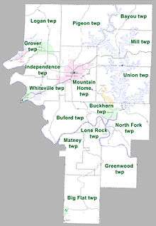
Townships in Arkansas are the divisions of a county. Each township includes unincorporated areas; some may have incorporated cities or towns within part of their boundaries. Arkansas townships have limited purposes in modern times. However, the United States Census does list Arkansas population based on townships (sometimes referred to as "county subdivisions" or "minor civil divisions"). Townships are also of value for historical purposes in terms of genealogical research. Each town or city is within one or more townships in an Arkansas county based on census maps and publications. The townships of Baxter County are listed below; listed in parentheses are the cities, towns, and/or census-designated places that are fully or partially inside the township. [13][14]
Notable residents

- Richard Antrim – naval rear admiral, World War II veteran and Medal of Honor recipient
- Lonnie D. Bentley – professor and the head of the Department of Computer and Information Technology at Purdue University
- Robbie Branscum – writer of children's books and young adult fiction
- Bob Cohee - former county judge, former state Republican chairman[17]
- Johnny R. Key - member of the Arkansas State Senate from Baxter County since 2009
- Richard A. Knaak – author of Minotaur Wars and other contributions to Dragonlance
- Carolyn D. Wright – poet, born in Mountain Home
See also
References
- 1 2 "State & County QuickFacts". United States Census Bureau. Retrieved May 19, 2014.
- ↑ "Find a County". National Association of Counties. Archived from the original on July 12, 2012. Retrieved 2011-06-07.
- ↑ Mulloy, Clement. "Mountain Home (Baxter County)". Encyclopedia of Arkansas. Retrieved 2 June 2015.
- ↑ "2010 Census Gazetteer Files". United States Census Bureau. August 22, 2012. Retrieved August 25, 2015.
- ↑ "Population and Housing Unit Estimates". Retrieved June 9, 2017.
- ↑ "U.S. Decennial Census". United States Census Bureau. Archived from the original on May 12, 2015. Retrieved August 25, 2015.
- ↑ "Historical Census Browser". University of Virginia Library. Retrieved August 25, 2015.
- ↑ Forstall, Richard L., ed. (March 27, 1995). "Population of Counties by Decennial Census: 1900 to 1990". United States Census Bureau. Retrieved August 25, 2015.
- ↑ "Census 2000 PHC-T-4. Ranking Tables for Counties: 1990 and 2000" (PDF). United States Census Bureau. April 2, 2001. Retrieved August 25, 2015.
- ↑ Based on 2000 census data
- ↑ "American FactFinder". United States Census Bureau. Archived from the original on September 11, 2013. Retrieved 2011-05-14.
- ↑ "Dave Leip's Atlas of U.S. Presidential Elections". Retrieved November 18, 2016.
- ↑ 2011 Boundary and Annexation Survey (BAS): Baxter County, AR (PDF) (Map). U. S. Census Bureau. Archived from the original (PDF) on 2012-10-19. Retrieved 2011-07-26.
- ↑ "Arkansas: 2010 Census Block Maps - County Subdivision". United States Census Bureau. Retrieved May 27, 2014.
- ↑ "County Subdivisions: Arkansas". Census 2010 U.S. Gazetteer Files. United States Census Bureau. Archived from the original (TXT) on 2014-05-31.
- ↑ "Census 2010 U.S. Gazetteer Files". United States Census Bureau.
- ↑ "Robert "Bob" L. Cohee". rollerfuneralhomes.com. Retrieved May 26, 2014.
External links
- Baxter County government's website
- Baxter County, Arkansas at Curlie (based on DMOZ)
- Ozark Amateur Radio Club - website
Places adjacent to Baxter County, Arkansas | ||||||||||
|---|---|---|---|---|---|---|---|---|---|---|
| ||||||||||
Municipalities and communities of Baxter County, Arkansas, United States | ||
|---|---|---|
| Cities | | |
| Towns | ||
| CDP | ||
| Unincorporated communities | ||
| Footnotes | ‡This populated place also has portions in an adjacent county or counties | |
Coordinates: 36°18′25″N 92°21′17″W / 36.30694°N 92.35472°W