Holmevatnet
| Holmevatnet | |
|---|---|
| Holmevatn | |
 Holmevatnet Location of the lake 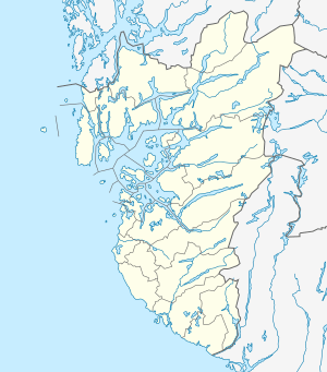 Holmevatnet Holmevatnet (Rogaland)  Holmevatnet Holmevatnet (Norway) | |
| Location |
Bykle, Aust-Agder Suldal, Rogaland |
| Coordinates | 59°27′43″N 7°00′49″E / 59.4620°N 07.0135°ECoordinates: 59°27′43″N 7°00′49″E / 59.4620°N 07.0135°E |
| Basin countries | Norway |
| Max. length | 4 kilometres (2.5 mi) |
| Max. width | 3.5 kilometres (2.2 mi) |
| Surface area | 4.76 km2 (1.84 sq mi) |
| Shore length1 | 34 kilometres (21 mi) |
| Surface elevation | 1,164 metres (3,819 ft) |
| References | NVE |
| 1 Shore length is not a well-defined measure. | |
Holmevatnet or Holmevatn is a lake in the Setesdalsheiene area of Norway. It is located in the mountains on the border of the municipalities of Bykle in Aust-Agder county and Suldal in Rogaland county. The 4.76-square-kilometre (1.84 sq mi) lake lies just west of the lake Store Urevatn and to the northeast of the lake Blåsjø. The nearest villages are Berdalen in Bykle, about 20 kilometres (12 mi) to the east and Suldalsosen, about 30 kilometres (19 mi) to the west. The mountain Kaldafjellet lies about 6 kilometres (3.7 mi) north of the lake.[1]
See also
References
- ↑ "Holmevatn" (in Norwegian). yr.no. Retrieved 2010-05-16.
This article is issued from
Wikipedia.
The text is licensed under Creative Commons - Attribution - Sharealike.
Additional terms may apply for the media files.