Snåsavatnet
| Snåsavatnet | |
|---|---|
 | |
 Snåsavatnet Location of the lake  Snåsavatnet Snåsavatnet (Norway) | |
| Location | Steinkjer and Snåsa, Trøndelag |
| Coordinates | 64°11′15″N 12°01′30″E / 64.1874°N 12.0249°ECoordinates: 64°11′15″N 12°01′30″E / 64.1874°N 12.0249°E |
| Basin countries | Norway |
| Max. length | 40 kilometres (25 mi) |
| Max. width | 5 kilometres (3.1 mi) |
| Surface area | 122 km2 (47 sq mi) |
| Max. depth | 186 metres (610 ft) |
| Surface elevation | 24 metres (79 ft) |
| References | NVE |
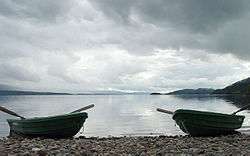
Snåsavatnet (English: Snåsa lake) is Norway's sixth-largest lake. The 120-square-kilometre (46 sq mi) lake Snåsavatnet is located in the municipalities of Steinkjer and Snåsa in Trøndelag county, Norway. The villages of Følling and Sunnan lie at the southwestern end of the lake and the village of Snåsa lies at the northeastern end of the lake. The European route E6 highway runs along the northern shore of the lake and the Nordlandsbanen railway line runs along the southern shore.
The lake is approximately 40 kilometres (25 mi) long and on average about 3 kilometres (1.9 mi) wide. The surface of the lake is only 24 metres (79 ft) above sea level, and it reaches depths of up to 186 metres (610 ft). The lake was created by glacial erosion. As is seen on a map, the lake looks like an extension of the Trondheimsfjord. The outlet is the river Byaelva, which empties into the Beitstadfjorden (an arm of the Trondheimsfjord) in the city of Steinkjer.[1]
See also
References
- ↑ Rosvold, Knut A., ed. (2018-02-06). "Snåsavatnet". Store norske leksikon (in Norwegian). Kunnskapsforlaget. Retrieved 2018-04-07.