Balvatnet
| Balvatnet Bállávvre | |
|---|---|
 | |
| Location | Saltdal, Nordland |
| Coordinates | 66°56′38″N 15°54′02″E / 66.94389°N 15.90056°E / 66.94389; 15.90056Coordinates: 66°56′38″N 15°54′02″E / 66.94389°N 15.90056°E / 66.94389; 15.90056 |
| Basin countries | Norway |
| Max. length | 11 kilometres (6.8 mi) |
| Max. width | 9 kilometres (5.6 mi) |
| Surface area | 41.46 km2 (16.01 sq mi) |
| Shore length1 | 54.32 kilometres (33.75 mi) |
| Surface elevation | 597 metres (1,959 ft) |
| References | NVE |
| 1 Shore length is not a well-defined measure. | |
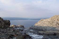
Balvatnet (Lule Sami: Bállávrre) is a lake that lies in the municipality of Saltdal in Nordland county, Norway. The 41.46-square-kilometre (16.01 sq mi) lake is located on the border of Junkerdal National Park, about 2 kilometres (1.2 mi) west of the border with Sweden. The lake is regulated for hydroelectric power at the Daja Hydroelectric Power Station 16 kilometres (9.9 mi) to the north in Sulitjelma.[1]
See also
References
- ↑ Store norske leksikon. "Balvatnet" (in Norwegian). Retrieved 2012-03-27.
This article is issued from
Wikipedia.
The text is licensed under Creative Commons - Attribution - Sharealike.
Additional terms may apply for the media files.