Rosskreppfjorden
| Rosskreppfjorden | |
|---|---|
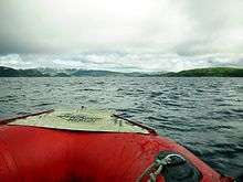
 View of the Rosskreppfjorden | |
 Rosskreppfjorden  Rosskreppfjorden  Rosskreppfjorden | |
| Location |
Valle (Aust-Agder) and Sirdal (Vest-Agder) |
| Coordinates | 59°05′48″N 07°09′54″E / 59.09667°N 7.16500°E |
| Primary inflows | Juvassåna river |
| Primary outflows | Øyarvatnet |
| Catchment area | Kvina river basin |
| Basin countries | Norway |
| Max. length | 11.1 kilometres (6.9 mi) |
| Max. width | 5.6 kilometres (3.5 mi) |
| Surface area | 29.51 km2 (11.39 sq mi) |
| Shore length1 | 70.39 kilometres (43.74 mi) |
| Surface elevation | 890 to 929 metres (2,920 to 3,048 ft) |
| Islands | Åneshaugane, Botnshaug |
| References | NVE |
| 1 Shore length is not a well-defined measure. | |
Rosskreppfjorden is a lake in Norway. The 29.51-square-kilometre (11.39 sq mi) lake lies on the border between the municipalities of Valle (in Aust-Agder county) and Sirdal (in Vest-Agder county). The lake is part of the Kvina river system and has a hydroelectric power plant in a dam on the south end of the lake. The dam keeps the lake at an elevation of about 929 to 890 metres (3,048 to 2,920 ft) above sea level.
The lake flows south into the Øyarvatnet lake. Rosskreppfjorden is located about 21 kilometres (13 mi) southwest of the village of Valle and about 28 kilometres (17 mi) east of the village of Lysebotn. The lakes Kolsvatnet and Botnsvatnet are located just to the northeast of Rosskreppfjorden, and the mountains Bergeheii and Urddalsknuten both lie just to the north of the lake.[1]
See also
References
- ↑ "Rosskreppfjorden" (in Norwegian). yr.no. Retrieved 2010-05-19.