Fort Huger
|
Fort Huger | |
 | |
  | |
| Location | Approx. 50 yds from jct. of Old Machlesfield Rd. and Macklesfield Ct., near Smithfield, Virginia |
|---|---|
| Coordinates | 37°06′35″N 76°39′34″W / 37.10972°N 76.65944°WCoordinates: 37°06′35″N 76°39′34″W / 37.10972°N 76.65944°W |
| Area | 22 acres (8.9 ha) |
| Built | 1861 |
| NRHP reference # | 08000320[1] |
| VLR # | 046-0037 |
| Significant dates | |
| Added to NRHP | April 16, 2008 |
| Designated VLR | December 5, 2007[2] |
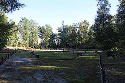
Fort Huger is a historic archaeological site located near Smithfield, Isle of Wight County, Virginia. The site is the location of an abandoned American Civil War fort on the south side of the James River across from Fort Eustis / Mulberry Point. Fort Huger was an integral part of the Confederate States Army James River defenses in late summer 1861 through spring 1862.
It was listed on the National Register of Historic Places in 2008.[1]
Further reading
- Official Records of the Union and Confederate Navies in the War of the Rebellion, Prepared by Edward K. Rawson, Comdr George P. Colvocoresses and Charles W. Stewart, Government Printing Office, Washington, 1901.
- King, Helen Haverty. Historical Notes on Isle of Wight County, Virginia. Donning and Company, Virginia Beach, Virginia. 1993.
- River of Lost Opportunities: The Civil War on the James River, 1861-1862. Ed Bearss, 1995.
References
- 1 2 National Park Service (2010-07-09). "National Register Information System". National Register of Historic Places. National Park Service.
- ↑ "Virginia Landmarks Register". Virginia Department of Historic Resources. Retrieved 5 June 2013.


This article is issued from
Wikipedia.
The text is licensed under Creative Commons - Attribution - Sharealike.
Additional terms may apply for the media files.