List of Farm to Market Roads in Texas (2200–2299)
|
Texas Farm to Market Road and Ranch to Market Road markers | |
| Highway names | |
|---|---|
| Interstates | Interstate Highway X (IH-X, I-X) |
| US Highways | U.S. Highway X (US X) |
| State | State Highway X (SH X) |
| Loops: | Loop X |
| Spurs: | Spur X |
| Farm or Ranch to Market Roads: |
Farm to Market Road X (FM X) Ranch-to-Market Road X (RM X) |
| Park Roads: | Park Road X (PR X) |
| System links | |
Farm to Market Roads in Texas are owned and maintained by the Texas Department of Transportation (TxDOT).
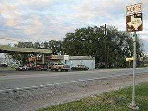
FM 2200
| |
|---|---|
| Location | Medina County |
| Length | 33.418 mi[1][nb 1] (53.781 km) |
| Existed | October 31, 1958[1]–present |
Farm to Market Road 2200 (FM 2200) is located entirely in Medina County.
FM 2200 begins at an intersection with US 90 in D'Hanis. The highway travels in a southern direction along the eastern edge of the town, leaving the city limits near County Road 5223. FM 2200 generally runs in a southern direction through rural farming areas, turning east at County Road 731. The highway has an overlap with FM 462 near Yancey. After leaving Yancey, FM 2200 mostly runs in an eastern direction towards Devine, ending at an intersection with SH 173.
The current FM 2200 was designated on October 31, 1958, running from SH 173 in Devine westward to FM 462 near Yancey at a distance of 14.2 miles (22.9 km). The highway was extended 5.1 miles (8.2 km) northwest of FM 462 on May 2, 1962, creating an overlap with that highway. FM 2200 was extended 11.0 miles (17.7 km) to US 90 on May 6, 1964.
- Junction list
The entire route is in Medina County.
| Location | mi[2] | km | Destinations | Notes | |
|---|---|---|---|---|---|
| D'Hanis | 0.0 | 0.0 | |||
| Yancey | 19.7 | 31.7 | West end of FM 462 overlap | ||
| | 20.3 | 32.7 | East end of FM 462 overlap | ||
| Devine | 34.1 | 54.9 | |||
1.000 mi = 1.609 km; 1.000 km = 0.621 mi
| |||||
FM 2200 (1953)
| |
|---|---|
| Location | Wilson County |
| Existed | October 29, 1953–October 29, 1954 |
The original FM 2200 was designated on October 29, 1953, traveling from SH 123 near Stockdale, southwestward to a road intersection at a distance of 6.5 miles (10.5 km). The highway was cancelled and combined with FM 537 on October 29, 1954.[3]
FM 2201
| |
|---|---|
| Location | Palo Pinto County |
| Length | 6.414 mi[4] (10.322 km) |
| Existed | December 2, 1953[4]–present |
Farm to Market Road 2201 (FM 2201) is located entirely in Palo Pinto County.
FM 2201 begins at an intersection with FM 4 in Santo. The highway travels in a northeast direction before turning in a more eastern direction near the Santo Volunteer Fire Department. FM 2201 continues to travel in a mostly eastern direction through rural farming areas, ending at an intersection with US 281 just north of I-20.
FM 2201 was designated on December 2, 1953 along the current route.
- Junction list
The entire route is in Palo Pinto County.
| Location | mi[4] | km | Destinations | Notes | |
|---|---|---|---|---|---|
| Santo | 0.000 | 0.000 | |||
| | 6.414 | 10.322 | |||
| 1.000 mi = 1.609 km; 1.000 km = 0.621 mi | |||||
FM 2202
| |
|---|---|
| Location | Moore County |
| Length | 5.186 mi[5] (8.346 km) |
| Existed | October 28, 1953[5]–present |
Farm to Market Road 2202 (FM 2202) is located entirely in Moore County in the Panhandle.
FM 2202 begins at an intersection with SH 354. The highway travels in a northern direction, ending at an intersection with FM 722. FM 2202 is rural for its entire length, traveling near several farms and ranches.
FM 2202 was designated on October 28, 1953 along the current route.
- Junction list
The entire route is in Moore County.
| Location | mi[5] | km | Destinations | Notes | |
|---|---|---|---|---|---|
| | 0.000 | 0.000 | |||
| | 5.186 | 8.346 | |||
| 1.000 mi = 1.609 km; 1.000 km = 0.621 mi | |||||
FM 2203
| |
|---|---|
| Location | Moore County |
| Length | 4.069 mi[6] (6.548 km) |
| Existed | 1953[6]–present |
Farm to Market Road 2203 (FM 2203) is located entirely in Moore County in the Panhandle.
FM 2203 begins at an intersection with SH 152 in Dumas. The highway travels in a northern direction along Maddox Avenue through a suburban area of the town. FM 2203 leaves Dumas at an intersection with McClary Lane, with the route becoming more rural. The highway travels in a northern direction through rural farming and ranching areas, ending at an intersection with FM 119 near the North Plains Country Club.
FM 2203 was designated on October 28, 1953 along the current route.
- Junction list
The entire route is in Moore County.
| Location | mi[6] | km | Destinations | Notes | |
|---|---|---|---|---|---|
| Dumas | 0.000 | 0.000 | |||
| | 4.069 | 6.548 | |||
| 1.000 mi = 1.609 km; 1.000 km = 0.621 mi | |||||
FM 2204
| |
|---|---|
| Location | Gregg County |
| Length | 8.636 mi[7] (13.898 km) |
| Existed | October 28, 1953[7]–present |
Farm to Market Road 2204, FM 2204, or Stone Road is a Farm to Market Road in Texas, running from US 259 Bus. in Kilgore east to SH 322 at East Texas Regional Airport. FM 2204 was designated on October 28, 1953 along its current route.
Major intersections
The entire route is in Gregg County.
| Location | mi[8] | km | Destinations | Notes | |
|---|---|---|---|---|---|
| Kilgore | 0.0 | 0.0 | |||
| 2.0 | 3.2 | Interchange | |||
| | 3.4 | 5.5 | |||
| | 7.0 | 11.3 | |||
| | 8.6 | 13.8 | |||
| 1.000 mi = 1.609 km; 1.000 km = 0.621 mi | |||||
FM 2205
| |
|---|---|
| Location | Gregg County |
| Length | 0.613 mi[9] (0.987 km) |
| Existed | October 28, 1953[9]–present |
Farm to Market Road 2205, FM 2205, or Jaycee Road is a Farm to Market Road in Texas, running from Loop 281 east to SH 31 in Longview. FM 2205 was designated on October 28, 1953 along its current route. On June 27, 1995, FM 2205 became an urban road.[10]
Major intersections
The entire route is in Longview, Gregg County.
| mi[9] | km | Destinations | Notes | ||
|---|---|---|---|---|---|
| 0.000 | 0.000 | ||||
| 0.613 | 0.987 | ||||
| 1.000 mi = 1.609 km; 1.000 km = 0.621 mi | |||||
FM 2206
| |
|---|---|
| Location | Gregg County |
| Length | 3.681 mi[11] (5.924 km) |
| Existed | 1953[11]–present |
Farm to Market Road 2206, FM 2206, or Harrison Road is a Farm to Market Road in Texas, running from SH 42 near White Oak east to Loop 281 in Longview.
FM 2206 was designated on October 28, 1953 along its current route. On June 27, 1995, FM 2206 became an urban road.[12]
The entire route is in Gregg County.
| Location | mi[11] | km | Destinations | Notes | |
|---|---|---|---|---|---|
| | 0.000 | 0.000 | |||
| Longview | 3.681 | 5.924 | |||
| 1.000 mi = 1.609 km; 1.000 km = 0.621 mi | |||||
FM 2207
| |
|---|---|
| Location | Gregg County |
| Length | 5.987 mi[13] (9.635 km) |
| Existed | 1953[13]–present |
Farm to Market Road 2207 or FM 2207 is a Farm to Market Road in Texas, running from SH 135 near Kilgore northwest to SH 135 near Liberty City.
FM 2207 was designated on October 28, 1953 from SH 135 south to FM 1252. On October 26, 1954, it was extended south to SH 135.
- Junction list
The entire route is in Gregg County.
| Location | mi[14] | km | Destinations | Notes | |
|---|---|---|---|---|---|
| | 0.0 | 0.0 | |||
| | 1.0 | 1.6 | |||
| | 6.0 | 9.7 | |||
| 1.000 mi = 1.609 km; 1.000 km = 0.621 mi | |||||
FM 2208
| |
|---|---|
| Location | Gregg, Harrison and Marion counties |
| Length | 24.176 mi[15][nb 2] (38.908 km) |
| Existed | 1953[15]–present |
Farm to Market Road 2208 or FM 2208 is a Farm to Market Road in Texas, running from US 80 in Longview northeast to FM 134 near Jefferson.
FM 2208 was designated on October 28, 1953 from US 80 to the Harrison County line. On October 31, 1957, it extended to FM 449. On December 31, 1959, it extended following FM 449 to FM 450 and replaced FM 2256 from FM 450 to FM 134. On October 27, 1963, the section from FM 450 to FM 2657 was transferred to FM 559, along with FM 2657 itself. On June 27, 1995, the section from FM 2879 to US 80 became an urban road.[16]
| County | Location | mi[17] | km | Destinations | Notes |
|---|---|---|---|---|---|
| Gregg | Longview | 0.0 | 0.0 | ||
| 1.0 | 1.6 | ||||
| 2.1 | 3.4 | Interchange; access to Longview Regional Hospital | |||
| Harrison | | 2.9 | 4.7 | ||
| | 8.5 | 13.7 | South end of FM 449 overlap | ||
| | 12.5 | 20.1 | South end of FM 450 overlap | ||
| | 12.6 | 20.3 | North end of FM 449 overlap | ||
| | 17.0 | 27.4 | North end of FM 450 overlap | ||
| | 18.2 | 29.3 | |||
| Marion | | 25.4 | 40.9 | ||
| | 31.4 | 50.5 | U.S. 59 is the future Interstate 369 | ||
| | 32.5 | 52.3 | |||
| 1.000 mi = 1.609 km; 1.000 km = 0.621 mi | |||||
FM 2209
| |
|---|---|
| Location | Willacy County |
| Length | 6.558 mi[18] (10.554 km) |
| Existed | 1953[18]–present |
Farm to Market Road 2209 (FM 2209) is located entirely in Willacy County.
FM 2209 begins at an intersection with County Road 380. The highway travels in an eastern direction, turning south at an unnamed county road. FM 2209 intersects FM 3142, then travels through the town of San Perlita. The highway continues to travel in a southern direction, ending at an intersection with SH 186. FM 2209's route is rural for most of its length, traveling through large, marshy farming areas.
FM 2209 was designated on December 2, 1953, traveling from SH 186 northward to a road intersection at a distance of 1.7 miles (2.7 km). The highway was extended 3.4 miles (5.5 km) to FM 497 on May 2, 1962. FM 2209 was extended 3.6 miles (5.8 km) from FM 497 to a road intersection on May 5, 1966. On May 31, 1973, the highway's routing was changed, with the old route being renumbered FM 3142, while FM 2209 was rerouted replacing a section of SH 186 to FM 497. SH 186 was truncated, but SH 186 was signed but not designated along FM 497. The redesignation of FM 497 to SH 186 became official on August 26, 1990.[19][20]
- Junction list
The entire route is in Willacy County.
| Location | mi[21] | km | Destinations | Notes | |
|---|---|---|---|---|---|
| | 0.0 | 0.0 | County Road 380 | ||
| | 4.9 | 7.9 | |||
| | 6.5 | 10.5 | |||
| 1.000 mi = 1.609 km; 1.000 km = 0.621 mi | |||||
FM 2210
| |
|---|---|
| Location | Jack and Wise counties |
| Length | 29.794 mi[22] (47.949 km) |
| Existed | 1953[22]–present |
Farm to Market Road 2210 (FM 2210) is located in Jack and Wise counties.
FM 2210 begins at an intersection with FM 4 in the Bartons Chapel area. The highway travels in an eastern direction, turning south at Pump Station Road, then turning back east near Heliport Road. FM 2210 continues to run in an eastern direction, intersecting US 281 in Perrin. A few miles east of Perrin, the highway turns north at Lone Star Road, intersects SH 199 southeast of Joplin, then turns back to the east near Willow Point. FM 2210 continues to run in an eastern direction, ending at an intersection with FM 920 in Balsora.
FM 2210 was designated on October 28, 1953, traveling from SH 199 southward to Gibtown at a distance of 3.0 miles (4.8 km). The highway was extended 13.4 miles (21.6 km) to a road intersection northwest of Perrin onSeptember 20, 1961, absorbing all of FM 2350.[23] The highway was extended 6.1 miles (9.8 km) westward to FM 206] (now FM 4) on June 28, 1963. FM 2210 was extended 3.9 miles (6.3 km) northeast of SH 199 to the Wise County line on May 5, 1966. The highway was extended 5.3 miles (8.5 km) to FM 920 at Balsora on May 7, 1970.
- Junction list
| County | Location | mi[24] | km | Destinations | Notes |
|---|---|---|---|---|---|
| Jack | | 0.0 | 0.0 | ||
| Perrin | 11.6 | 18.7 | |||
| | 21.7 | 34.9 | |||
| Wise | Balsora | 29.8 | 48.0 | ||
| 1.000 mi = 1.609 km; 1.000 km = 0.621 mi | |||||
FM 2211
| |
|---|---|
| Location | Stonewall County |
| Length | 14.64 mi[25] (23.56 km) |
| Existed | 1954[25]–present |
FM 2212
| |
|---|---|
| Location | Dawson, Martin and Howard counties |
| Length | 10.464 mi[26] (16.840 km) |
| Existed | 1953[26]–present |
FM 2213
| |
|---|---|
| Location | San Augustine County |
| Length | 4.203 mi[27] (6.764 km) |
| Existed | 1954[27]–present |
FM 2214
| |
|---|---|
| Location | Eastland County |
| Length | 14.674 mi[28] (23.616 km) |
| Existed | 1954[28]–present |
FM 2215
| |
|---|---|
| Location | Henderson County |
| Length | 1.339 mi[29] (2.155 km) |
| Existed | April 25, 1978[29]–present |
Farm to Market Road 2215, or FM 2215, runs about 1.34 miles (2.16 km) from north of Frankston, Texas east, to a county road within the town of Berryville near the west shore of Lake Palestine. It is in the southeast portion of Henderson County.
FM 2215 has no local street names. Rural for the most part, the landscape along the road includes rolling hills of alternating open pastures and trees. The road has 2 lanes and no shoulders for its entire length. FM 2215 serves only Berryville, and is within the town's city limits for its entire length. It connects the small lakeside town to SH 155, which leads to Frankston to the south, and Coffee City, Dogwood City, Noonday, and Tyler to the north. FM 2215 only intersects with local county roads besides that of SH 155, its west terminus.[29][30][31]
The current FM 2215 was commissioned on April 25, 1978, though it is unclear as to when FM 2215 was completed. The road replaced a narrow, bumpy county road that was in existence through most of the 1970s.[29]
- Junction list
The entire route is in Berryville, Henderson County.
| mi[29] | km | Destinations | Notes | ||
|---|---|---|---|---|---|
| 0.000 | 0.000 | Western terminus | |||
| 1.339 | 2.155 | County Road 4117 | Eastern terminus | ||
| 1.000 mi = 1.609 km; 1.000 km = 0.621 mi | |||||
FM 2215 (1954)
| |
|---|---|
| Location | Erath County |
| Existed | January 27, 1954–August 1, 1967 |
FM 2215 was first designated on January 27, 1954, running from FM 8 near Stephenville southeastward to US 67 at a distance of 1.2 miles (1.9 km). This highway was removed from the state highway system on August 1, 1967 in exchange for the new FM 988, a road that intersects US 67 to the west.[32]
FM 2216
| |
|---|---|
| Location | Fannin and Lamar counties |
| Length | 4.661 mi[33] (7.501 km) |
| Existed | May 6, 1964[33]–present |
FM 2216 (1953)
| |
|---|---|
| Location | Hansford County |
| Existed | December 1, 1953–November 21, 1963 |
FM 2217
| |
|---|---|
| Location | Hudspeth County |
| Length | 1.27 mi[34] (2.04 km) |
| Existed | 1954[34]–present |
Farm to Market Road 2217 (FM 2217) is a Farm to Market Road entirely in Hudspeth County in the U.S. state of Texas maintained by the Texas Department of Transportation (TxDOT). It connects I-10 with FM 192.
FM 2217 runs southward from I-10 at exit 81 about 4 miles east of McNary, then eastward before ending at FM 192.[34][35]
On February 25, 1954, FM 2217 was designated from US 80 (present-day I-10) southeastward to FM 192.[34]
The entire route is in Hudspeth County.
| Location | mi[34] | km | Destinations | Notes | |
|---|---|---|---|---|---|
| | 0.0 | 0.0 | Southern terminus | ||
| | 1.3 | 2.1 | Northern terminus | ||
| 1.000 mi = 1.609 km; 1.000 km = 0.621 mi | |||||
FM 2218
| |
|---|---|
| Location | Fort Bend County |
| Length | 5.657 mi[36] (9.104 km) |
| Existed | 1954[36]–present |
Farm to Market Road 2218 (FM 2218) is a state highway in the U.S. state of Texas that stays within Fort Bend County. The highway begins at State Highway 36 (SH 36) in Pleak, heads northeast through Rosenberg and ends at Farm to Market Road 1640 (FM 1640) in Richmond.
FM 2218 begins at a traffic signal on SH 36 in Pleak. There is a filling station on the northeast corner and the Pleak City Hall is nearby. The highway immediately heads northeast. On the outskirts of Pleak, FM 2218 curves north, then it turns north-northeast near the Meadow Bend Park Estates subdivision. Near Lane Airpark, the highway veers northeast again. At a distance 3.8 miles (6.1 km) from its starting point, the highway comes to the Interstate 69 (I-69)/U.S. Route 59 (US 59) overpass. FM 2218 continues northeast from I-69/US 59 through Rosenberg, with traffic lights at Airport Avenue, Avenue N, Reading Road and Town Center Boulevard. This stretch of the highway is also known as B. F. Terry Boulevard. B. F. Terry High School in the Lamar Consolidated Independent School District is situated on the northwest side of FM 2218 between Airport and Avenue N. The highway ends at a traffic signal on FM 1640. There is a Walmart on the south side and a Wharton County Junior College campus on the north side.[37]
FM 2218 was first designated on March 24, 1954, to run from FM 1640 at Richmond to SH 36 at Pleak. Since its original authorization there has been no change to the route.[36]
- Junction list
The entire highway is in Fort Bend County.
| Location | mi[38] | km | Destinations | Notes | |
|---|---|---|---|---|---|
| Pleak | 0.0 | 0.0 | Southern terminus of FM 2218 | ||
| Rosenberg | 3.7– 3.8 | 6.0– 6.1 | I-69/US 59 exit 102 | ||
| Richmond | 5.7 | 9.2 | Northern terminus of FM 2218 | ||
| 1.000 mi = 1.609 km; 1.000 km = 0.621 mi | |||||
 Filling station on FM 2218 near SH 36 in Pleak
 What is now I-69/US 59 overpass on FM 2218 in Rosenberg
 View southwest at FM 1640 and FM 2218 in Richmond
FM 2219
| |
|---|---|
| Location | Randall County |
| Length | 10.294 mi[39] (16.567 km) |
| Existed | 1954[39]–present |
FM 2220
| |
|---|---|
| Location | Hidalgo County |
| Length | 13.851 mi[40] (22.291 km) |
| Existed | 1954[40]–present |
FM 2221
| |
|---|---|
| Location | Hidalgo County |
| Length | 14.646 mi[41] (23.570 km) |
| Existed | 1954[41]–present |
RM 2222
| |
|---|---|
| Location | Travis County |
| Length | 10.844 mi[42] (17.452 km) |
| Existed | 1954[42]–present |
Ranch to Market Road 2222 (RM 2222) is located entirely in Travis County.
FM 2223
| |
|---|---|
| Location | Brazos County |
| Length | 6.586 mi[43] (10.599 km) |
| Existed | October 26, 1954[43]–present |
Farm to Market Road 2223, FM 2223, or Old Cameron Ranch Road, is a Farm to Market Road in Texas, running from FM 974, 3 miles (4.8 km) northeast of Bryan, northwestward to SH OSR, 4 miles (6.4 km) northeast of Benchley.
The current FM 2223 was designated on its current route on October 26, 1954.
- Junction list
The entire route is in Brazos County.
| Location | mi[43] | km | Destinations | Notes | |
|---|---|---|---|---|---|
| | 0.000 | 0.000 | |||
| | 6.586 | 10.599 | |||
| 1.000 mi = 1.609 km; 1.000 km = 0.621 mi | |||||
FM 2223 (May 1954)
| |
|---|---|
| Location | Hood County |
| Existed | May 21, 1954–October 25, 1954 |
The original FM 2223 was designated on May 21, 1954 from FM 201 (now FM 56) southwest to the Paluxy River. Later that year, this route was cancelled, and mileage was transferred to FM 204, which would become part of FM 51 in 1984.[44][45]
FM 2224
| |
|---|---|
| Location | Archer County |
| Length | 5.142 mi[46] (8.275 km) |
| Existed | 1954[46]–present |
FM 2225
| |
|---|---|
| Location | Wood County |
| Length | 8.858 mi[47] (14.256 km) |
| Existed | October 31, 1958–present |
FM 2225 (1954)
| |
|---|---|
| Location | Archer County |
| Existed | September 29, 1954–July 18, 1958 |
FM 2226
| |
|---|---|
| Location | Archer County |
| Length | 1.192 mi[48] (1.918 km) |
| Existed | September 29, 1954[48]–present |
FM 2227
| |
|---|---|
| Location | Ector County |
| Existed | September 29, 1954–September 29, 1992[49] |
Farm to Market Road 2227 (FM 2227) is a former highway that was located in Ector County.
FM 2227 was designated on September 29, 1954, running from US 80 (now BL I-20) in Odessa southward to SH 51 (now US 385) at a distance of 3.7 miles (6.0 km). The highway was cancelled on September 29, 1992, with the mileage being transferred to FM 1882.[50]
FM 2228
| |
|---|---|
| Location | Callahan County |
| Length | 13.864 mi[51] (22.312 km) |
| Existed | 1954[51]–present |
FM 2229
| |
|---|---|
| Location | Haskell and Knox counties |
| Length | 17.303 mi[52] (27.846 km) |
| Existed | 1954[52]–present |
FM 2230
| |
|---|---|
| Location | Howard County |
| Length | 17.658 mi[53] (28.418 km) |
| Existed | 1954[53]–present |
FM 2231
| |
|---|---|
| Location | Stephens County |
| Length | 10.385 mi[54] (16.713 km) |
| Existed | 1954[54]–present |
FM 2232
| |
|---|---|
| Location | Sherman County |
| Length | 4.006 mi[55] (6.447 km) |
| Existed | September 21, 1955[55]–present |
FM 2232 (1954)
| |
|---|---|
| Location | Stephens County |
| Existed | September 29, 1954–November 3, 1954 |
FM 2233
Farm to Market Road 2233 (FM 2233) is a designation that has been used twice. No highway currently uses the FM 2233 designation.
FM 2233 (1954)
| |
|---|---|
| Location | El Paso County |
| Existed | September 29, 1954–December 19, 1959 |
The first FM 2233 was designated on September 29, 1954, running from Loop 16 (now US 62 / US 85) in El Paso, eastward and southeastward to FM 659 near Ysleta at a distance of 8.0 miles (12.9 km). The highway was extended 18.2 miles (29.3 km) southeastward to a road intersection near Fabens on November 29, 1955. FM 2233 was cancelled on December 19, 1959, becoming part of I-10.
FM 2233 (1961)
| |
|---|---|
| Location | Johnson County |
| Existed | September 20, 1961–May 21, 1964 |
The second FM 2233 was designated in 1961, running from SH 174 northwestward to the Tarrant County line at a distance of 2.2 miles (3.5 km). The highway was cancelled in 1964, with the mileage being transferred to FM 731.[56]
RM 2233
| |
|---|---|
| Location | Llano County |
| Length | 5.394 mi[57] (8.681 km) |
| Existed | June 1, 1965[57]–present |
FM 2234
| |
|---|---|
| Location | Brazoria and Fort Bend counties |
| Length | 11.597 mi[58] (18.664 km) |
| Existed | September 29, 1954[58]–present |
Farm to Market Road 2234 (FM 2234) is a farm-to-market road in the U.S. state of Texas.
FM 2234 is an urban and suburban route between Missouri City and Pearland, south-southwest of Houston. Beginning at Alternate Highway 90, the road follows a southerly path through neighborhoods of Missouri City, in Fort Bend County, passing briefly through Stafford. After making an east curve, FM 2234 passes briefly through Houston and then crosses under the Fort Bend Parkway. It then travels into more undeveloped areas, for a distance following a south boundary of Houston. After intersecting with FM 521, FM 2234 enters Brazoria County and ends at State Highway 288 (SH 288) in the Shadow Creek Ranch area of Pearland. The highway is signed north-south until it reaches the FM 521 intersection, from which it is signed as an east-west highway.
FM 2234 was designated from US 59 (now US 90 Alternate) to the Blue Ridge State Prison Farm. On September 21, 1955, it was extended east to FM 521. On April 30, 1987, it was extended east to SH 288. Effective June 27, 1995, FM 2234 was re-designated as Urban Road 2234 (UR 2234),[59] but the highway continues to be signed as a farm-to-market road.
- Junction list
| County | Location | mi[60] | km | Destinations | Notes |
|---|---|---|---|---|---|
| Fort Bend | Missouri City | 0.0 | 0.0 | Interchange | |
| 2.7 | 4.3 | ||||
| Houston | 4.0 | 6.4 | Fort Bend Parkway Toll Road | ||
| Pearland | 8.5 | 13.7 | |||
| Brazoria | 11.6 | 18.7 | Interchange | ||
| 1.000 mi = 1.609 km; 1.000 km = 0.621 mi | |||||
FM 2235
| |
|---|---|
| Location | Calhoun County |
| Length | 7.39 mi[61] (11.89 km) |
| Existed | 1954[61]–present |
FM 2236
| |
|---|---|
| Location | Crosby County |
| Length | 4.897 mi[62] (7.881 km) |
| Existed | September 21, 1955[62]–present |
FM 2236 was designated on September 21, 1955 on its current route.
FM 2236 (1954)
| |
|---|---|
| Location | De Witt County |
| Existed | 1954–1955 |
The original FM 2236 was designated on September 29, 1954, from FM 240 east to US 87 9 miles northwest of Cuero. This was eliminated by 1955.[63]
FM 2237
| |
|---|---|
| Location | Fayette County |
| Length | 13.764 mi[64] (22.151 km) |
| Existed | 1954[64]–present |
FM 2238
| |
|---|---|
| Location | Fayette County |
| Length | 7.245 mi[65] (11.660 km) |
| Existed | 1954[65]–present |
FM 2239
| |
|---|---|
| Location | Lee and Bastrop counties |
| Length | 6.681 mi[66] (10.752 km) |
| Existed | 1954[66]–present |
FM 2240
| |
|---|---|
| Location | Bowie County |
| Length | 1.606 mi[67] (2.585 km) |
| Existed | June 22, 1964[67]–present |
Farm to Market Road 2240 (FM 2240) is located entirely in Bowie County in the city of Texarkana. The highway is known locally as Moores Lane.
FM 2240 begins at an intersection with FM 559. The highway travels in a eastern direction through a suburban area, passing Pleasant Grove Middle School and the First Baptist Church, ending at an intersection with FM 1397. FM 2240 is three lanes for its entire length: one eastbound lane, one westbound, and a center turn-lane.
The current FM 2240 was designated on June 22, 1964 from FM 559 to FM 1397. On June 27, 1995, the entire highway was internally re-designated as Urban Road 2240 by TxDOT.[68]
- Junction list
The entire route is in Texarkana, Bowie County.
| mi[67] | km | Destinations | Notes | ||
|---|---|---|---|---|---|
| 0.000 | 0.000 | ||||
| 1.606 | 2.585 | ||||
| 1.000 mi = 1.609 km; 1.000 km = 0.621 mi | |||||
FM 2240 (1954)
| |
|---|---|
| Location | Caldwell County |
| Existed | September 29, 1954–May 15, 1964 |
The original FM 2240 was designated on September 29, 1954, running from FM 20 near Lockhart, southeastward to FM 86 near Brownsboro at a distance of 9.7 miles (15.6 km). This highway was cancelled in 1964, with the mileage being transferred to FM 1322.[69]
RM 2241
| |
|---|---|
| Location | Llano County |
| Length | 16.417 mi[70] (26.421 km) |
| Existed | 1954[70]–present |
RM 2242
| |
|---|---|
| Location | Mason County |
| Length | 1.449 mi[71] (2.332 km) |
| Existed | 1954[71]–present |
FM 2243
| |
|---|---|
| Location | Williamson County |
| Existed | September 29, 1954–May 5, 1966 |
Farm to Market Road 2243 (FM 2243) was first designated on September 29, 1954, connecting US 183 in Leander to US 81 (later replaced by IH 35 Business) in Georgetown. A westward extension of about 4.4 mi (7.1 km), from US 183 to Travis County, was added on May 5, 1966; that same year, the route was reinventoried by TxDOT as an RM.
RM 2243
| |
|---|---|
| Location | Williamson County |
| Length | 11.286 mi[72] (18.163 km) |
| Existed | May 5, 1966[72]–present |
Ranch to Market Road 2243 (RM 2243) is a 11.286 mi (18.163 km) ranch to market road in Williamson County, Texas.[72]
RM 2243 begins in Leander, at an intersection with US 183.[73] It travels to the east along South Street, crossing the current 183A Toll Road along its current non-controlled-access northern stub. RM 2243 then crosses the Ronald Reagan Boulevard arterial, which provides access to FM 734 and RM 1431 in Cedar Park to the south and to SH 29 to the north. Farther east, the route enters Georgetown, where it is known as Leander Drive, and has a junction with IH 35 at its Exit #260. The RM 2243 designation ends at South Austin Avenue (the former IH 35 Business, now designated Spur 26).[74] The roadway continues as FM 1460.[72][75]
RM 2243 was designated on May 5, 1966 when FM 2243 was re-designated. The segment west of US 183 was removed from the state highway system and returned to the city of Leander's jurisdiction on April 24, 2003.
- Junction list
The entire route is in Williamson County.
| Location | mi[76] | km | Destinations | Notes | |
|---|---|---|---|---|---|
| Leander | 0.0 | 0.0 | Western terminus | ||
| 1.0 | 1.6 | ||||
| 2.8 | 4.5 | Ronald Reagan Boulevard | |||
| Georgetown | 10.6 | 17.1 | I-35 exit 260 | ||
| 11.3 | 18.2 | Eastern terminus; road continues as | |||
| 1.000 mi = 1.609 km; 1.000 km = 0.621 mi | |||||
RM 2244
| |
|---|---|
| Location | Travis County |
| Length | 11.26 mi[77] (18.12 km) |
| Existed | 1954[77]–present |
Ranch to Market Road 2244 (RM 2244) is located entirely in Travis County.
FM 2245
| |
|---|---|
| Location | Jasper County |
| Length | 3.655 mi[78] (5.882 km) |
| Existed | 1954[78]–present |
FM 2246
| |
|---|---|
| Location | Jasper County |
| Length | 9.241 mi[79] (14.872 km) |
| Existed | 1954[79]–present |
FM 2247
| |
|---|---|
| Location | Comanche County |
| Length | 15.061 mi[80] (24.238 km) |
| Existed | 1954[80]–present |
FM 2248
| |
|---|---|
| Location | Mills County |
| Existed | September 29, 1954–September 2, 1955 |
Farm to Market Road 2248 (FM 2248) is a former highway that was located in Mills County.
FM 2248 was designated on September 29, 1954, running from FM 575 northeastward to a road intersection at a distance of 5.1 miles (8.2 km). The highway was cancelled on September 2, 1955, with the mileage being transferred to FM 2005.[81]
RM 2248
| |
|---|---|
| Location | Lipscomb County |
| Length | 3.574 mi[82] (5.752 km) |
| Existed | October 31, 1958[82]–present |
FM 2249
| |
|---|---|
| Location | Hudspeth County |
| Length | 5.121 mi[83] (8.241 km) |
| Existed | September 29, 1954[83]–present |
Farm to Market Road 2249 (FM 2249) is a Farm to Market Road entirely in Hudspeth County near Dell City in the U.S. state of Texas The road is maintained by the Texas Department of Transportation (TxDOT).
FM 2249 runs from 2.0 miles west of Dell City, eastward through Dell City, before ending at FM 1576.[83][84]
On September 29, 1954, FM 2249 was designated from Dell City 4.0 miles eastward and 2.0 miles northward. On December 17 of that year, FM 2249 was changed so that it went 3.0 miles eastward and 3.0 miles northward. On July 28, 1955, FM 2249 extended west 2 miles. On September 18, 1957, the north-south portion was transferred to FM 1576.[85]
- Junction list
The entire route is in Hudspeth County.
| Location | mi[86] | km | Destinations | Notes | |
|---|---|---|---|---|---|
| | 0.0 | 0.0 | CR 2009 / CR 2030 | Western terminus | |
| Dell City | 2.0 | 3.2 | |||
| | 5.1 | 8.2 | Eastern terminus | ||
| 1.000 mi = 1.609 km; 1.000 km = 0.621 mi | |||||
FM 2250
| |
|---|---|
| Location | Armstrong County |
| Length | 5.173 mi[87] (8.325 km) |
| Existed | 1954[87]–present |
FM 2251
| |
|---|---|
| Location | Angelina County |
| Length | 5.431 mi[88] (8.740 km) |
| Existed | 1954[88]–present |
FM 2252
| |
|---|---|
| Location | Bexar and Comal counties |
| Length | 14.254 mi[89] (22.940 km) |
| Existed | 1954[89]–present |
Farm to Market Road 2252 (FM 2252) is a 14.254 mi (22.940 km) farm to market road in Greater San Antonio, Texas.[89]
FM 2252 begins at a junction with Interstate 410 in San Antonio, and travels north along Perrin-Beitel Road. It crosses the controlled-access portion of Wurzbach Parkway, and turns to the northeast, where the route becomes Nacogdoches Road. FM 2252 intersects Loop 1604 before entering Comal County and the community of Bracken. The route continues to the northeast, intersecting FM 3009 in Garden Ridge, before making a dogleg turn to the southeast. FM 2252 ends at an intersection with FM 482, which provides access to Interstate 35 in Schertz.[89][90]
FM 2252 was designated on October 13, 1954, with a northern terminus at the Comal County line. It was extended to its current length on September 5, 1973, through Comal County to and along FM 1337 which started at Bracken, with a spur route into Bracken.[91] The spur route was removed on March 31, 1976.[89] On June 27, 1995, the portion between IH 410 and FM 3009 was officially changed to Urban Road 2252 (UR 2252); however, as with other urban roads, TxDOT continues to sign the route with the farm-to-market route marker.[92]
- Junction list
| County | Location | mi[93] | km | Destinations | Notes |
|---|---|---|---|---|---|
| Bexar | San Antonio | 0.0 | 0.0 | Southern terminus; continues as Perrin-Beitel Road | |
| 1.4 | 2.3 | Wurzbach Parkway | |||
| 6.9 | 11.1 | ||||
| Comal | Garden Ridge | 11.4 | 18.3 | ||
| Schertz | 14.3 | 23.0 | Northern terminus | ||
| 1.000 mi = 1.609 km; 1.000 km = 0.621 mi | |||||
FM 2253
| |
|---|---|
| Location | Bowie County |
| Length | 6.328 mi[94] (10.184 km) |
| Existed | October 13, 1954[94]–present |
Farm to Market Road 2253 (FM 2253) is located entirely in Bowie County.
FM 2253 begins at an intersection with US 82 in eastern Leary. The highway travels in a generally northern direction, intersecting I-30 and FM 2148 before leaving the town. North of Leary, FM 2253 travels through rural areas with playa lakes and farms, ending at an intersection with FM 559 northeast of Wamba.
FM 2253 was designated on October 13, 1954, traveling from FM 2148 northward to FM 559 at a distance of 4.8 miles (7.7 km). On May 26, 1966, the highway was extended 1.7 miles (2.7 km) southward to US 82 over part of FM 2148.[95]
- Junction list
The entire route is in Bowie County.
| Location | mi[96] | km | Destinations | Notes | |
|---|---|---|---|---|---|
| Leary | 0.0 | 0.0 | |||
| 0.3 | 0.48 | I-30 exit 213 | |||
| 1.7 | 2.7 | ||||
| | 6.3 | 10.1 | |||
| 1.000 mi = 1.609 km; 1.000 km = 0.621 mi | |||||
FM 2254
| |
|---|---|
| Location | Camp County |
| Length | 6.362 mi[97] (10.239 km) |
| Existed | 1954[97]–present |
FM 2255
| |
|---|---|
| Location | Lubbock County |
| Length | 8.696 mi[98] (13.995 km) |
| Existed | 1955[98]–present |
Farm to Market Road 2255 (FM 2255) is a farm to market road located in Lubbock, Texas. The entire highway is internally designated as Urban Road 2255 (UR 2255) by TxDOT.
FM 2255 begins at an intersection with Spur 309 in Lubbock near Reese Center. The highway runs east, meeting FM 179 (Inler Avenue) at a stop sign-controlled intersection. Between Inler Avenue and Milwaukee Avenue, FM 2255 runs in a rural area of northern Lubbock. East of Milwaukee Avenue, the highway sees much more development along its route, including commercial developments and numerous subdivisions. From Quaker Avenue to US 82 (Marsha Sharp Freeway), FM 2255 runs through the northern half of Texas Tech University and passes by University Medical Center. The highway ends at an interchange with the Marsha Sharp Freeway.
The entire highway is known locally in Lubbock as 4th Street.
FM 2255 was designated on September 21, 1955 from War Highway 5 (now Spur 309) east to west Lubbock City Limits. On March 29, 1956, FM 2255 extended east to US 82. On June 27, 1995, FM 2255 changed to an urban road.[99] There have been no changes since.
- Junction list
The entire route is in Lubbock, Lubbock County.
| mi[100] | km | Destinations | Notes | ||
|---|---|---|---|---|---|
| 0.0 | 0.0 | ||||
| 1.0 | 1.6 | ||||
| 4.9 | 7.9 | ||||
| 5.5 | 8.9 | Interchange | |||
| 8.7 | 14.0 | Interchange; eastbound exit and westbound entrance | |||
| 1.000 mi = 1.609 km; 1.000 km = 0.621 mi | |||||
FM 2256
| |
|---|---|
| Location | Palo Pinto County |
| Length | 5.109 mi[101] (8.222 km) |
| Existed | September 20, 1961[101]–present |
FM 2256 (1954)
| |
|---|---|
| Location | Harrison and Marion counties |
| Existed | October 13, 1954–December 31, 1959 |
FM 2257
| |
|---|---|
| Location | Parker and Tarrant counties |
| Length | 7.579 mi[102] (12.197 km) |
| Existed | September 20, 1961[102]–present |
FM 2257 (1954)
| |
|---|---|
| Location | San Jacinto County |
| Existed | October 13, 1954–November 28, 1958 |
FM 2258
| |
|---|---|
| Location | Johnson and Ellis counties |
| Length | 9.351 mi[103] (15.049 km) |
| Existed | 1954[103]–present |
FM 2259
| |
|---|---|
| Location | Nacogdoches County |
| Length | 9.723 mi[104] (15.648 km) |
| Existed | 1954[104]–present |
FM 2260
| |
|---|---|
| Location | Panola County |
| Length | 1.71 mi[105] (2.75 km) |
| Existed | 1954[105]–present |
FM 2261
| |
|---|---|
| Location | Shelby County |
| Length | 9.013 mi[106] (14.505 km) |
| Existed | 1954[106]–present |
FM 2262
| |
|---|---|
| Location | Trinity County |
| Length | 20.75 mi[107] (33.39 km) |
| Existed | 1954[107]–present |
FM 2263
| |
|---|---|
| Location | Upshur County |
| Length | 6.225 mi[108] (10.018 km) |
| Existed | 1954[108]–present |
FM 2264
| |
|---|---|
| Location | Wise County |
| Length | 13.347 mi[109] (21.480 km) |
| Existed | 1954[109]–present |
FM 2265
| |
|---|---|
| Location | Wise County |
| Length | 8.928 mi[110] (14.368 km) |
| Existed | September 20, 1961[110]–present |
FM 2265 was designated on September 20, 1961, from SH 114 east to FM 1655. On June 1, 1965, FM 2265 extended west to FM 2127.
FM 2265 (1954)
| |
|---|---|
| Location | Hill County |
| Existed | October 26, 1954–1955 |
The first use of FM 2265 was designated on October 26, 1954, from FM 66 at Itasca to US 77 10 miles northeast of Hillsboro. This was cancelled by 1955 and removed from the designated highway system.
FM 2265 (1955)
| |
|---|---|
| Location | Floyd County |
| Existed | September 21, 1955–March 24, 1958 |
The second use of FM 2265 was designated on September 21, 1955, from US 70 2.3 moles west of the Floyd-Motley county line northward 5.3 miles to a road intersection. FM 2265 was cancelled on March 21, 1957 and mileage was transferred to FM 28.
FM 2265 (1958)
| |
|---|---|
| Location | Palo Pinto County |
| Existed | October 31, 1958–December 15, 1959 |
The third use of FM 2265 was designated on October 31, 1958, from FM 4 northeastward 4.2 miles to west of Brazos. This was cancelled on December 15, 1959 and mileage was transferred to FM 129.
FM 2266
| |
|---|---|
| Location | Hemphill County |
| Length | 10.76 mi[111] (17.32 km) |
| Existed | 1954[111]–present |
FM 2267
| |
|---|---|
| Location | Anderson County |
| Length | 5.32 mi[112] (8.56 km) |
| Existed | 1954[112]–present |
FM 2268
| |
|---|---|
| Location | Bell and Milam counties |
| Length | 20.102 mi[113] (32.351 km) |
| Existed | 1954[113]–present |
FM 2269
| |
|---|---|
| Location | Milam County |
| Length | 9.996 mi[114] (16.087 km) |
| Existed | 1954[114]–present |
FM 2270
| |
|---|---|
| Location | Palo Pinto County |
| Length | 0.518 mi[115] (0.834 km) |
| Existed | September 20, 1961[115]–present |
FM 2270 (1954)
| |
|---|---|
| Location | Bell and Milam counties |
| Existed | October 26, 1954–December 31, 1959 |
FM 2271
| |
|---|---|
| Location | Bell County |
| Length | 2.001 mi[116] (3.220 km) |
| Existed | 1954[116]–present |
FM 2272
| |
|---|---|
| Location | Armstrong County |
| Length | 6.077 mi[117] (9.780 km) |
| Existed | 1954[117]–present |
FM 2273
| |
|---|---|
| Location | Brown County |
| Length | 7.898 mi[118] (12.711 km) |
| Existed | 1954[118]–present |
Farm to Market Road 2273 or FM 2273 is a farm-to-market road in Texas that serves Brown County. The road begins at US 183 south of May, and continues west until it reaches FM 2559 northeast of Grosvenor, where it subsequently changes numbers.
FM 2273 was designated on October 26, 1954 along its current route.
FM 2274
| |
|---|---|
| Location | Cherokee County |
| Length | 12.241 mi[119][nb 3] (19.700 km) |
| Existed | 1954[119]–present |
Farm to Market Road 2274, or FM 2274, in the eastern part of Texas (USA), runs about 12.24 miles (19.70 km) from an intersection with TX 204 in Ponta north past two multiplex intersections, then onward to an intersection with FM 856 south of the community of Concord. The road is located in east-northeast Cherokee County.
FM 2274 has no local street names. Mostly rural for all of its length, FM 2274 passes by a landscape of rolling hills of trees and farmland. All of FM 2274 has 2 lanes and no shoulders.
The original commissioning for FM 2274 by Minute Order came on October 26, 1954. The road in that Order spanned 8.3 miles (13.4 km) between TX 204 and US 79. Another Minute Order was added on May 6, 1964, this added 4.1 miles (6.6 km) more to the road. This extra mileage was along a route north of US 79, to an intersection with FM 856 near Concord. The road serves just the town of Ponta. The southern terminus intersection connects to TX 204 which goes east to near Nacogdoches and west to Jacksonville and Tyler; while the northern terminus intersection connects to FM 856 which goes north to Concord and south to near New Summerfield. Besides intersections at various county roads, FM 2274 has a brief multiplex with FM 235, an intersection with FM 3288, a brief multiplex with US 79, and its termini at TX 204 and at FM 856.
The entire route is in Cherokee County.
| Location | mi[120] | km | Destinations | Notes | |
|---|---|---|---|---|---|
| Ponta | 0.0 | 0.0 | Southern terminus | ||
| | 4.1 | 6.6 | South end of FM 235 overlap | ||
| | 4.5 | 7.2 | North end of FM 235 overlap | ||
| | 6.7 | 10.8 | |||
| | 8.4 | 13.5 | South end of US 79 overlap | ||
| | 8.8 | 14.2 | North end of US 79 overlap | ||
| | 12.9 | 20.8 | Northern terminus | ||
1.000 mi = 1.609 km; 1.000 km = 0.621 mi
| |||||
FM 2275
| |
|---|---|
| Location | Gregg County |
| Length | 8.186 mi[121] (13.174 km) |
| Existed | 1954[121]–present |
Farm to Market Road 2275 or FM 2275 is a Farm to Market Road in Texas, running from US 271 in Gladewater east to US 259 in Longview. It is known as Vesta Avenue in Gladewater, and as George Richey Road elsewhere along its route.
FM 2275 was designated on October 26, 1954 from US 271 east to SH 300 (then FM 1403). The entire highway was internally re-deisngated as Urban Road 2275 on June 27, 1995.[122] On February 24, 2011 TXDOT announced that FM 2275 will be extended 4.4 miles to US 259.[123]
- Junction list
The entire route is in Gregg County.
| Location | mi[124] | km | Destinations | Notes | |
|---|---|---|---|---|---|
| Gladewater | 0.0 | 0.0 | |||
| White Oak | 4.5 | 7.2 | |||
| Longview | 6.3 | 10.1 | |||
| 8.2 | 13.2 | ||||
| 10.0 | 16.1 | ||||
| | 11.3 | 18.2 | |||
| | 12.4 | 20.0 | |||
| 1.000 mi = 1.609 km; 1.000 km = 0.621 mi | |||||
FM 2276
| |
|---|---|
| Location | Gregg and Rusk counties |
| Length | 18.223 mi[125] (29.327 km) |
| Existed | 1954[125]–present |
Farm to Market Road 2276 or FM 2276 is a Farm to Market Road in Texas, running from SH 323 near Henderson north to FM 2087 near Kilgore.
FM 2276 was designated on October 26, 1954 from FM 2087 to SH 322. On March 29, 1957, FM 2276 was rerouted to end at US 259. On May 6, 1964, FM 2276 extended to SH 323.
- Junction list
| County | Location | mi[126] | km | Destinations | Notes |
|---|---|---|---|---|---|
| Rusk | | 0.0 | 0.0 | ||
| | 0.6 | 0.97 | |||
| | 2.8 | 4.5 | |||
| | 7.7 | 12.4 | |||
| | 12.5 | 20.1 | |||
| Gregg | | 15.6 | 25.1 | ||
| | 17.0 | 27.4 | |||
| | 18.2 | 29.3 | |||
| 1.000 mi = 1.609 km; 1.000 km = 0.621 mi | |||||
FM 2277
| |
|---|---|
| Location | Hutchinson County |
| Existed | October 26, 1954–September 21, 1955 |
RM 2277
| |
|---|---|
| Location | Hutchinson County |
| Length | 7.586 mi[127] (12.208 km) |
| Existed | September 21, 1955[127]–present |
FM 2278
| |
|---|---|
| Location | Cottle County |
| Length | 8.776 mi[128] (14.124 km) |
| Existed | 1954[128]–present |
FM 2279
| |
|---|---|
| Location | Knox and Haskell counties |
| Length | 15.467 mi[129] (24.892 km) |
| Existed | 1954[129]–present |
FM 2280
| |
|---|---|
| Location | Johnson County |
| Length | 5.813 mi[130] (9.355 km) |
| Existed | October 31, 1958[130]–present |
FM 2280 (1954)
| |
|---|---|
| Location | Coryell County |
| Existed | October 26, 1954–March 21, 1958 |
FM 2281
| |
|---|---|
| Location | Denton County |
| Length | 2.153 mi[131] (3.465 km) |
| Existed | 1954[131]–present |
Farm to Market Road 2281 (FM 2281) is a short 5.1 mile Farm to Market Road located in southeastern Denton County, Texas. The highway begins at Hebron Parkway in Carrollton and runs north to the Sam Rayburn Tollway in Lewisville. FM 2281 is known locally as Old Denton Road.
In 1995, TxDOT internally designated FM 2281 as Urban Road 2281.[132]
FM 2281 begins in Carrollton at an intersection with Hebron Parkway. The highway runs through a heavily developed area of the city. FM 2281 enters Lewisville and intersects with FM 544 before ending at the Sam Rayburn Tollway.
Many housing developments line the highway for most of its length.
FM 2281 was designated on October 26, 1954, from FM 544 south to the Denton-Dallas county line. On July 28, 1994, FM 2281 extended north to SH 121. On November 16, 2000, the section south of Hebron Parkway was given to the city of Carrollton.
- Junction list
The entire route is in Denton County.
| Location | mi[133] | km | Destinations | Notes | |
|---|---|---|---|---|---|
| Carrollton | 0.0 | 0.0 | Hebron Parkway | Continues south as Old Denton Road | |
| Lewisville | 1.8 | 2.9 | |||
| 2.2 | 3.5 | ||||
| 1.000 mi = 1.609 km; 1.000 km = 0.621 mi | |||||
FM 2282
| |
|---|---|
| Location | Lynn and Garza counties |
| Length | 7.172 mi[134] (11.542 km) |
| Existed | 1954[134]–present |
FM 2283
| |
|---|---|
| Location | Red River County |
| Length | 2.163 mi[135] (3.481 km) |
| Existed | 1954[135]–present |
FM 2284
| |
|---|---|
| Location | Hale County |
| Length | 8.101 mi[136] (13.037 km) |
| Existed | 1954[136]–present |
FM 2285
| |
|---|---|
| Location | Hopkins County |
| Length | 9.925 mi[137] (15.973 km) |
| Existed | 1954[137]–present |
FM 2286
| |
|---|---|
| Location | Hale and Floyd counties |
| Length | 26.345 mi[138] (42.398 km) |
| Existed | 1954[138]–present |
FM 2287
| |
|---|---|
| Location | Callahan County |
| Length | 14.769 mi[139] (23.768 km) |
| Existed | June 2, 1967[139]–present |
FM 2287 (1954)
| |
|---|---|
| Location | Jim Wells and Live Oak counties |
| Existed | October 26, 1954–May 18, 1966 |
FM 2288
| |
|---|---|
| Location | Tom Green County |
| Length | 11.411 mi[140] (18.364 km) |
| Existed | 1954[140]–present |
Farm to Market Road 2288 (FM 2288) is located entirely in Tom Green County.
FM 2288 begins at an intersection with US 67 in western San Angelo near a major retail center. The highway travels in a north/northwest direction near a large subdivision then leaves the city near an intersection with RM 853. After leaving San Angelo, FM 2288 curves and bends around San Angelo State Park and the southern and western shores of O.C. Fisher Reservoir. The highway crosses over the North Concho River and enters the town of Grape Creek, ending at a junction with US 87.
FM 2288 was designated on October 26, 1954, traveling from US 87 southward to FM 853 at a distance of 10.2 miles (16.4 km). The highway was extended 1.5 miles (2.4 km) south of FM 853 to US 67 on October 31, 1957. In 1995, the section of FM 2288 between US 67 and RM 853 was internally re-designated as Urban Road 2288 by TxDOT on June 27, 1995.[141]
- Junction list
The entire route is in Tom Green County.
| Location | mi[142] | km | Destinations | Notes | |
|---|---|---|---|---|---|
| San Angelo | 0.0 | 0.0 | |||
| 1.6 | 2.6 | ||||
| Grape Creek | 11.4 | 18.3 | Interchange | ||
| 1.000 mi = 1.609 km; 1.000 km = 0.621 mi | |||||
FM 2289
| |
|---|---|
| Location | Madison County |
| Length | 10.446 mi[143] (16.811 km) |
| Existed | 1954[143]–present |
FM 2290
| |
|---|---|
| Location | Parmer County |
| Length | 8.882 mi[144] (14.294 km) |
| Existed | 1954[144]–present |
FM 2291
| |
|---|---|
| Location | Menard County |
| Existed | October 26, 1954–October 31, 1957 |
RM 2291
| |
|---|---|
| Location | Menard and Kimble counties |
| Length | 30.949 mi[145] (49.808 km) |
| Existed | October 31, 1957[145]–present |
FM 2292
| |
|---|---|
| Location | Nueces County |
| Length | 7.592 mi[146] (12.218 km) |
| Existed | October 26, 1954[146]–present |
FM 2293
| |
|---|---|
| Location | Robertson County |
| Length | 11.788 mi[147] (18.971 km) |
| Existed | October 26, 1954[147]–present |
FM 2294
| |
|---|---|
| Location | Starr County |
| Length | 16.668 mi[148] (26.825 km) |
| Existed | October 26, 1954[148]–present |
FM 2295
| |
|---|---|
| Location | Duval and Jim Wells counties |
| Length | 34.485 mi[149] (55.498 km) |
| Existed | October 26, 1954[149]–present |
FM 2296
| |
|---|---|
| Location | Walker County |
| Length | 7.398 mi[150] (11.906 km) |
| Existed | October 26, 1954[150]–present |
FM 2297
| |
|---|---|
| Location | Hopkins County |
| Length | 7.78 mi[151] (12.52 km) |
| Existed | November 21, 1956[151]–present |
FM 2297 (1954)
| |
|---|---|
| Location | Moore County |
| Existed | October 26, 1954–May 23, 1956 |
FM 2298
| |
|---|---|
| Location | Deaf Smith and Parmer counties |
| Length | 8.017 mi[152] (12.902 km) |
| Existed | September 20, 1961[152]–present |
FM 2298 (1954)
| |
|---|---|
| Location | Moore County |
| Existed | October 26, 1954–May 23, 1956 |
FM 2298 (1956)
| |
|---|---|
| Location | Hunt County |
| Existed | November 21, 1956–March 5, 1959 |
FM 2299
| |
|---|---|
| Location | Wheeler County |
| Length | 4.159 mi[153] (6.693 km) |
| Existed | September 27, 1960[153]–present |
FM 2299 (1954)
| |
|---|---|
| Location | Moore County |
| Existed | October 26, 1954–May 23, 1956 |
FM 2299 (1956)
| |
|---|---|
| Location | Rains County |
| Existed | November 21, 1956–December 31, 1959 |
Notes
- ↑ The certified length given is shorter than the actual mileage, as the Texas Department of Transportation description of FM 2200 considers it to be discontinuous at rather than concurrent with FM 462.
- ↑ The certified length given is shorter than the actual mileage, as the Texas Department of Transportation description of FM 2208 considers it to be discontinuous at rather than concurrent with FM 449.
- ↑ The certified length given is shorter than the actual mileage, as the Texas Department of Transportation description of FM 2274 considers it to be discontinuous at rather than concurrent with US 79.
References
- 1 2 Transportation Planning and Programming Division (n.d.). "Farm to Market Road No. 2200". Highway Designation Files. Texas Department of Transportation. Retrieved June 29, 2018.
- ↑ Google (June 29, 2018). "Route of FM 2200" (Map). Google Maps. Google. Retrieved June 29, 2018.
- ↑ Transportation Planning and Programming Division (n.d.). "Farm to Market Road No. 537". Highway Designation Files. Texas Department of Transportation. Retrieved June 29, 2018.
- 1 2 3 Transportation Planning and Programming Division (n.d.). "Farm to Market Road No. 2201". Highway Designation Files. Texas Department of Transportation. Retrieved June 30, 2018.
- 1 2 3 Transportation Planning and Programming Division (n.d.). "Farm to Market Road No. 2202". Highway Designation Files. Texas Department of Transportation. Retrieved June 30, 2018.
- 1 2 3 Transportation Planning and Programming Division (n.d.). "Farm to Market Road No. 2203". Highway Designation Files. Texas Department of Transportation. Retrieved June 30, 2018.
- 1 2 Transportation Planning and Programming Division (n.d.). "Farm to Market Road No. 2204". Highway Designation Files. Texas Department of Transportation. Retrieved June 28, 2018.
- ↑ Google (June 29, 2018). "Route of FM 2204" (Map). Google Maps. Google. Retrieved June 29, 2018.
- 1 2 3 Transportation Planning and Programming Division (n.d.). "Farm to Market Road No. 2205". Highway Designation Files. Texas Department of Transportation. Retrieved June 28, 2018.
- ↑ Transportation Planning and Programming Division (n.d.). "Urban Road No. 2205". Highway Designation Files. Texas Department of Transportation. Retrieved June 28, 2018.
- 1 2 3 Transportation Planning and Programming Division (n.d.). "Farm to Market Road No. 2206". Highway Designation Files. Texas Department of Transportation. Retrieved June 29, 2018.
- ↑ Transportation Planning and Programming Division (n.d.). "Urban Road No. 2206". Highway Designation Files. Texas Department of Transportation. Retrieved June 29, 2018.
- 1 2 Transportation Planning and Programming Division (n.d.). "Farm to Market Road No. 2207". Highway Designation Files. Texas Department of Transportation. Retrieved June 29, 2018.
- ↑ Google (June 29, 2018). "Route of FM 2207" (Map). Google Maps. Google. Retrieved June 29, 2018.
- 1 2 Transportation Planning and Programming Division (n.d.). "Farm to Market Road No. 2208". Highway Designation Files. Texas Department of Transportation. Retrieved June 30, 2018.
- ↑ Transportation Planning and Programming Division (n.d.). "Urban Road No. 2208". Highway Designation Files. Texas Department of Transportation. Retrieved June 30, 2018.
- ↑ Google (June 30, 2018). "Route of FM 2208" (Map). Google Maps. Google. Retrieved June 30, 2018.
- 1 2 Transportation Planning and Programming Division (n.d.). "Farm to Market Road No. 2209". Highway Designation Files. Texas Department of Transportation. Retrieved June 30, 2018.
- ↑ Transportation Planning and Programming Division (n.d.). "Farm to Market Road No. 497". Highway Designation Files. Texas Department of Transportation. Retrieved June 30, 2018.
- ↑ Transportation Planning and Programming Division (n.d.). "Farm to Market Road No. 3142". Highway Designation Files. Texas Department of Transportation. Retrieved June 30, 2018.
- ↑ Google (June 30, 2018). "Route of FM 2209" (Map). Google Maps. Google. Retrieved June 30, 2018.
- 1 2 Transportation Planning and Programming Division (n.d.). "Farm to Market Road No. 2210". Highway Designation Files. Texas Department of Transportation. Retrieved June 30, 2018.
- ↑ Transportation Planning and Programming Division (n.d.). "Farm to Market Road No. 2350". Highway Designation Files. Texas Department of Transportation. Retrieved June 30, 2018.
- ↑ Google (June 30, 2018). "Route of FM 2210" (Map). Google Maps. Google. Retrieved June 30, 2018.
- 1 2 Transportation Planning and Programming Division (n.d.). "Farm to Market Road No. 2211". Highway Designation Files. Texas Department of Transportation. Retrieved June 30, 2018.
- 1 2 Transportation Planning and Programming Division (n.d.). "Farm to Market Road No. 2212". Highway Designation Files. Texas Department of Transportation. Retrieved June 30, 2018.
- 1 2 Transportation Planning and Programming Division (n.d.). "Farm to Market Road No. 2213". Highway Designation Files. Texas Department of Transportation. Retrieved June 30, 2018.
- 1 2 Transportation Planning and Programming Division (n.d.). "Farm to Market Road No. 2214". Highway Designation Files. Texas Department of Transportation. Retrieved June 30, 2018.
- 1 2 3 4 5 Transportation Planning and Programming Division (n.d.). "Farm to Market Road No. 2215". Highway Designation Files. Texas Department of Transportation. Retrieved June 29, 2018.
- ↑ County Grid Map 553 (PDF) (Map). Texas Department of Transportation. 2010. Retrieved October 25, 2011.
- ↑ Google (October 25, 2011). "overview of Farm to Market Road 2215" (Map). Google Maps. Google. Retrieved October 25, 2011.
- ↑ http://www.dot.state.tx.us/tpp/hwy/FM0500/FM0988.htm. Missing or empty
|title=(help) - 1 2 Transportation Planning and Programming Division (n.d.). "Farm to Market Road No. 2216". Highway Designation Files. Texas Department of Transportation. Retrieved June 30, 2018.
- 1 2 3 4 5 Transportation Planning and Programming Division (n.d.). "Farm to Market Road No. 2217". Highway Designation Files. Texas Department of Transportation. Retrieved June 29, 2018.
- ↑ Transportation Planning and Programming Division (2012). Texas County Mapbook (PDF) (Map) (2012 ed.). 1:120,000. Texas Department of Transportation. p. 76. OCLC 867856197. Retrieved 2011-09-22.
- 1 2 3 Transportation Planning and Programming Division (n.d.). "Farm to Market Road No. 2218". Highway Designation Files. Texas Department of Transportation. Retrieved June 29, 2018.
- ↑ Google (February 18, 2013). "List of Farm to Market Roads in Texas (2200–2299)" (Map). Google Maps. Google. Retrieved February 18, 2013.
- ↑ Google (June 30, 2018). "Route of FM 2218" (Map). Google Maps. Google. Retrieved June 30, 2018.
- 1 2 Transportation Planning and Programming Division (n.d.). "Farm to Market Road No. 2219". Highway Designation Files. Texas Department of Transportation. Retrieved June 30, 2018.
- 1 2 Transportation Planning and Programming Division (n.d.). "Farm to Market Road No. 2220". Highway Designation Files. Texas Department of Transportation. Retrieved June 30, 2018.
- 1 2 Transportation Planning and Programming Division (n.d.). "Farm to Market Road No. 2221". Highway Designation Files. Texas Department of Transportation. Retrieved June 30, 2018.
- 1 2 Transportation Planning and Programming Division (n.d.). "Ranch to Market Road No. 2222". Highway Designation Files. Texas Department of Transportation. Retrieved June 29, 2018.
- 1 2 3 Transportation Planning and Programming Division (n.d.). "Farm to Market Road No. 2223". Highway Designation Files. Texas Department of Transportation. Retrieved June 29, 2018.
- ↑ Transportation Planning and Programming Division (n.d.). "Farm to Market Road No. 204". Highway Designation Files. Texas Department of Transportation. Retrieved June 29, 2018.
- ↑ Transportation Planning and Programming Division (n.d.). "Farm to Market Road No. 51". Highway Designation Files. Texas Department of Transportation. Retrieved June 29, 2018.
- 1 2 Transportation Planning and Programming Division (n.d.). "Farm to Market Road No. 2224". Highway Designation Files. Texas Department of Transportation. Retrieved June 30, 2018.
- ↑ Transportation Planning and Programming Division (n.d.). "Farm to Market Road No. 2225". Highway Designation Files. Texas Department of Transportation. Retrieved June 30, 2018.
- 1 2 Transportation Planning and Programming Division (n.d.). "Farm to Market Road No. 2226". Highway Designation Files. Texas Department of Transportation. Retrieved June 30, 2018.
- ↑ Transportation Planning and Programming Division (n.d.). "Farm to Market Road No. 2227". Highway Designation Files. Texas Department of Transportation. Retrieved June 30, 2018.
- ↑ Transportation Planning and Programming Division (n.d.). "Farm to Market Road No. 1882". Highway Designation Files. Texas Department of Transportation. Retrieved June 30, 2018.
- 1 2 Transportation Planning and Programming Division (n.d.). "Farm to Market Road No. 2228". Highway Designation Files. Texas Department of Transportation. Retrieved June 30, 2018.
- 1 2 Transportation Planning and Programming Division (n.d.). "Farm to Market Road No. 2229". Highway Designation Files. Texas Department of Transportation. Retrieved June 30, 2018.
- 1 2 Transportation Planning and Programming Division (n.d.). "Farm to Market Road No. 2230". Highway Designation Files. Texas Department of Transportation. Retrieved June 30, 2018.
- 1 2 Transportation Planning and Programming Division (n.d.). "Farm to Market Road No. 2231". Highway Designation Files. Texas Department of Transportation. Retrieved June 30, 2018.
- 1 2 Transportation Planning and Programming Division (n.d.). "Farm to Market Road No. 2232". Highway Designation Files. Texas Department of Transportation. Retrieved June 30, 2018.
- ↑ Transportation Planning and Programming Division (n.d.). "Farm to Market Road No. 731". Highway Designation Files. Texas Department of Transportation. Retrieved June 30, 2018.
- 1 2 Transportation Planning and Programming Division (n.d.). "Ranch to Market Road No. 2233". Highway Designation Files. Texas Department of Transportation. Retrieved June 30, 2018.
- 1 2 Transportation Planning and Programming Division (n.d.). "Farm to Market Road No. 2234". Highway Designation Files. Texas Department of Transportation. Retrieved June 23, 2018.
- ↑ Transportation Planning and Programming Division (n.d.). "Urban Road No. 2234". Highway Designation Files. Texas Department of Transportation. Retrieved June 23, 2018.
- ↑ Google (June 30, 2018). "Route of FM 2234" (Map). Google Maps. Google. Retrieved June 30, 2018.
- 1 2 Transportation Planning and Programming Division (n.d.). "Farm to Market Road No. 2235". Highway Designation Files. Texas Department of Transportation. Retrieved June 30, 2018.
- 1 2 Transportation Planning and Programming Division (n.d.). "Farm to Market Road No. 2236". Highway Designation Files. Texas Department of Transportation. Retrieved June 30, 2018.
- ↑ (PDF) https://publicdocs.txdot.gov/minord/MinuteOrderDocLib/003676459.pdf. Missing or empty
|title=(help) - 1 2 Transportation Planning and Programming Division (n.d.). "Farm to Market Road No. 2237". Highway Designation Files. Texas Department of Transportation. Retrieved June 30, 2018.
- 1 2 Transportation Planning and Programming Division (n.d.). "Farm to Market Road No. 2238". Highway Designation Files. Texas Department of Transportation. Retrieved June 30, 2018.
- 1 2 Transportation Planning and Programming Division (n.d.). "Farm to Market Road No. 2239". Highway Designation Files. Texas Department of Transportation. Retrieved June 30, 2018.
- 1 2 3 Transportation Planning and Programming Division (n.d.). "Farm to Market Road No. 2240". Highway Designation Files. Texas Department of Transportation. Retrieved June 29, 2018.
- ↑ Transportation Planning and Programming Division (n.d.). "Farm to Market Road No. 2240". Highway Designation Files. Texas Department of Transportation. Retrieved June 29, 2018.
- ↑ Transportation Planning and Programming Division (n.d.). "Farm to Market Road No. 1322". Highway Designation Files. Texas Department of Transportation. Retrieved June 29, 2018.
- 1 2 Transportation Planning and Programming Division (n.d.). "Ranch to Market Road No. 2241". Highway Designation Files. Texas Department of Transportation. Retrieved June 30, 2018.
- 1 2 Transportation Planning and Programming Division (n.d.). "Ranch to Market Road No. 2242". Highway Designation Files. Texas Department of Transportation. Retrieved June 30, 2018.
- 1 2 3 4 Transportation Planning and Programming Division (n.d.). "Ranch to Market Road No. 2243". Highway Designation Files. Texas Department of Transportation. Retrieved June 30, 2018.
- ↑ Transportation Planning and Programming Division (2012). Texas County Mapbook (PDF) (Map) (2012 ed.). 1:120,000. Texas Department of Transportation. p. 430. OCLC 867856197. Retrieved 2011-01-06.
- ↑ Transportation Planning and Programming Division (n.d.). "State Highway Spur No. 26". Highway Designation Files. Texas Department of Transportation. Retrieved 2011-01-06.
- ↑ Transportation Planning and Programming Division (n.d.). "Farm to Market Road No. 1460". Highway Designation Files. Texas Department of Transportation. Retrieved 2011-01-06.
- ↑ Google (June 30, 2018). "Route of RM 2243" (Map). Google Maps. Google. Retrieved June 30, 2018.
- 1 2 Transportation Planning and Programming Division (n.d.). "Ranch to Market Road No. 2244". Highway Designation Files. Texas Department of Transportation. Retrieved June 30, 2018.
- 1 2 Transportation Planning and Programming Division (n.d.). "Farm to Market Road No. 2245". Highway Designation Files. Texas Department of Transportation. Retrieved June 30, 2018.
- 1 2 Transportation Planning and Programming Division (n.d.). "Farm to Market Road No. 2246". Highway Designation Files. Texas Department of Transportation. Retrieved June 30, 2018.
- 1 2 Transportation Planning and Programming Division (n.d.). "Farm to Market Road No. 2247". Highway Designation Files. Texas Department of Transportation. Retrieved June 30, 2018.
- ↑ Transportation Planning and Programming Division (n.d.). "Farm to Market Road No. 2005". Highway Designation Files. Texas Department of Transportation. Retrieved June 30, 2018.
- 1 2 Transportation Planning and Programming Division (n.d.). "Ranch to Market Road No. 2248". Highway Designation Files. Texas Department of Transportation. Retrieved June 30, 2018.
- 1 2 3 Transportation Planning and Programming Division (n.d.). "Farm to Market Road No. 2249". Highway Designation Files. Texas Department of Transportation. Retrieved June 29, 2018.
- ↑ Transportation Planning and Programming Division (2012). Texas County Mapbook (PDF) (Map) (2012 ed.). 1:120,000. Texas Department of Transportation. p. 78. OCLC 867856197. Retrieved 2011-09-22.
- ↑ Transportation Planning and Programming Division (n.d.). "Farm to Market Road No. 1576". Highway Designation Files. Texas Department of Transportation. Retrieved June 29, 2018.
- ↑ Google (2011-09-22). "Route of FM 2249" (Map). Google Maps. Google. Retrieved 2011-09-22.
- 1 2 Transportation Planning and Programming Division (n.d.). "Farm to Market Road No. 2250". Highway Designation Files. Texas Department of Transportation. Retrieved June 30, 2018.
- 1 2 Transportation Planning and Programming Division (n.d.). "Farm to Market Road No. 2251". Highway Designation Files. Texas Department of Transportation. Retrieved June 30, 2018.
- 1 2 3 4 5 Transportation Planning and Programming Division (n.d.). "Farm to Market Road No. 2252". Highway Designation Files. Texas Department of Transportation. Retrieved June 29, 2018.
- ↑ Transportation Planning and Programming Division (2012). Texas County Mapbook (PDF) (Map) (2012 ed.). 1:120,000. Texas Department of Transportation. p. 404. OCLC 867856197. Retrieved 2011-01-05.
- ↑ Transportation Planning and Programming Division (n.d.). "Farm to Market Road No. 1337". Highway Designation Files. Texas Department of Transportation. Retrieved June 29, 2018.
- ↑ Transportation Planning and Programming Division (n.d.). "Urban Road No. 2252". Highway Designation Files. Texas Department of Transportation. Retrieved June 29, 2018.
- ↑ Google (2011-01-05). "Overview map of Farm to Market Road 2252 Distances Between Interchanges" (Map). Google Maps. Google. Retrieved 2011-01-05.
- 1 2 Transportation Planning and Programming Division (n.d.). "Farm to Market Road No. 2253". Highway Designation Files. Texas Department of Transportation. Retrieved June 30, 2018.
- ↑ Transportation Planning and Programming Division (n.d.). "Farm to Market Road No. 2148". Highway Designation Files. Texas Department of Transportation. Retrieved June 30, 2018.
- ↑ Google (June 30, 2018). "Route of FM 2253" (Map). Google Maps. Google. Retrieved June 30, 2018.
- 1 2 Transportation Planning and Programming Division (n.d.). "Farm to Market Road No. 2254". Highway Designation Files. Texas Department of Transportation. Retrieved June 30, 2018.
- 1 2 Transportation Planning and Programming Division (n.d.). "Farm to Market Road No. 2255". Highway Designation Files. Texas Department of Transportation. Retrieved June 29, 2018.
- ↑ Transportation Planning and Programming Division (n.d.). "Urban Road No. 2255". Highway Designation Files. Texas Department of Transportation. Retrieved June 21, 2017.
- ↑ Google (August 2, 2016). "Map of FM 2255" (Map). Google Maps. Google. Retrieved August 2, 2016.
- 1 2 Transportation Planning and Programming Division (n.d.). "Farm to Market Road No. 2256". Highway Designation Files. Texas Department of Transportation. Retrieved June 30, 2018.
- 1 2 Transportation Planning and Programming Division (n.d.). "Farm to Market Road No. 2257". Highway Designation Files. Texas Department of Transportation. Retrieved June 30, 2018.
- 1 2 Transportation Planning and Programming Division (n.d.). "Farm to Market Road No. 2258". Highway Designation Files. Texas Department of Transportation. Retrieved June 30, 2018.
- 1 2 Transportation Planning and Programming Division (n.d.). "Farm to Market Road No. 2259". Highway Designation Files. Texas Department of Transportation. Retrieved June 30, 2018.
- 1 2 Transportation Planning and Programming Division (n.d.). "Farm to Market Road No. 2260". Highway Designation Files. Texas Department of Transportation. Retrieved July 2, 2018.
- 1 2 Transportation Planning and Programming Division (n.d.). "Farm to Market Road No. 2261". Highway Designation Files. Texas Department of Transportation. Retrieved July 2, 2018.
- 1 2 Transportation Planning and Programming Division (n.d.). "Farm to Market Road No. 2262". Highway Designation Files. Texas Department of Transportation. Retrieved July 2, 2018.
- 1 2 Transportation Planning and Programming Division (n.d.). "Farm to Market Road No. 2263". Highway Designation Files. Texas Department of Transportation. Retrieved July 2, 2018.
- 1 2 Transportation Planning and Programming Division (n.d.). "Farm to Market Road No. 2264". Highway Designation Files. Texas Department of Transportation. Retrieved July 2, 2018.
- 1 2 Transportation Planning and Programming Division (n.d.). "Farm to Market Road No. 2265". Highway Designation Files. Texas Department of Transportation. Retrieved July 2, 2018.
- 1 2 Transportation Planning and Programming Division (n.d.). "Farm to Market Road No. 2266". Highway Designation Files. Texas Department of Transportation. Retrieved July 2, 2018.
- 1 2 Transportation Planning and Programming Division (n.d.). "Farm to Market Road No. 2267". Highway Designation Files. Texas Department of Transportation. Retrieved July 2, 2018.
- 1 2 Transportation Planning and Programming Division (n.d.). "Farm to Market Road No. 2268". Highway Designation Files. Texas Department of Transportation. Retrieved July 2, 2018.
- 1 2 Transportation Planning and Programming Division (n.d.). "Farm to Market Road No. 2269". Highway Designation Files. Texas Department of Transportation. Retrieved July 2, 2018.
- 1 2 Transportation Planning and Programming Division (n.d.). "Farm to Market Road No. 2270". Highway Designation Files. Texas Department of Transportation. Retrieved July 2, 2018.
- 1 2 Transportation Planning and Programming Division (n.d.). "Farm to Market Road No. 2271". Highway Designation Files. Texas Department of Transportation. Retrieved July 2, 2018.
- 1 2 Transportation Planning and Programming Division (n.d.). "Farm to Market Road No. 2272". Highway Designation Files. Texas Department of Transportation. Retrieved July 2, 2018.
- 1 2 Transportation Planning and Programming Division (n.d.). "Farm to Market Road No. 2273". Highway Designation Files. Texas Department of Transportation. Retrieved June 29, 2018.
- 1 2 Transportation Planning and Programming Division (n.d.). "Farm to Market Road No. 2274". Highway Designation Files. Texas Department of Transportation. Retrieved June 29, 2018.
- ↑ Google (June 29, 2018). "Route of FM 2274" (Map). Google Maps. Google. Retrieved June 29, 2018.
- 1 2 Transportation Planning and Programming Division (n.d.). "Farm to Market Road No. 2275". Highway Designation Files. Texas Department of Transportation. Retrieved June 29, 2018.
- ↑ Transportation Planning and Programming Division (n.d.). "Urban Road No. 2275". Highway Designation Files. Texas Department of Transportation. Retrieved June 29, 2018.
- ↑
- ↑ Google (June 30, 2018). "Route of FM 2275" (Map). Google Maps. Google. Retrieved June 30, 2018.
- 1 2 Transportation Planning and Programming Division (n.d.). "Farm to Market Road No. 2276". Highway Designation Files. Texas Department of Transportation. Retrieved June 29, 2018.
- ↑ Google (June 30, 2018). "Route of FM 2276" (Map). Google Maps. Google. Retrieved June 30, 2018.
- 1 2 Transportation Planning and Programming Division (n.d.). "Ranch to Market Road No. 2277". Highway Designation Files. Texas Department of Transportation. Retrieved June 30, 2018.
- 1 2 Transportation Planning and Programming Division (n.d.). "Farm to Market Road No. 2278". Highway Designation Files. Texas Department of Transportation. Retrieved June 30, 2018.
- 1 2 Transportation Planning and Programming Division (n.d.). "Farm to Market Road No. 2279". Highway Designation Files. Texas Department of Transportation. Retrieved June 30, 2018.
- 1 2 Transportation Planning and Programming Division (n.d.). "Farm to Market Road No. 2280". Highway Designation Files. Texas Department of Transportation. Retrieved June 30, 2018.
- 1 2 Transportation Planning and Programming Division (n.d.). "Farm to Market Road No. 2281". Highway Designation Files. Texas Department of Transportation. Retrieved June 30, 2018.
- ↑ Transportation Planning and Programming Division (n.d.). "Urban Road No. 2281". Highway Designation Files. Texas Department of Transportation. Retrieved May 29, 2017.
- ↑ Google (June 30, 2018). "Route of FM 2281" (Map). Google Maps. Google. Retrieved June 30, 2018.
- 1 2 Transportation Planning and Programming Division (n.d.). "Farm to Market Road No. 2282". Highway Designation Files. Texas Department of Transportation. Retrieved July 2, 2018.
- 1 2 Transportation Planning and Programming Division (n.d.). "Farm to Market Road No. 2283". Highway Designation Files. Texas Department of Transportation. Retrieved July 2, 2018.
- 1 2 Transportation Planning and Programming Division (n.d.). "Farm to Market Road No. 2284". Highway Designation Files. Texas Department of Transportation. Retrieved July 2, 2018.
- 1 2 Transportation Planning and Programming Division (n.d.). "Farm to Market Road No. 2285". Highway Designation Files. Texas Department of Transportation. Retrieved July 2, 2018.
- 1 2 Transportation Planning and Programming Division (n.d.). "Farm to Market Road No. 2286". Highway Designation Files. Texas Department of Transportation. Retrieved July 2, 2018.
- 1 2 Transportation Planning and Programming Division (n.d.). "Farm to Market Road No. 2287". Highway Designation Files. Texas Department of Transportation. Retrieved July 2, 2018.
- 1 2 Transportation Planning and Programming Division (n.d.). "Farm to Market Road No. 2288". Highway Designation Files. Texas Department of Transportation. Retrieved July 2, 2018.
- ↑ Transportation Planning and Programming Division (n.d.). "Urban Road No. 2288". Highway Designation Files. Texas Department of Transportation. Retrieved July 2, 2018.
- ↑ Google (July 2, 2018). "Route of FM 2288" (Map). Google Maps. Google. Retrieved July 2, 2018.
- 1 2 Transportation Planning and Programming Division (n.d.). "Farm to Market Road No. 2289". Highway Designation Files. Texas Department of Transportation. Retrieved July 2, 2018.
- 1 2 Transportation Planning and Programming Division (n.d.). "Farm to Market Road No. 2290". Highway Designation Files. Texas Department of Transportation. Retrieved July 2, 2018.
- 1 2 Transportation Planning and Programming Division (n.d.). "Ranch to Market Road No. 2291". Highway Designation Files. Texas Department of Transportation. Retrieved June 30, 2018.
- 1 2 Transportation Planning and Programming Division (n.d.). "Farm to Market Road No. 2292". Highway Designation Files. Texas Department of Transportation. Retrieved June 30, 2018.
- 1 2 Transportation Planning and Programming Division (n.d.). "Farm to Market Road No. 2293". Highway Designation Files. Texas Department of Transportation. Retrieved June 30, 2018.
- 1 2 Transportation Planning and Programming Division (n.d.). "Farm to Market Road No. 2294". Highway Designation Files. Texas Department of Transportation. Retrieved June 30, 2018.
- 1 2 Transportation Planning and Programming Division (n.d.). "Farm to Market Road No. 2295". Highway Designation Files. Texas Department of Transportation. Retrieved June 30, 2018.
- 1 2 Transportation Planning and Programming Division (n.d.). "Farm to Market Road No. 2296". Highway Designation Files. Texas Department of Transportation. Retrieved June 30, 2018.
- 1 2 Transportation Planning and Programming Division (n.d.). "Farm to Market Road No. 2297". Highway Designation Files. Texas Department of Transportation. Retrieved June 30, 2018.
- 1 2 Transportation Planning and Programming Division (n.d.). "Farm to Market Road No. 2298". Highway Designation Files. Texas Department of Transportation. Retrieved June 30, 2018.
- 1 2 Transportation Planning and Programming Division (n.d.). "Farm to Market Road No. 2299". Highway Designation Files. Texas Department of Transportation. Retrieved June 30, 2018.