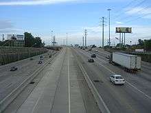
Interstate 69 in Texas
| ||||
|---|---|---|---|---|
.svg.png) | ||||
| Route information | ||||
| Maintained by TxDOT | ||||
| Length | 74.9 mi (120.5 km) | |||
| Existed | December 5, 2011 – present | |||
| Major junctions | ||||
| South end |
| |||
|
| ||||
| North end |
| |||
| Highway system | ||||
| ||||
.svg.png)
Interstate 69 (I-69) in the U.S. state of Texas is an extension of that existing Interstate Highway that will pass through the eastern part of the state and along the Gulf Coast to Victoria, where it will split into multiple segments with I-69E terminating in Brownsville, I-69C terminating in Pharr, and I-69W terminating in Laredo.
The first segment of I-69 in Texas was opened in 2011 near Corpus Christi. The American Association of State Highway and Transportation Officials (AASHTO) approved an additional 53 miles (85 km) of US 77 from Brownsville to Raymondville for designation as I-69, which was to be signed as I-69E upon concurrence from the Federal Highway Administration (FHWA). FHWA approval for this segment was announced on May 29, 2013.[1] By March 2015, a 74.9 mile section of US-59 had been completed and designated as I-69 through the Houston Metropolitan Area.
Route description
The congressionally designated I-69 corridor begins at the Mexican border with 3 auxiliary routes:
- I-69W begins at the entrance to the World Trade International Bridge, which connects to Mexican Federal Highway 85D (Fed. 85D), near the border in Laredo. It is co-signed with both US 59 and Loop 20 (Bob Bullock Loop) and extends 1.4 miles (2.3 km) to I-35 (which connects to Fed. 85 south of the border). It will continue on US 59 east to George West, where it will intersect I-69C, it will then intersect I-37 east of George West, and it will then continue east to Victoria.
- I-69C (with connections to Fed. 97) begins in Pharr at I-2 and is designated for 18 miles (29 km) through Edinburg and co-signed with US 281. It will continue north along US 281 to George West, where it will intersect I-69W and terminate at this point.
- I-69E begins just north of the Veterans International Bridge, which connects to both Fed. 101 and Fed. 180, near the border in Brownsville and continues for 53.3 miles (85.8 km) through Olmito, where it intersects I-169 and through Harlingen, where it intersects I-2 and past Raymondville and co-signed with US 77, it is also co-signed with US 83 from Brownsville to Harlingen. The route will follow the US 77 corridor north to Corpus Christi, where a 7.8-mile (12.6 km) segment is already designated as I-69E and co-signed with US 77 and also intersects I-37, and it will then continue north to Victoria.
I-69W and I-69E will merge just south of Victoria, Texas, where mainline I-69 will follow US 59 northeast to Fort Bend County. In the Houston area, I-69 follows US 59 (Southwest Freeway) from Fort Bend County to the west loop of I-610. I-69 then follows US 59 (Eastex Freeway) from the north loop of I-610 to the Liberty-Montgomery county line. The segment of US 59 inside Loop I-610, through downtown Houston, was approved for designation as I-69 by the FHWA on March 9, 2015 and approved for signage as I-69 by the Texas Transportation Commission on March 25, 2015.[2]
I-69 will follow US 59 to the north, serving Cleveland, Shepherd, Livingston, Lufkin, Nacogdoches, and Tenaha. At Tenaha, I-69 will head into Louisiana along the US 84 corridor. The segment of US 59 from Tenaha to Texarkana will be signed as I-369.
Since the first section of US 77 between Corpus Christi and Robstown was signed as I-69, it implied that the I-69 mainline would follow the coastal (US 77) route from Victoria to Brownsville. This also implied that the branch along US 59 from Victoria to Laredo and the branch along US 281 from George West to Pharr would be signed as either three-digit spurs of I-69 (I-x69) or as separate two-digit Interstate Highways. While federal legislation designating the south Texas branches as I-69 suggested that these routes may be designated as "I-69E" (east, following US 77), "I-69C" (central, following US 281), and "I-69W" (west, following US 59), the American Association of State Highway and Transportation Officials Special Committee on Route Numbering rejected the Texas Department of Transportation's request for these three designations along the proposed I-69 branches, citing that AASHTO policy no longer allows Interstate Highways to be signed as suffixed routes. Stating that the I-69E, I-69C, and I-69W designations for the three I-69 branches south of Victoria were written into federal law, the initial denial of TxDOT's applications were subsequently overturned by the AASHTO Standing Committee on Highways, and the approval for the I-69E, I-69C, and I-69W branch designations were confirmed by the AASHTO Board of Directors, pending concurrence from the Federal Highway Administration during the AASHTO Spring Meeting on May 7, 2013. During this same meeting, the section of US 83 between Harlingen and Penitas was conditionally approved to be designated as I-2, with FHWA concurrence. The US 83 freeway in south Texas was widely anticipated to receive an I-x69 designation instead of I-2. In any case, Texas is proceeding in the same fashion as Indiana, conducting environmental studies for its portion of I-69 in a two-tier process. The mainline route through Texas will be approximately 500 miles (800 km). On June 11, 2008, TxDOT announced they planned to limit further study of I-69 to existing highway corridors (US 59, US 77, US 84, US 281, and SH 44) outside transition zones in the lower Rio Grande Valley, Laredo, Houston, and Texarkana.[3]
Texas originally sought a public-private partnership to construct much of the route through Texas as a privately operated toll road under the failed Trans-Texas Corridor project. However, on June 26, 2008, TxDOT announced that they had approved a proposal by Zachry American and ACS Infrastructure to develop the I-69 corridor in Texas, beginning with upgrades to the US 77 corridor between Brownsville and I-37; the Zachry/ACS plan calls for the majority of the freeway to be toll-free; the only two tolled sections would be bypasses of Riviera and Driscoll.[4]
Original plans for the route included a potential overlap with the "TTC-35" corridor component as well, but the preferred alternative for that component follows I-35 south of San Antonio instead of entering the lower Rio Grande Valley.
History
Since July 2011, Texas has been proceeding with upgrading rural sections of US 59, US 77, and US 281 to interstate standards by replacing intersections with interchanges, and converting two-lane stretches to four lanes by adding a second carriageway to the existing roadway.
A stated goal of TxDOT's I-69 initiative is that "existing suitable freeway sections of the proposed system be designated as I-69 as soon as possible".[5] A bill was introduced and passed by the House of Representatives that allows interstate quality sections of US 59, US 77, and US 281 to be signed as I-69 regardless of whether or not they connected to other Interstate Highways.
Meanwhile, TxDOT has submitted an application to the Federal Highway Administration (FHWA) and the American Association of State Highway and Transportation Officials (AASHTO) to designate 75 miles (121 km) of US 59 in the Houston area and eight miles (13 km) of US 77 near Corpus Christi as I-69, as these sections are already built to Interstate standards and connect to other Interstate Highways. In August 2011, TxDOT received approval from FHWA for a six-mile (9.7 km) segment of US 77 between I-37 and SH 44 near Corpus Christi, and was approved by AASHTO in October 2011.[6] Officials held a ceremony on December 5, 2011, to unveil I-69 signs on the Robstown–Corpus Christi section.[7] On May 29, 2013, the Robstown–Corpus Christi section of I-69 was re-signed as I-69E.
At the May 18, 2012, AASHTO meeting, 35 miles (56 km) of US 59 (Eastex Freeway) from I-610 in Houston (on the loop's northern segment) to Fostoria Road in Liberty County were also approved as ready for I-69 signage, pending concurrence from the Federal Highway Administration.[8] FHWA later granted concurrence and with the final approval of the Texas Transportation Commission (TTC), the 35-mile (56 km) stretch was officially designated as I-69.[9] It was announced on February 6, 2013, that FHWA had approved a 28.4-mile (45.7 km) segment of US 59 (Southwest Freeway) from I-610 in Houston (on the loop's western segment) to just southwest of Rosenberg,[10][11] The TTC gave final approval later that month and signage was erected on April 3, 2013.[12][13] The remaining segment of the original 75-mile (121 km) submission (the section within Houston between the northern and western sections of I-610) was approved for designation as I-69 by the FHWA on March 9, 2015, and approved for signage as I-69 by the TTC on March 25, 2015. The south terminus of the I-69 designation is to be extended to the Fort Bend-Wharton county line; this project is scheduled to be completed by September 2020.[14]
On May 29, 2013, the TTC gave approval to naming completed Interstate-standard segments of US 77 and US 281 as I-69. On July 15, 2013, the Interstate markers were unveiled.[15] US 77 through Cameron and Willacy counties are signed as I-69E. That includes 53 miles (85 km) of existing freeway starting at the international boundary in the middle of the Rio Grande in Brownsville and running north past Raymondville. The 13 miles (21 km) of US 281 freeway in Pharr and Edinburg are signed as I-69C.[16]
On November 20, 2014, The TTC voted to add two new sections totaling 6.1 miles (9.8 km) to I-69 in South Texas.[17] The first section is 1.6 miles (2.6 km) of newly finished freeway near Robstown in Nueces County and was co-designated as I-69E/US 77[17] and the second section is a 4.5-mile (7.2 km) section of new freeway on the north side of Edinburg in Hidalgo County which was co-designated as I-69C/US 281.[17] The designations were approved by the Federal Highway Administration and by AASHTO.[17] As a result, there is now a total of 192 miles (309 km) of I-69 in Texas (including I-2).
Exit list
| County | Location | mi | km | Exit | Destinations | Notes |
|---|---|---|---|---|---|---|
| Fort Bend | Rosenberg | 100 | Current southern end of US 59 overlap; at-grade intersection with Spur 529; southern end of freeway; southbound access only; current southern end of I-69 | |||
| 101A | Bamore Road | No southbound exit | ||||
| 101B | Signed as exit 101 northbound | |||||
| 102 | ||||||
| 103A | Reading Road | No southbound exit | ||||
| | 103B | Signed as exit 103 northbound | ||||
| | 104 | Access to Oak Bend Medical Center | ||||
| Sugar Land | 105 | Access to Memorial Hermann Sugar Land Hospital | ||||
| 106 | Brazos River Turnaround | |||||
| 107 | University Boulevard | |||||
| 108 | Access to Methodist Sugar Land Hospital | |||||
| 109 | ||||||
| 110 | Access to St. Luke's Sugar Land Hospital | |||||
| 111 | Dairy Ashford Road / Sugar Creek Boulevard | |||||
| 112 | ||||||
| Stafford | 113 | Kirkwood Road / West Airport Boulevard | ||||
| Harris | Houston | 114 | Wilcrest Drive / Murphy Road (FM 1092 south) / West Bellfort Avenue | |||
| 115 | ||||||
| 116A | No direct northbound exit (signed at Wilcrest/Murphy) | |||||
| 116B | Bissonnet Street | Signed as exit 116 northbound | ||||
| 117 | Access to Memorial Hermann Southwest Hospital | |||||
| 118 | Fondren Road / Bellaire Boulevard | |||||
| 121A | Hillcroft Avenue | |||||
| 121B | Northbound exit only | |||||
| 121C | Southbound exit and northbound entrance | |||||
| 121D | Westpark Drive | No direct northbound exit (signed at Hillcroft Avenue); exit 120 northbound | ||||
| 122A | Fountainview Drive | Southbound exit and northbound entrance | ||||
| 122B | Chimney Rock Road | Signed as exit 122 northbound | ||||
| 123 | I-610 exit 8A | |||||
| 124 | Newcastle Drive | No direct northbound exit (signed at Weslayan Road) | ||||
| 125A | Weslayan Road | |||||
| 125B | Edloe Street, Buffalo Speedway | |||||
| 126A | Kirby Drive | |||||
| 128 | 206 | 126B | Greenbriar Drive / Shepherd Drive | |||
| 127B | Richmond Avenue / Downtown Houston via Louisiana Street (Spur 527) | Northbound exit and southbound entrance, left exit | ||||
| 127A | Northbound exit and southbound entrance; access to Texas Medical Center | |||||
| 128A | Southbound exit and northbound entrance; access to Texas Medical Center | |||||
| 128B | ||||||
| 129C | Southbound exit and northbound entrance; access to St. Joseph Medical Center | |||||
| 129B | Northbound exit and southbound entrance; access to St. Joseph Medical Center | |||||
| 129A | I-45 exit 46; access to George Bush Intercontinental Airport and William P. Hobby Airport | |||||
| 130 | Polk Street – Downtown Destinations | Northbound exit only | ||||
| 131 | Jackson Street – Downtown Destinations | Southbound exit and northbound entrance | ||||
| 132 | I-10 exit 770 | |||||
| 132B | Lyons Avenue / Quitman Street | Signed as exit 133A southbound | ||||
| 133B | Collingsworth Street / Kelley Street | Signed as exit 133A northbound | ||||
| 134 | Cavalcade Street | No direct northbound exit (signed at Collingsworth Street) | ||||
| 135 | I-610 exit 20; signed as exits 135A (west) & 135B (east) southbound and as exit 134 northbound | |||||
| 136 | 219 | 136A | Crosstimbers Road / Kelley Street | Signed as exit 136 southbound | ||
| 136B | Laura Koppe Road | No direct southbound exit (signed at Tidwell Road) | ||||
| 137 | Tidwell Road | |||||
| 138 | Parker Road / Jensen Drive / Saunders Road | |||||
| | 139 | Little York Road | ||||
| | 140A | Hopper Road | No direct northbound exit (signed at Little York Road) | |||
| | 140B | East Mount Houston Road | Signed as exit 140 northbound | |||
| | 141 | Aldine Mail Route | ||||
| | 143A | Lauder Road | No direct northbound exit (signed at Aldine Mail Route) | |||
| | 142 | Old Humble Road / Lee Road (FM 525 Spur) | Northbound exit and southbound entrance | |||
| Houston | 143 | Signed as exit 143B southbound | ||||
| 144A | ||||||
| 144B | No direct northbound exit (signed at FM 525) | |||||
| 144C | Greens Road | |||||
| Humble | 145 | Rankin Road | ||||
| 147A | ||||||
| 147B | Access to Memorial Hermann Northeast Hospital | |||||
| 148 | Townsen Boulevard | No direct southbound exit (signed at Hamblen Road / Sorters-McClellan Road) | ||||
| Montgomery | Kingwood | 150 | ||||
| 151 | Kingwood Drive | |||||
| 153 | Northpark Drive | |||||
| | 155 | |||||
| | 156 | Community Drive | Northbound exit to Community Drive | |||
| | 157 | I-69 Northbound flyover to Westbound SH 99 Toll; southbound exit to I-69 & Community Drive | ||||
| | 159 | Southbound exit to Loop 494; U-turn under the freeway | ||||
| | 160 | Northbound exit to Loop 494 | ||||
| Patton Village | 161 | |||||
| 163 | Creekwood Lane | |||||
| Splendora | 164 | |||||
| 166 | East River Drive | |||||
| | 167 | 269 | 167 | Fostoria Road | Northbound exit to Fostoria Road | |
| Montgomery–Liberty county line | | 169 | 272 | 169 | Current northern end of US 59 overlap; Montgomery–Liberty county line; southbound exit to Fostoria Road, exit 167; northern end of freeway | |
1.000 mi = 1.609 km; 1.000 km = 0.621 mi
| ||||||
References
- ↑ Clark, Steve (May 29, 2013). "SH 550 Ribbon-Cutting crowd Gets big I-69 News". Brownsville Herald. Retrieved June 5, 2013.
- ↑ Minute Order 5 - March 25, 2015, Texas Transportation Commission
- ↑ Cross, Mark (June 11, 2008). "TxDOT Recommends Narrowing Study Area for Texas Portion of I-69" (Press release). Texas Department of Transportation. Archived from the original on July 5, 2008.
- ↑ Texas Department of Transportation (June 26, 2008). "Transportation Commission Picks Developer for Texas Portion of I-69". Keep Texas Moving. Texas Department of Transportation. Archived from the original on September 26, 2008.
- ↑ "What's Next for I-69 Texas?". Texas Department of Transportation. Retrieved August 1, 2011.
- ↑ "Portion of US 77 Approved as Part of U.S. Interstate System" (Press release). Texas Department of Transportation. Archived from the original on November 2, 2011. Retrieved August 2, 2011.
- ↑ Clark, Steve (October 30, 2011). "First I-69 signs going up on U.S. 77 in December". Brownsville Herald. Retrieved January 1, 2012.
- ↑ Special Committee on U.S. Route Numbering (May 19, 2012). "Report to SCOH" (PDF) (Report). Washington, DC: American Association of State Highway and Transportation Officials.
- ↑ Alliance for I-69 Texas (July 26, 2012). "35 More Miles of I-69 Route Added to Interstate Highway System" (Press release). Alliance for I-69 Texas. Retrieved January 29, 2013.
- ↑ Fikac, Peggy & Begley, Dug (February 6, 2013). "Interstate 69 coming, piece by piece". Houston Chronicle. Retrieved April 12, 2013.
- ↑ Media Relations. "I-69 Designation as an Interstate Means More Jobs for Texas and Economic Development in Growing Communities" (Press release). Texas Department of Transportation. Retrieved June 5, 2013.
- ↑ Alliance for I-69 Texas (February 28, 2013). "Southwest Freeway Now Interstate 69" (Press release). Alliance for I-69 Texas. Retrieved June 5, 2013.
- ↑ "28 miles of US Hwy. 59 now Interstate 69". Houston, TX: KPRC-TV. April 3, 2013. Archived from the original on April 20, 2013. Retrieved June 5, 2013.
- ↑ news, elissa rivas, eyewitness news, reporter, anchor, morning news, weekend (2018-02-10). "Highway construction on I-69 making progress in Fort Bend Co". ABC13 Houston. Retrieved 2018-08-26.
- ↑ Janes, Jared. "Valley's I-69 signage the latest stop along superhighway dream". The Monitor. Retrieved July 16, 2013.
- ↑ Essex, Allen (May 30, 2013). "I-69 Comes to the Valley: 111 Miles Added to Interstate System". Valley Morning Star. Harlingen, TX. Retrieved June 3, 2013.
- 1 2 3 4 Alliance for I-69 Texas. "6.1 Miles in Two New Sections Added to I-69" (Press release). Alliance for I-69 Texas. Retrieved December 2, 2014.
External links
Route map:
| Previous state: Terminus |
Texas | Next state: Louisiana |